Webberweather53
Meteorologist
The EPS has CAD for a week straight in NC. Jfc
I imagine Minneapolis will have a much bigger snowpack tomorrow with their upcoming Winter Storm !
The wild thing is it hasn’t been related to warmth in the east. It’s been plenty cold this month. Just no snow. I think the ski resorts up around beech mountain are already north of 20” on the seasonIf this is accurate; we're a week before Christmas and there is almost no accumulation anywhere below about 6k or 7k feet in elevation; not in Denver, The NE cities, the plains; and only a dusting around Chicago and Minneapolis. This has got to be about as paltry as it gets.
View attachment 156216
It’ll improve over the next week but then get obliterated again shortly afterIf this is accurate; we're a week before Christmas and there is almost no accumulation anywhere below about 6k or 7k feet in elevation; not in Denver, The NE cities, the plains; and only a dusting around Chicago and Minneapolis. This has got to be about as paltry as it gets.
View attachment 156216
New normal!If this is accurate; we're a week before Christmas and there is almost no accumulation anywhere below about 6k or 7k feet in elevation; not in Denver, The NE cities, the plains; and only a dusting around Chicago and Minneapolis. This has got to be about as paltry as it gets.
View attachment 156216
Its been dry, qpf and will continue through winter. We chase Cold down here and rightfully so. But it takes 2 ingredients to get snow. We take 1 for granted.The wild thing is it hasn’t been related to warmth in the east. It’s been plenty cold this month. Just no snow. I think the ski resorts up around beech mountain are already north of 20” on the season
Gotta have both, but I look at it as one of the two (cold air) is by far the more difficult to obtainIts been dry, qpf and will continue through winter. We chase Cold down here and rightfully so. But it takes 2 ingredients to get snow. We take 1 for granted.
As usual I’m on the a/chance line.He’s awful. The worst, even.View attachment 156219
This reeks of.... a lot of things.He’s awful. The worst, even.View attachment 156219
The first year tv mets posted this it was kinda funny but several years in a row now it’s just old. Like find something new to do. I seriously hope it bites them in the ass one day.He’s awful. The worst, even.View attachment 156219
Don’t worry, this Saturday you will see side by side comparisons of real time weather for Saturday & the fantasy run that the GFS run showed for this Saturday..He’s awful. The worst, even.View attachment 156219
Don't worry, anytime he puts out a first call snowfall map it does.The first year tv mets posted this it was kinda funny but several years in a row now it’s just old. Like find something new to do. I seriously hope it bites them in the ass one day.
I just had an incredible downpour with lots of lightning. Reminded me of a July storm.Not very December at the moment with thunderstorms and a special wx statement right now. 60/57
Agreed. As long as they are not using the very real 'heat island' effect as a criteria for the other reason.https://www.wral.com/news/local/climate-change-warming-raleigh-winters-dec-2024/
I know WRAL has an agenda with just about every news item they give the public these days but there is no denying that weather patterns have changed during the last fifty years and winter weather is harder to come by. The warmer average temperatures are not a surprise though considering that the temperature sensors at KRDU run three to five degrees in many cases above those of surrounding weather stations.
Release the Arctic houndsPost pics of the ice accrual on Christmas Eve for us Jimmy. Man what a boring tour through overnight model runs. GFS cant even do cold Rain events right anymore. Chilly Rains is all we get.
View attachment 156227

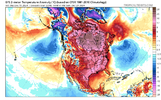
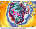
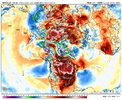
Your challenging the heat miser and he never losesI can't put much stock in that..... I don't believe I have ever seen wall-to-wall heat in winter from the North Pole all the way to South America. Correct me if I am wrong. Just doesn't seem possible. Someone please keep this pic for verification.
It's not "heat" it's above-normal 2m temperature anomalies. It's still plenty cold, but it's warmer-than-normal for the date. Every op and every ensemble are in lock-step agreement, so as @Stevo24 said you can pretty much take it to the bank when it comes to a warm spell like this considering the background setup and raging, poleward-shifted Pacific jet as @Webberweather53 has pointed out.I can't put much stock in that..... I don't believe I have ever seen wall-to-wall heat in winter from the North Pole all the way to South America. Correct me if I am wrong. Just doesn't seem possible. Someone please keep this pic for verification.


As you've pointed out also, this is an insanely long-duration CAD episode. ECMWF doesn't really ever lose confluence over the northeast until after New Years and we may break down the CAD wedge with the pattern changing system. That would be wild. Maybe we don't totally lose soil temps if this is the case haha.I still really like the idea of there being 1-2 legit severe weather outbreaks coming down the road in the southern tier the us between about Christmas and New Year’s.
What might end up being one of the only ways to break the CAD in the Carolinas and VA is to get a giant low pressure system to the west and a rapidly advancing warm sector out ahead of it.

As you've pointed out also, this is an insanely long-duration CAD episode. ECMWF doesn't really ever lose confluence over the northeast until after New Years and we may break down the CAD wedge with the pattern changing system. That would be wild. Maybe we don't totally lose soil temps if this is the case haha.
As you've pointed out also, this is an insanely long-duration CAD episode. ECMWF doesn't really ever lose confluence over the northeast until after New Years and we may break down the CAD wedge with the pattern changing system. That would be wild. Maybe we don't totally lose soil temps if this is the case haha.
View attachment 156254
No substantial snow cover over New England and the upper Mid-Atlantic would also make a difference here as well. I agree, some sneaky overrunning event could still come out of nowhere so-to-speak, but it'll be tougher given the antecedent conditions.Seeing pattern like this 50+ years ago would have probably produced at least one ice storm down here.
Not saying this one absolutely can’t (& maybe it will), but the long term background climatic changes (warmer initial air masses over the Arctic, lower sea ice, etc.) are getting the spotlight briefly shown on them here
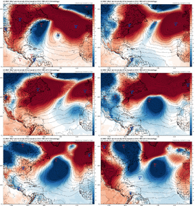
I've always felt pretty good about this period as being the time when the +TNH/-EPO would really come up. The fact it showed up so early this winter kind of surprised me a bit, especially when it had to overcome an apparently unfavorable MJO to do it, says a lot about where the base state is and how the TNH is more receptive to low frequency forcing greater than one season.
There's a gigantic subseasonal signal here for a +TNH/-EPO near the end of Dec into early January that's going to be heavily reinforced &/or arguably led by low frequency variability & internal storm track variability.
View attachment 154855
View attachment 154853
Where is this? I’ll leave now4 inches getting ready to drop with 40 mph gust up on the ridge. RC fiill up with gas and go get us some pics
I was going to ask if you thought sleet was possible around the I-77 area due to the convective showers and the cold 850 tempsView attachment 156292
Yeh may go up for a gander today or tomorrow. Also somebody along I-77 send me graupel pics later today
Blacksburg mentioning snow along and west off 77 in NC and SW VA.I was going to ask if you thought sleet was possible around the I-77 area due to the convective showers and the cold 850 temps
I think technically speaking it’ll be hail/graupel if it does occur, but yeah I wouldn’t be surprised to see some reports. Most every TV Met / NWS office has at least offhand mentioned itI was going to ask if you thought sleet was possible around the I-77 area due to the convective showers and the cold 850 temps
