• Hello, please take a minute to check out our awesome content, contributed by the wonderful members of our community. We hope you'll add your own thoughts and opinions by making a free account!

Pattern December Doldrums 2025 🎄 ❄️

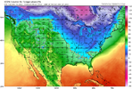
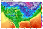
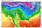
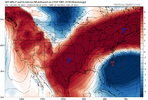
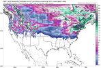
Check out this GFS trend toward strong CAD even earlier, on 12/22: models are so unstable right now even before fantasyland:

View attachment 178850
heck, they’re not in agreement on the back half of next week. GFS is on an island with its depiction of how things go after Tuesday!

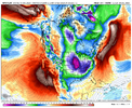
Even the ecmwf/AIFS are not in super tight agreement. I just split the difference for the most part this morning, but will be interesting to see how it pans. Just big temp differences
 
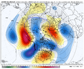
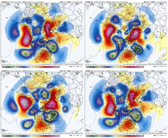
These doomsday Herculean Aleutian ridges don’t just disappear overnight. We’ve had winters that these have persisted.

But we can have fun tracking CAD events where highs are muted from the 60’s to the 40’s. That’s always fun in the heart of winter.

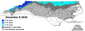
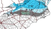
But we’ve already had 2 events…solid winter.

IMG_5066.png
 
These doomsday Herculean Aleutian ridges don’t just disappear overnight. We’ve had winters that these have persisted.

But we can have fun tracking CAD events where highs are muted from the 60’s to the 40’s. That’s always fun in the heart of winter.

But we’ve already had 2 events…solid winter.

View attachment 178855
People panicking a week before winter even begins is something
 
While we fret over the coming warm-up that may wind up being more of a back-and-forth kind of thing rather than a sustained torch between now and Christmas, I, for one, am looking forward to tomorrow's Arctic front. The front will blow through here around daybreak and go sub-freezing by late afternoon.

Stepping outside of my basement sports bar with a cold beer in hand to feel the temperature fall throughout the day on a stiff NW wind, despite full sunshine, as my beloved Saints dash the Panthers' playoff hopes, will be nice.
 
I know I've sounded like a beaten horse, but there's a reason I don't trust extended torches around here. Even if you don't have a -NAO or 50/50 low showing up in the extended, we still figure out a way to CAD. We've always have and I lean on what I know vs what a model or ensemble shows. You typically will see 50/50 lows and North Atlantic troughs start to show up the closer we get in time. We will see days of warm weather, but there's going to be several days of 40 degree cold rains and clouds too. I highly doubt you end up with anything frozen until January right now, but if you think we are going a month straight of mostly 60's and 70's in VA/NC/SC, I've got some bad news for you.

With that said, I still doubt anybody south of VA or the TN/NC border sees any type of frozen until you get the Aleutian ridge to move east. I respect our meteorologist on this board and their knowledge of pattern recognition, but I just can't take much seriously past 10 days right now. They still rely on models, teleconnections, etc to make these predictions and a week to 10 days ago pretty much everything said we should be cold going into January and now they don't. Sorry, but I just will not take these things as gospel beyond 10 days. Whether it's showing cold or heat.
 
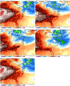
In the interest of showing objectivity, I expect the 12Z Euro, which is about to be released, to not be as cold as the 0Z that I posted 3 temp anom maps from. But the overall trends toward not as warm, more CAD, and instability of models within just a week seems real to me and tells me not to bet the farm at least yet on a mainly mild 12/18-31 in the SE like has been suggested by ens. means. We’ll see.
 
I'm hoping the 6z GFS is right about Christmas. 70's for all outside of the mountains.
The GFS performed well, in fact, it scored a coup compared to some of the models during this past Monday's event. While its track record doesn't inspire confidence, maybe the GFS is on to something again even if I prefer a colder Christmas.
 
The dreaded 0Z Euro torch: awful!

12/20
View attachment 178831

12/22
View attachment 178832

12/25
View attachment 178833

Followup on 12Z Euro vs 0Z:

-12/20 map not quite as cold but still BN

-12/22 and 12/25 maps much warmer

I expected this because 0Z was such a cold run and thus appeared to go too far. But regardless, 12/20 is overall still trending colder in model consensus and models remain unstable telling me to not bet too heavily in late month mild domination.
 
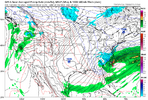
Noobie question- what's a banana high? Google didn't help me out, but Jan of 1988 was a good snow time for my area.
It's a bridge between two high pressure systems that forms a banana shape. On the map two posts before this one, it would be the bridge between the high pressure system in the Northeast and the one located on the Texas/Oklahoma border that forms a banana shaped bridge.
 
Back
Top