accu35
Member
You mean a long range warm up fading in the medium range? No way! Never seen that this year.
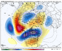
Yep. Seems like in every nina recently we get these big npac nuke ridges which we have to ride or die withMaybe the hope is that the mega ridge modeled up around AK and into the North Pacific could be looked at as a wild card. A wobble here or there is going to make a massive difference downstream. The unfortunate thing is the NAO is not playing ball. There’s not going to be higher heights in that region for the foreseeable future
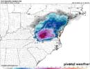
Accumulated in all the eves of the roofs here. Still present as well as melted mpisture on cars roadRaleigh has reported at least a Trace of snow today at the airport
Sent from my iPhone using Tapatalk
CAD killing torches in the medium and short range? Color me shocked


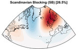
Easy medicine to take if the eventual outcome is cold and winter weather.A lot of people like to forget that the onset of these +NAO >> -NAO transitions usually are associated with ridging over the SE US as the Scandinavian high goes up.
You will have to take your medicine at some point if you want the -NAO to come back in early January
View attachment 178809
View attachment 178810
As many have said, get it out of the way now and have things reset for JanuaryThe Aleutian & Scandinavian ridges are tag teaming the development of the SE ridge in late month & no amount of fantasy land temperature maps on deterministic models is going to change the fact that this isn’t exactly a cold pattern for the SE US.
Until the Scandinavian ridge retrogrades over Greenland & the Baffin Bay and becomes a strong -NAO (which it could early Jan), the warmer-than-normal days will likely outweigh any cooler ones in frequency and intensity. Sure, we could CAD for a few days and keep things seasonable for a little bit, but it probably will be followed by even more anomalously warmer days when those CADs break
Once/if the -NAO shows up, the CADs will probably become stronger and more frequent and be able to more easily hold the warm air masses at bay to the SW, but we’re still a little ways from that here
View attachment 178806
View attachment 178808
View attachment 178807
As many have said, get it out of the way now and have things reset for January
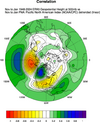
NEEEEEEEED that pacific shake up. As we can see a decent pacific can work for Mid-Atlantic but not for anyone in the southeast. Need +PNA to be solidThe -NAO at least puts us in the game and I'd take it. But if I'm being honest the -NAO being our only hope without pacific cooperation give me little solace. We need the -EPO/+PNA to cooperate (some variation that allows the cold to enter in at least the central conus). -NAO by itself I feel will just give us cool/wedgy rains. Maybe if that PV is trapped south enough we'd score but that rarely happens. I guess I'm saying I really want to see a pacific shake up.
The -NAO at least puts us in the game and I'd take it. But if I'm being honest the -NAO being our only hope without pacific cooperation give me little solace. We need the -EPO/+PNA to cooperate (some variation that allows the cold to enter in at least the central conus). -NAO by itself I feel will just give us cool/wedgy rains. Maybe if that PV is trapped south enough we'd score but that rarely happens. I guess I'm saying I really want to see a pacific shake up.
Are you addicted to CAD? Asking for a friendCAD killing torches in the medium and short range? Color me shocked
Yep. They get uglier every run. They do this every winter, with the exception of about a 2 week period. That's why they get posted like crazy when they actually show cold. It's so rare.The EPS weeklies have gotten uglier for those who like winter weather. The temperature forecast shows a blowtorch through the New Year and after that, it cools things down through the middle of January to only three above normal. I know things in a long range weather forecast are never written in stone but things look discouraging from late next week through the end of the period they cover.
@LukeBarrette will still find a way to get 6-12” during this time period

Well this is a weather forum and it's a routine thing that happens here just about every 5-10 days minimum around here. Pointing that out when it is one of the most common weather patterns that show up is not being addicted but go on.They en
Are you addicted to CAD? Asking for a friend
How often does that CAD happen around here??
Even when we do have enough cold air to work with we don’t get snow and ice.Awesome, let’s CAD up on Christmas while we don’t even remotely have enough cold air to work with to get snow or ice. I’ll pass
View attachment 178821
View attachment 178822
You can still swing the clubs in those temps bro.Awesome, let’s CAD up on Christmas while we don’t even remotely have enough cold air to work with to get snow or ice. I’ll pass
View attachment 178821
View attachment 178822
As I quoted a post other day CAD to what 55-60°Awesome, let’s CAD up on Christmas while we don’t even remotely have enough cold air to work with to get snow or ice. I’ll pass
View attachment 178821
View attachment 178822
It has upper 30s and cold rainAs I quoted a post other day CAD to what 55-60°
