Blue_Ridge_Escarpment
Member
So it’s not just one OP run now?Awesome, let’s CAD up on Christmas while we don’t even remotely have enough cold air to work with to get snow or ice. I’ll pass
View attachment 178821
View attachment 178822
So it’s not just one OP run now?Awesome, let’s CAD up on Christmas while we don’t even remotely have enough cold air to work with to get snow or ice. I’ll pass
View attachment 178821
View attachment 178822
And it's the GFS So you believe itIt has upper 30s and cold rain
It’s not the GFS it’s the newly rolled out AI-GFS, and never said I believed it. But the AI-EC has the same exact thing with rain and a wedge in the 40s so I guess it’s not impossibleAnd it's the GFS So you believe it
CAD usually shows up in the shorter range on the trad models so it's possible AI is learning?It’s not the GFS it’s the newly rolled out AI-GFS, and never said I believed it. But the AI-EC has the same exact thing with rain and a wedge in the 40s so I guess it’s not impossible
Extreme cold watch issued for the Pee Dee region of SC
Nothing says torch quite like heavy snow and sleet in the NRV.
This is bad? Or not conducive to switch back to cold after Christmas?Disgusting CAD pattern starting to show up with a 50/50 low showing up on the GEFS View attachment 178827
He meant disgusting as in disgustingly good.This is bad? Or not conducive to switch back to cold after Christmas?
Ha! I thought so.He meant disgusting as in disgustingly good.
Sent from my iPhone using Tapatalk
372 hours. Out. Book itHappy New Year
Torch be gone!View attachment 178830
I wouldn't worry about it. His last video was all positive. The next one will probably be also, when the models flip back and the -NAO gets a foothold.This video depressed me..
Good night
Some light at the end of the tunnel?
Nice to finally see some slightly positive trends at the end of the model runs now anyways.
Maybe we will have a window around the first week of January.
View attachment 178841
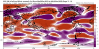
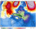
Been the trend for a while now, bet the streak.
Yea the 00z Euro ext. ensemble control from yesterday cooked up something big at hr 360. It's a long shot, but can't rule it out yet.Based on the instability of the models much earlier (like as early as 6 days out), I’m not so sure there isn’t at least a faint light well inside the tunnel. Something to monitor.
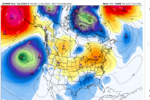
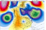
How do skies, winds look sunday night?Haven't hit single digits in the calendar year 2025 Monday morning is an opportunity but I think we stop in the 12-17 range
Skies should be mostly clear, maybe a few passing patches. Winds probably stay up until right around sun up. We almost always are warmer in these setups than expectedHow do skies, winds look sunday night?
If EC is to be believed it should be pretty darn calm in the foothills. I am always a skeptic of the big cold nights and think further east country spots won’t be able to get below maybe 13-15Fat best. Up in Dobson or the likes I could see a 9-12FBen Crosby kind of a.m. as another caked on mega frost has made an appearance.
Short term, will the winds be calm sunday night? If its a clear, calm ,max radiational cooling night. Some of the country folk could get a 9 degree reading.
I had trouble with pivital, but euro looked like it sent a gusty line of heavy storms from west to east next Friday. We could use something that can generate more than a tenth of an inch qpf. Thats one thing a 50/50 low would do. Is finally slow up this fast flow a perhaps allow one of the ns vorts to dig an amplify for a change. But thats still 10 days out. But good news, signal is consistently shiwing on all models. Golf course is closed christmas eve a day anyway. So bring a cad storm on
Disgusting CAD pattern starting to show up with a 50/50 low showing up on the GEFS View attachment 178827
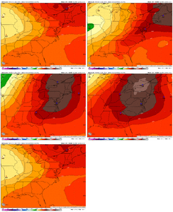
That's a strong one too!Check out this GFS trend toward strong CAD even earlier, on 12/22: models are so unstable right now even before fantasyland:
View attachment 178850
