Grit basically told us there’s no hope. Oh well.In essence, we still kicking the can down the road like Bruce likes to say lol. Keep us posted when things may turn for a better pattern configuration. I guess the good news is it's still only mid December. If we are still saying this a month from now, then that's a different story
-
Hello, please take a minute to check out our awesome content, contributed by the wonderful members of our community. We hope you'll add your own thoughts and opinions by making a free account!
You are using an out of date browser. It may not display this or other websites correctly.
You should upgrade or use an alternative browser.
You should upgrade or use an alternative browser.
Pattern December Doldrums 2025 🎄 ❄️
- Thread starter SD
- Start date
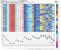
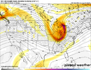
GFS AI is following the trend too. Not as sharp as the ICON...yet, but it's getting there.ICON trend just since the 0Z run for Thur night:
View attachment 178933
GaWx, you putting in work to kill this “torch”. Just got back from vacation, I’m about to go to war with you brother. Let’s get itICON trend just since the 0Z run for Thur night:
View attachment 178933
That's right, enough of the gloom and doom pre-solstice. Let's go!GaWx, you putting in work to kill this “torch”. Just got back from vacation, I’m about to go to war with you brother. Let’s get it
GeorgiaGirl
Member
Currently 70’s in SE Georgia and upper 20’s in NE Georgia..as big a spread as you’ll see
Yeah I'm currently in transit back to Augusta (my dad is the best) and I can see the front is STRUGGLING.
Temps seem as if they've just begun dropping. 60ish earlier and now 57.
Webberweather53
Meteorologist
Webberweather53
Meteorologist
ICON trend just since the 0Z run for Thur night:
View attachment 178933
Kudos to you Larry for being all over this.
What I'm interested in for the longer-term is seeing if this digging trend in our trough can result in a faster onset of the -NAO upstream. That's what happens on this GFS run at least.
Webberweather53
Meteorologist
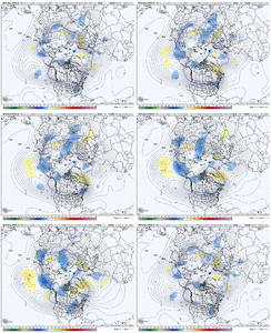
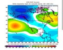
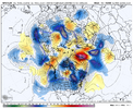
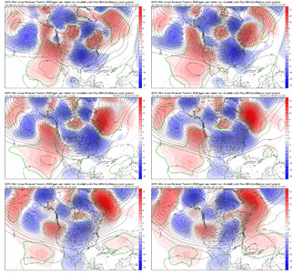
This is very interesting...
You can actually see on GFS Ensemble 48-hour trend plot that the deeper trough over the Eastern US late this week actually leads to quicker onset of the -NAO nearly on the edge of the screen over the N Atlantic.
This makes some sense as -NAOs are typically associated with an equatorward shifted Atlantic Jet Stream, and having troughs dig farther south helps to speed up that process of a southward-shifted jet.

accu35
Member
So we need to hope for a quicker onset of a -NAO to get things cranked up again? Very niceThis is very interesting...
You can actually see on GFS Ensemble 48-hour trend plot that the deeper trough over the Eastern US late this week actually leads to quicker onset of the -NAO nearly on the edge of the screen over the N Atlantic.
This makes some sense as -NAOs are typically associated with an equatorward shifted Atlantic Jet Stream, and having troughs dig farther south helps to speed up that process of a southward-shifted jet.
View attachment 178940
NBAcentel
Member
maybe can dig enough to start interests on a Highly sheared QLCS with low capeICON trend just since the 0Z run for Thur night:
View attachment 178933
NBAcentel
Member
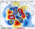
I’d say one more less likely but possible scenario on the pacific side is rolling over the Aleutian ridge temporarily and cutting off in the pacific for a short duration ridge bridge, been seeing this look show up on basically almost every deterministic time to timeAbout the only good news we have is that Canada looks to remain cold in this -WPO / -PNA pattern, so any hiccup in the wave pattern could add some interest. But I feel like the only thing that could enact real change is if Greenland Blocking were to go to town and bully the pattern, and with the aforementioned cold air in Canada being redirected south - hard to achieve, but not a crazy idea given the pattern at hand in the Atlantic and a stratosphere that is not hostile to blocking developing.
MJO 7-8-1-2 progression has typically been fruitful in Cool ENSO / La Nina, but this fast-moving tropical wave embedded within a psuedo MJO setup has been a pill, and there is no sign of help coming from Asia (+EAMT) with wave breaking from the Pac Jet occurring well to the west in the Pacific (-WPO / -PNA).
Webberweather53
Meteorologist
12z GFS in a nutshell for late Dec:
Cold shot >> CAD >> CAD erodes >> big warm-up >> another cold shot. Wash rinse repeat.
Big roller coaster ride
Cold shot >> CAD >> CAD erodes >> big warm-up >> another cold shot. Wash rinse repeat.
Big roller coaster ride
Webberweather53
Meteorologist
Things could get really weird once this -NAO develops and retrogrades west closer to North America.
Webberweather53
Meteorologist
12z GFS in a nutshell for late Dec:
Cold shot >> CAD >> CAD erodes >> big warm-up >> another cold shot. Wash rinse repeat.
Big roller coaster ride
Consistent with what you said about the 12Z GFS, yes there are 4 torches in NC, but each one lasts only one day: 12/18, 12/21, 12/24, and 12/28. The cumulative cold periods meet, if not exceed, these 4 warm days!
i'd take it in a heartbeat over sustainted warmth, just my personal preference.12z GFS in a nutshell for late Dec:
Cold shot >> CAD >> CAD erodes >> big warm-up >> another cold shot. Wash rinse repeat.
Big roller coaster ride
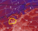
if you want a shorter term roller coaster ride, watch the high elevation stations in WNC tonight. for example, mount mitchell started the day at 36.6F at 12am. by 6am it was 23F, and it is currently (12pm) 6.5F. they'll likely bottom out somewhere in the subzero single digits (perhaps -5F or so) after sunset tonight, between 7-10pm. then we head back up. winds die down, radiational cooling sets up, and temps up top warm as the core of the cold aloft is pulled away from the region overnight. the 12z HRRR takes 850s from somewhere in the -12 to -15C range and cooks them up to -4 to -2C by sunrise. you can see the black mountains sitting in the 20s tomorrow morning while valleys/foothills are in the low teens and singe digits.
does this impact anyone really? no. did i do a research project on large scale temp inversions in wnc and that's why i'm posting about it? yes! hope everyone enjoyed this entirely useless lesson
Webberweather53
Meteorologist
Webberweather53
Meteorologist
Daytime temps could legitimately oscillate between the 40s and 70s in NC late month depending on the day and location
Webberweather53
Meteorologist
The 12z ECMWF is following the GFS’s lead with a deeper eastern trough this weekend ultimately triggering faster onset of the -NAO
LukeBarrette
im north of 90% of people on here so yeah
Meteorology Student
Member
2024 Supporter
2017-2023 Supporter
5:15am- 57/54
12:55pm- 41/8, wind chill 31
12:55pm- 41/8, wind chill 31
If my memory is correct that’s pretty similar to how late December 1995 was after Christmas to New Years. Then it shifted cold and we all know what happened the first weekend of JanuaryDaytime temps could legitimately oscillate between the 40s and 70s in NC late month depending on the day and location
Not good for viral spread over the holidays. Could be a petri dish of fluDaytime temps could legitimately oscillate between the 40s and 70s in NC late month depending on the day and location
Shaggy
Member
We went from 61 to 43 in under 2 hours5:15am- 57/54
12:55pm- 41/8, wind chill 31
olhausen
Member
Webberweather53
Meteorologist
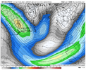
The southern branch of the jet is going to be unusually strong over the Atlantic next week. In fact, in a mean sense, it’s nearly as strong as the polar jet over the CONUS!
This is largely thanks to a Kelvin & Rossby Wave passage over the Atlantic. The associated convective heating anomalies will accelerate the jet over the Atlantic & Africa.
This provides favorable background momentum for Rossby waves to utilize (via barotropic energy conversion), which ultimately leads to the onset of blocking over Scandinavia & eventually Greenland in the extended range
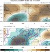


Be that as it may and despite my more optimistic posts so far today, I always still try to be objective and show everything, good or bad. The Euro Weeklies remain steadfast on a warmer than average SE and Mid-Atlantic westward/solid -PNA through almost the entire run. The torchiest still remains well to the west of the E/SE US thanks to occasional cool-offs likely largely related to CAD saving the day. It tries to cool off in general the last week (1/19-25), but it isn’t really exciting looking.
I continue to hope that just like the models have performed in many cases for the last 3.5 weeks, that they keep busting too warm in the E US.
I continue to hope that just like the models have performed in many cases for the last 3.5 weeks, that they keep busting too warm in the E US.
Tsappfrog20
Member
Be that as it may and despite my more optimistic posts so far today, I always still try to be objective and show everything, good or bad. The Euro Weeklies remain steadfast on a warmer than average SE and Mid-Atlantic westward/solid -PNA through almost the entire run. The torchiest still remains well to the west of the E/SE US thanks to occasional cool-offs likely largely related to CAD saving the day. It tries to cool off in general the last week (1/19-25), but it isn’t really exciting looking.
I continue to hope that just like the models have performed in many cases for the last 3.5 weeks, that they keep busting too warm in the E US.
Luke I appreciate all your hard work and analysis brother! I learn a lot from you and others
Sent from my iPhone using Tapatalk
Webberweather53
Meteorologist
Be that as it may and despite my more optimistic posts so far today, I always still try to be objective and show everything, good or bad. The Euro Weeklies remain steadfast on a warmer than average SE and Mid-Atlantic westward/solid -PNA through almost the entire run. The torchiest still remains well to the west of the E/SE US thanks to occasional cool-offs likely largely related to CAD saving the day. It tries to cool off in general the last week (1/19-25), but it isn’t really exciting looking.
I continue to hope that just like the models have performed in many cases for the last 3.5 weeks, that they keep busting too warm in the E US.
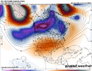
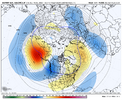
I'm having a hard time being sold on the giant ridge that extends from the Southern Plains to Europe on the weeklies, just using Jan 4 here as an example.
In reality, I suspect we could end up w/ a much more wavy & slow pattern with shortening wavelengths as the blocking high retrogrades just south of Greenland while the upstream Aleutian ridge refuses to budge. May have to be on the lookout for cut-off upper lows.
trackersacker
Member
Might get the job done here in the Southern Appalachian region with some of those lows if they stall out under a block . I’ll take itI'm having a hard time being sold on the giant ridge that extends from the Southern Plains to Europe on the weeklies, just using Jan 4 here as an example.
In reality, I suspect we could end up w/ a much more wavy & slow pattern with shortening wavelengths as the blocking high retrogrades just south of Greenland while the upstream Aleutian ridge refuses to budge. May have to be on the lookout for cut-off upper lows.
View attachment 178958
Blue_Ridge_Escarpment
Member
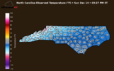
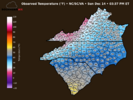
ive always wondered where the Boone obs come from, because the airport is reporting 18 degrees, not 9. I always assumed the airport but not sure.
boobear
Member
It was 59 at 1 am in Woodstock Georgia. I just took the dogs out. I have two waterlily bowls on the deck. The smaller one has a thick layer of ice. The larger one none sitting next to each other. The temperature right now is 36 windchill is 28. I guess I should drip my water now instead of later!
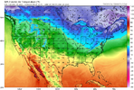
I was having a real battle getting the API to work from the official stations so these arent the official site obs yet just a sample from each counties center pointive always wondered where the Boone obs come from, because the airport is reporting 18 degrees, not 9. I always assumed the airport but not sure.
CNCsnwfan1210
Member

GFS going with a split PV around 12/24
Sent from my iPhone using Tapatalk

