NBAcentel
Member
Let’s not panic (yet) gfs will save the day (maybe)Deflating balloon sound
Let’s not panic (yet) gfs will save the day (maybe)Deflating balloon sound
I thought the icon was going somewhere good from 72-81 hrs then the wheels came off. I will be interested to see the gfs and Euro tonight and how they manage the energyLet’s not panic (yet) gfs will save the day (maybe)


Northern wave gotta go straight south. Think it's going to make a run at being interesting but not be enough
Northern wave gotta go straight south. Think it's going to make a run at being interesting but not be enough

Meh. Let's see what it does with the stuff near stl but it's probably too open with the wave and too flat at the base. Need it consolidated near STL
Meh. Let's see what it does with the stuff near stl but it's probably too open with the wave and too flat at the base. Need it consolidated near STL


It may fire some light stuff over the Carolinas View attachment 55278View attachment 55279
Yeah good thing is we are still 4-5 days out. Bad thing is we keep taking Ls on every model. Unless we can get that southern wave to hang back and phase at the right time or the northern steam to dig far enough SW it may end up as the suck.Lol we trade in a worse tilt for a further west solution, smh , the positive with the more further west/flatter solution is some moisture with the ULT itself East of the mountains
.png")


tht look like a peepee dudeCan make it work View attachment 55281
Weather peentht look like a peepee dude
looks like it shots it load of upslope on the mtns and got tired. Drizzle in the east if it the clouds and ooze some precipitation.Weather peen


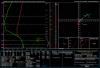
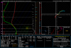
What about the upstate north of 85Yep soundings near CLT, it’s certainly close but it supports wet snow if rates are good View attachment 55291View attachment 55292
I was just looking because I was interested (don’t take that solution exact given how bad the models are right now) but it was the same, soundings supportive of wet snowWhat about the upstate north of 85
To DubuqueWe gonna try reel hard , to real this in! - Dirtybird


Biggest snow mean in my county (Chatham)