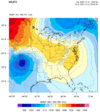
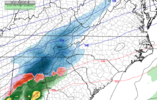
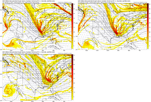
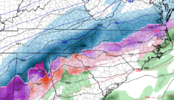
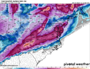
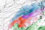
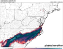
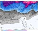
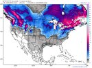
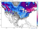
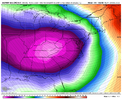
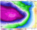
First system on ECMWF cuts.. second system is suppressed into the middle of the GOM.. great.
-
Hello, please take a minute to check out our awesome content, contributed by the wonderful members of our community. We hope you'll add your own thoughts and opinions by making a free account!
You are using an out of date browser. It may not display this or other websites correctly.
You should upgrade or use an alternative browser.
You should upgrade or use an alternative browser.
Pattern Dazzling December
- Thread starter Rain Cold
- Start date
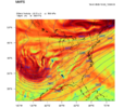
Meanwhile 00z UKMET looked like it was setting up for a monster. Initial "cutting" low so far north that it would help push a secondary low at hr 144 south towards a boundary near the gulf coast.. classic miller A setup there if it went out past 144 hrs.


I joked the other day that I never worry about suppression (after all, we have like, what, 10-15 days a year when it's even cold enough for wintry precipitation), and I mentioned that if I saw lows running from Mexico City to Havana, it wouldn't bother me a bit. Well, the Euro just did that, lol. But it really wasn't that far off from the GFS here. Just give it a touch more spacing and room to breathe and it's good to go. It's a good position to be in 10 days outFirst system on ECMWF cuts.. second system is suppressed into the middle of the GOM.. great.

CMC Ensemble Mean has a cold Miller A look


00z Canadian Ensemble Members on Christmas Day


Euro Ens Mean also has a cold, suppressed, Miller A look here.....good by me


- Joined
- Jan 23, 2021
- Messages
- 4,601
- Reaction score
- 15,196
- Location
- Lebanon Township, Durham County NC
I just don’t know how much faith I have in storm #2. My gut feeling is sorta like the euro with it - I think the immense amount of cold air is going to suppress it into oblivion.
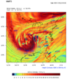
GFS turning the Christmas day system into a long duration overrunning event before slp gets cranking..... mercy
Met1985
Member
Ill take my 30 inches and be happy.
With this depiction, RDU would have nearly 36 hours of heavy sleet. Would be fun...
Wild how different the 06z GFS is with the second cold air dump
I don't trust anything right now. All we can take from these runs is that we have a chance... Need to get within 5 days of these events.Wild how different the 06z GFS is with the second cold air dump
NEGaweather
Member
Models are all over the place with solutions but the main take away is the store signal is there. I like the euro being suppressed at 10 days. 25-27th is gonna be fun.
Sent from my iPhone using Tapatalk
Sent from my iPhone using Tapatalk
NorthGaWinter4
Member
Chances for scattered snow showers (possibly mixed with rain)
will be possible, but confidence is shaky. An outside chance for
some wintry mix is possible for the high elevations of North
Georgia Tuesday morning, with a better possibility Thursday
morning. The big fly in the ointment is a scrappy, occasional GFS
run putting in a pre- Christmas snow storm across North Georgia
Thursday Night into Friday morning. In this instance, this
solution is an outlier, but enough to warrant a slight chance for
snow across North Georgia at this time, with plenty of time
between now and then for the forecast to go one way or the other.
It`s too early to say whether North Georgia could have a White
Christmas, but it`s not entirely outside the realm of
possibilities at this point.
FROM NWS
Seems as though the first system we have multiple ways to score something here in NC. As for areas outside of here y’all need the tall ridge even more than we do. I’ll take absolutely whatever Mother Nature gives us as long as it’s wintry. I like to see that our second system has multiple ways of producing either overrunning or a miller A.. it’s much easier to get a widespread winter storm down here when you get the cold air established first.
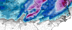
The 6z GFS backed down for Wednesday night - Thursday system. The 0z showed a small event for Raleigh NE to just west of Virginia Beach. The European and Candian also show the potential event, but surface temps are warmer (less CAD). Funny thing is the 6z GFS was actually a little stronger with the CAD, just less precip. So in short, we need to continue looking at this first potential.
- Joined
- Jan 23, 2021
- Messages
- 4,601
- Reaction score
- 15,196
- Location
- Lebanon Township, Durham County NC
Storm 1 on GEFS looks substantially colder this run. I haven’t looked at the panels. I hope that means more easterly solutions.
NBAcentel
Member
This past Monday I knew as much about my backyard weather forecast for the period Wednesday Dec 21 through Dec 26th as I do today, 5 days latter.
Today we should start getting things ironed out at 12z and again by 0z tonight. That Ukmet warning shot from several runs back, has had me worried. Espeacilly in light of the 0z Euro spitting out a Lakes Cutter.
The Ukmet is notorious for sniffing out Phased storms and forecasting them. MODEOLOGY is a tough business
Cbmatt2408
Member
Looks about right for us in West Central GA south of I-20. I can already let everyone know that the 34 degree rain is going to be miserable.
packfan98
Moderator
Definitely decent, but there’s one huge ensemble member that skews it quite a bit. Maybe it’s right???The mean as a whole is pretty good View attachment 126938
iGRXY
Member
6z GEFS did uptick the mean and had nicer cold push and hit rate
Looks like we have a legit winter storm threat for the 23rd to 27th. Of course the models are going to have all kinds of solutions and totals between now and then. But it looks like we will have a game. Just won't know the final score until it's over.
Shaggy
Member
We are days away from the pieces being sampled and really nailing down the forecast. We are also in that range where storms like to "disappear" before coming back in the 2-3 day range. I'm not sweating any run right now just watching the ensemblesI don't trust anything right now. All we can take from these runs is that we have a chance... Need to get within 5 days of these events.
I'd love to be wrong but I'd lean Euro/Ukie with 1st system, probably inland too warm for most except higher elevation. I'm concerned the impressive cold press after will suppress 2nd system but NW shifts, historically, are more doable then SE one's. We shall see
iGRXY
Member
With overrunning you’re going to get a relapse of last year. Front end FGEN driven moisture out ahead of the main system. That’s the reason why we got widespread 5-8” of snow before a switch over to sleet and ZR. Models had us with maybe 1-2” of front end snow before a switch over so this has front end over performer written all over it if this is how it actually goes. It’s a very long duration event. MBY for example gets about 9.5” between the 2 systems before 3-4” of sleet. Realistically it’s probably would be closer to a foot before the switch over with FGEN banding. But be happy with whatever you get
The differences on 500mb vort maps across southern Canada from the west coast to especially off the NE coast by hour 72 is really amazing. Explains how we got Globals going in diff directions with regards to sensible weather from that point onward. Got to get the big pieces pegged just right and we aren't exactly there yet.
Yeah, it does seem the five-day disappearing act is real. It's almost like a day 7 model run is better than day 5.We are days away from the pieces being sampled and really nailing down the forecast. We are also in that range where storms like to "disappear" before coming back in the 2-3 day range. I'm not sweating any run right now just watching the ensembles
NBAcentel
Member

