-
Hello, please take a minute to check out our awesome content, contributed by the wonderful members of our community. We hope you'll add your own thoughts and opinions by making a free account!
You are using an out of date browser. It may not display this or other websites correctly.
You should upgrade or use an alternative browser.
You should upgrade or use an alternative browser.
Pattern Dazzling December
- Thread starter Rain Cold
- Start date
- Joined
- Jan 2, 2017
- Messages
- 1,566
- Reaction score
- 4,279
Key is the heighth of the pac ridge. Like Fro said its gotta be taller and that will help the dig. Plenty of time. We will see some good ens and some misses
Definitely, Ukie threw a small scare but it is way outsider at this point... will probably come around someBetter than UKMET
I’ll happy take a late bloomer at this lead time. There’s a decent chance of snow between the 23rd and 27th for many across the SE.
- Joined
- Jan 23, 2021
- Messages
- 4,603
- Reaction score
- 15,199
- Location
- Lebanon Township, Durham County NC
Pretty strong signal on GEPS and GEFS. If EPS follows, we might be on.
LukeBarrette
im north of 90% of people on here so yeah
Meteorology Student
Member
2024 Supporter
2017-2023 Supporter
Same thing Fro is saying, he’s exactly right. Depends on PNA height.
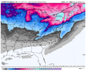
GFS

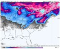
Euro

Euro

Euro

Euro
NBAcentel
Member
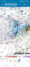
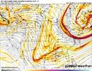
This storm associated with the TPV imho isn’t getting me as being the one, that’s my opinion, I hope it is, and I hope I’m wrong, and I may be wrong because it isn’t far away on the models that don’t have it, but history always tells us big deep cold vortex in place then energy rides the western ridge then we score, that look AFTER is what gets my attention, absolutely classic 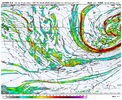

Cad Wedge NC
Member
Yeah, this is still a week away. need to stick with the ensembles until at least 96 hours out. Good news it that the GFS ensembles have not waivered. This time frame has been looking good for a week. Now, ..... If the EPS goes the way of the GEFS in bringing down the cold, then we can start looking closer to what may be in store. Right now, I am pretty stoked about the potential right before Christmas.Signal is still there, that’s all that matters at this moment
accu35
Member
So much energy flying around between 23rd-27th.
Agree. If we score on the first, we really got lucky on a setup that generally doesn’t work.This storm assisted with the TPV imho isn’t getting me as being the one, I hope it is, and I hope I’m wrong, and I may be wrong because it isn’t far away on the models that don’t have it, but history always tells us big deep cold vortex in place then energy rides the western ridge then we score, that look AFTER is what gets my attention, absolutely classic View attachment 126698
The trends we need to focus on at this rate is the strength and trend of strength of that ridge out west. We get a taller ridge? More chance to score on the 23rd. Shorter ridge? We miss out on a big first event but set up better for maybe a 25-26 event.
On Euro we Need that southern streak of energy zipping out of the northern baja area, not southern. Like someone said earlier. Needs to run across GOM shoreline. This is doable and how we get an earlier bloomer like the GFS.
accu35
Member
LukeBarrette
im north of 90% of people on here so yeah
Meteorology Student
Member
2024 Supporter
2017-2023 Supporter
I think we can agree that the Euro has been behind the 8 ball in the west coast ridging department the last few days. So we got that going for us, I guess.The trends we need to focus on at this rate is the strength and trend of strength of that ridge out west. We get a taller ridge? More chance to score on the 23rd. Shorter ridge? We miss out on a big first event but set up better for maybe a 25-26 event.
NBAcentel
Member
however with a strong upper level trough moving over like that, and as we seen several and several times, light snow showers breaking containment is a somewhat intriguing prospect, typically associated with low DGZs so models don’t see it until short rangers see it. this by itself, is a huge win near Christmas 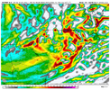

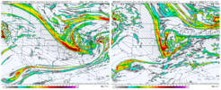
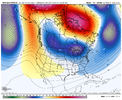
The Baja wave needs to stay intact more on the euro, futher north. That will solve the problem and they ( NS & SS) can link / hook up.Dig? While you are correct the southern energy is not even close to what the GFS brings:
View attachment 126696
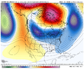
Not too many tics away from interacting with that PV up there! At the very least, that southern vort needs to skeedaddle east quicker.View attachment 126702
Interesting look to end the run
I love all the interpretation of the modelling but, in my opinion, it's kind of like giving directions to someone in a place you are not familiar. Oh, the directions sound great but the chances of getting lost are greater for the poor sucker taking those directions.
The pattern modeled is a rarity with this anomalous pattern. I honestly think the precip/amount won't get dialed in until we are just a couple days out or even then. This chance for cold reminds me a lot of 1989 around and just after Christmas. That one happened to be dry and cold not the greatest winter afterwards (Birmingham, AL) This one has the looks of something rare and different.
I am with you guys on this rollercoaster though. Let's reel one in for the ages. It will be fun to track. Hell, it's been already!
The Baja wave needs to stay intact more on the euro, futher north. That will solve the problem and they ( NS & SS) can link / hook up.
Curius to know if the Ridge is playing a role in that.
iGRXY
Member

EPS looks to be increasing western ridging as well
iGRXY
Member

Off first glance it looks better tilted compared to the OP as well.
Shaggy
Member
Models always seem.to be too slow with the energy out west it seems. Hopefully that will be the case here as wellNot too many tics away from interacting with that PV up there! At the very least, that southern vort needs to skeedaddle east quicker.
NBAcentel
Member
Thats beyond my pay grade lol. The Ridge isn't quite as tall/sharp pointed as the gfs. One is the cause and effect of the other.Curius to know if the Ridge is playing a role in that.
Ill be watching the trajectory of that southern stream energy everyrun now. Gfs has painted the picture of what it needs to look like at 500mb.
NBAcentel
Member
Looks like the snow mean is going to be a improvement
That's all we can ask. You can't expect all op models to lock onto a storm almost 200 hrs out. I'm interested if the number of hits go up on ensembles.Looks like the snow mean is going to be a improvement
NBAcentel
Member
- Joined
- Jan 23, 2021
- Messages
- 4,603
- Reaction score
- 15,199
- Location
- Lebanon Township, Durham County NC
iGRXY
Member


People will sell their souls for 42
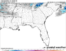
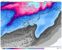
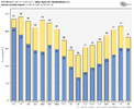
I like that it’s a lot of light members as opposed to just 1or 2 big ones. The important thing is that very cold air is coming and there looks to be a good amount energy flying around with it. Btw… TWC now CLT forecasted a high of 28 next Friday and that’s with sunny conditions.Not impressive but it’s somewhat better then last run, looks like a lot of light members View attachment 126709View attachment 126707View attachment 126708
- Joined
- Jan 23, 2021
- Messages
- 4,603
- Reaction score
- 15,199
- Location
- Lebanon Township, Durham County NC
That really aint a bad look.
It also makes me feel better seeing that it's probably snow or nothing.
It also makes me feel better seeing that it's probably snow or nothing.
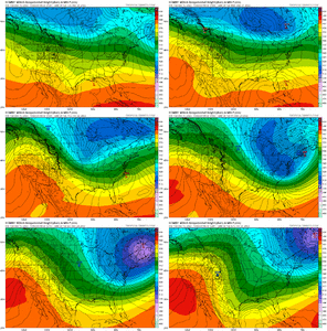
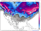
After the initial Arctic boundary storm that drops down mid-late next week, the Euro is plowing the closed low over the Great Lakes / NE up into the blocking Greenland ridge and breaking it down (less +PNA ridge contributes as well) - 1st loop
The GFS has a much better looking evolution where the closed low rolls up under the blocking ridge that retrogrades into Hudson Bay - 2nd loop
This slows things down and you can see how the next wave then starts to dig more sharpely thru the Rockies on the GFS (better) vs. the Plains on the Euro
This is a key piece to watch for with respect to follow-up storm potential which would be loaded with wintry potential if this could hit right given the influx of deep south cold air.


NBAcentel
Member

