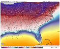
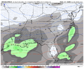
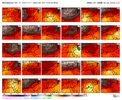
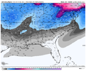
-
Hello, please take a minute to check out our awesome content, contributed by the wonderful members of our community. We hope you'll add your own thoughts and opinions by making a free account!
You are using an out of date browser. It may not display this or other websites correctly.
You should upgrade or use an alternative browser.
You should upgrade or use an alternative browser.
Pattern Dazzling December
- Thread starter Rain Cold
- Start date
NBAcentel
Member
accu35
Member
I'm not sure the GFS has a wheelhouse lolThe thing is this has support from ensembles. Yess it's just one run and will change. But where in the wheelhouse now. Like you said get the euro on board and it's game on.
Big picture, it *appears* we have all that we need to build at least one good SE snowstorm. Now, it's time to just sit back and see if the Grinch shows up and takes our stuff away. If not, then it's just going to be a matter of figuring out where the mix line sets up. Either way, it's a pretty awesome place to be headed into Christmas.
That was an epic, epic run...one to be enjoyed for at least the next 30 minutes lol
NBAcentel
Member
Definitely looks like it’s gonna bite.


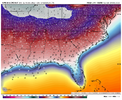
GEFS looks like it's also going to support the multi system possibility with a nice western ridge and energy building in the SW. Those 850's are some of the coldest I've seen around here.
iGRXY
Member

Yep, GEFS looks like it will support a multisystem like the OP.
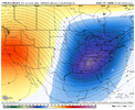
Gfs verefies. It can do what it wants in Jan,rest of winter .On a completely diff note, we’re gonna start putting lots of pressure on the SPV with the jet extension, especially with lower highs over the Aleutian Islands and Bering sea, and as HM mentioned on Twitter, another round of +SCAND/urals High, this is a SPV killing pattern, we’re increasing the chances of some sort of warming event in jan by doing this
NBAcentel
Member
DadOfJax
Member
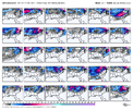
GEFS crushing AL on Christmas and the day after!
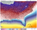
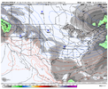
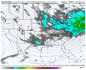
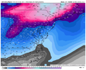
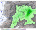
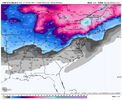
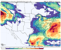
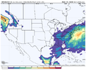
What is crazy is how many members so far are close to the coast, yet may not matter with this strong of cold.This is so weenie View attachment 126650View attachment 126651
iGRXY
Member
JHS
Member
This makes me think of Jan 1982 for how cold and snowy this would be IF it verified. 2 big systems that month and at least 2 days of single digit lows afterward.
Also a major coldwave before those 2 storms too. Got down near 0 here with it.
Also a major coldwave before those 2 storms too. Got down near 0 here with it.
NBAcentel
Member
Bradddd is bittingggggg
iGRXY
Member

The mean on this run is going to be top 2 and it's not number 2
?
iGRXY
Member
Bradddd is bittingggggg
All it took was -EPO/+PNA, record type -NAO with 50/50 confluence, arctic airmasses falling into the US from Siberia, favorable MJO, and multiple runs of ensembles showing a storm potential to get him to finally bite.
You want snow in central MS, AL, GA, the GEFS says the second storm is the ticket. Perfect low track besides for a couple early bombs.
Yep, 4" mean has crept into northern part of NC (outside the mountains) and gets better and better.
The mean on this run is going to be top 2 and it's not number 2
NBAcentel
Member
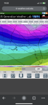
This is the weenie look @Ollie Williams was aiming for, just need more lower heights in the Atlantic 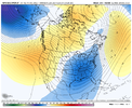

NBAcentel
Member
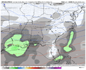
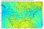
We really don't because higher heights allow the wave to tilt positively. The SE Canada vortex moving out with the first wave is perfect IMO. All we need is the ridge over the west coast and in central Canada to trend stronger to allow our wave to dig more.This is the weenie look @Ollie Williams was aiming for, just need more lower heights in the Atlantic View attachment 126654
Well I'll put it this way I pay a lot more attention under 200 hours. We're definitely in the period where it will start to show hints of what's possible next week that's a better way of putting it.I'm not sure the GFS has a wheelhouse lol
Big picture, it *appears* we have all that we need to build at least one good SE snowstorm. Now, it's time to just sit back and see if the Grinch shows up and takes our stuff away. If not, then it's just going to be a matter of figuring out where the mix line sets up. Either way, it's a pretty awesome place to be headed into Christmas.
That was an epic, epic run...one to be enjoyed for at least the next 30 minutes lol
NBAcentel
Member
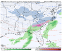
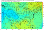
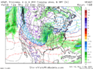
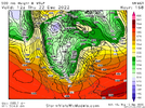
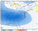
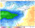
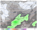
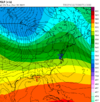
It’s prob right lol12z UKMET is going with a massive cutter in the central U.S. I would say don’t shoot the messenger, but, there really is no way that you can shoot me
View attachment 126659
View attachment 126660
NBAcentel
Member
It may not have it yet, but the GEFS is about to give a nod to a third system.
If euro goes this way will be a lot of gfs hangoversIt’s prob right lol
I have to ask, can you ever think of a time when a storm has caved to the UKMET? I know it has good verification scores, but I can only think of multiple times where it's been an outlier and the last to cave.12z UKMET is going with a massive cutter in the central U.S. I would say don’t shoot the messenger, but, there really is no way that you can shoot me
View attachment 126659
View attachment 126660
NBAcentel
Member
iGRXY
Member
It's lead the way on some storms but usually had some of model supporting as well. But I have seen it be the last to jump on board certain stormsI have to ask, can you ever think of a time when a storm has caved to the UKMET? I know it has good verification scores, but I can only think of multiple times where it's been an outlier and the last to cave.
Yuck, yeah there is just a slight difference between the GFS and Ukie....12z UKMET is going with a massive cutter in the central U.S. I would say don’t shoot the messenger, but, there really is no way that you can shoot me
View attachment 126659
View attachment 126660
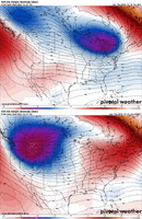
I have to ask, can you ever think of a time when a storm has caved to the UKMET? I know it has good verification scores, but I can only think of multiple times where it's been an outlier and the last to cave.
Yeah. the hurricane named IAN last year. It did GREAT with it.
rburrel2
Member
- Joined
- Jan 23, 2021
- Messages
- 4,601
- Reaction score
- 15,196
- Location
- Lebanon Township, Durham County NC

