In the old days it had a suppression bias - I remember it being the first model to track the Dec 2010 storm farther south. About 4-5 years ago it got some upgrades, and it went on a bit of a heater where it had some good wins. In the past few years though, it has had more misses than hits in my viewI have to ask, can you ever think of a time when a storm has caved to the UKMET? I know it has good verification scores, but I can only think of multiple times where it's been an outlier and the last to cave.
-
Hello, please take a minute to check out our awesome content, contributed by the wonderful members of our community. We hope you'll add your own thoughts and opinions by making a free account!
You are using an out of date browser. It may not display this or other websites correctly.
You should upgrade or use an alternative browser.
You should upgrade or use an alternative browser.
Pattern Dazzling December
- Thread starter Rain Cold
- Start date
NBAcentel
Member
Still waiting on my 19 degree ice storm it showed for 4 runs from it in Feb 2021 ??In the old days it had a suppression bias - I remember it being the first model to track the Dec 2010 storm farther south. About 4-5 years ago it got some upgrades, and it went on a bit of a heater where it had some good wins. In the past few years though, it has had more misses than hits in my view
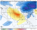
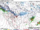
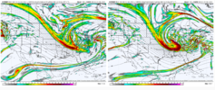
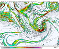
that gfs run was a splendid high but i think people are savvy and seasoned enough here to know that there's still a full tacklebox of possibilities on the table with this thing 200 hours out. i think that where the trough (that thing is way too stout and strong to limit to calling a "shortwave" lol) will continue to ping around, jackpotting us, jackpotting chicago one run, then maybe memphis another, i would go ahead and bake in some disappointment because there's nowhere to go but down after that run lol. not meant to be dour post, i'm actually very optimistic, but i don't think the dec 23 storm is "ours" by any means12z UKMET is going with a massive cutter in the central U.S. I would say don’t shoot the messenger, but, there really is no way that you can shoot me
Temp keeps dropping today. Just had a heavy shower,down to 36 degrees
Storm5
Member
??
ukmet absolutely crushed irma, consistently the southernmost model while others brought it into miami if i remember correctly, i also think it was one of the first globals to pick up on more precip with the pixiedust storm last year. it's a good model, often foreshadows the euro, and the reason it doesn't get highlighted more is that it's just way less accessible than other modelsI have to ask, can you ever think of a time when a storm has caved to the UKMET? I know it has good verification scores, but I can only think of multiple times where it's been an outlier and the last to cave.
NBAcentel
Member
Pilotwx
Member
Well being as cold as predicted , cold can overwhelm the moisture and dry up. 10-15 degrees in southeast US is perfect setup for too cold to snow.
There was a time when,In the old days it had a suppression bias - I remember it being the first model to track the Dec 2010 storm farther south. About 4-5 years ago it got some upgrades, and it went on a bit of a heater where it had some good wins. In the past few years though, it has had more misses than hits in my view
If the Euro & UK was in lockstep with each other it was pretty solid.
Things may have changed.
Let's hope the Euro is closer to the GFS.
Shaggy
Member
at least they look very similar in the short to mid range. So much potential
Brad P noting the potential
iGRXY
Member
Was just fixing to say that the EURO and GFS look similar and different from the Uk at 72 hours
Western ridge coming in stronger at 120.
NBAcentel
Member
dsaur
Member
This is how the ice age begins. Starts doing this and doesn't stop, lol. I'm ready, I have cords of wood cut and my sleds ready. Got some studded snow tires, and a Mavic 3 drone that I can't wait to fly over a new snow pack. I don't have a mastodon pelt, but that might be possible a few years into the ice age. And I'm still holding out hope for some sleet from the 18th moisture underneath to put down a nice base of stick around for a long time for my foot of snow.Multiple rounds of high pressure in the 1050s and 1040s dropping into the middle of the country. You want big snowstorms in the SE, that's a HUGE ingredient in recipe. What a site to see!
iGRXY
Member

Euro looks better honestly. Ridge building in faster than even the GFS.
NBAcentel
Member
I'd say that's some very good agreement for 5 days. Where the models diverge from here is unknowable, but ya can't dislike this general agreement here.


Well to make some feel more secure, the NBM (not sure 12z guidance is even in here yet) has CAE with a 55% chance to at least see snowfall 22-24... with a mean of 2 inches. KCHELL doesn't get snow; so that's a good sign for others.
NBAcentel
Member
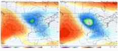
GFS looks better tilted while the Euro looks more flatter as it entered the US, let’s see what it does
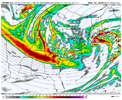
Dang Euro is a decent tick stronger than the GFS with the ridge at 144.
WXinCanton
Member
Yep looking like it might be a late bloomerGFS looks better tilted while the Euro looks more flatter as it entered the US, let’s see what it does
NBAcentel
Member
accu35
Member
Pulling the cutoff out of the baja on the euro isn't helping
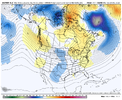
For perspective "King Euro" for the same time period 48 hours ago:


NBAcentel
Member
Iceagewhereartthou
Member
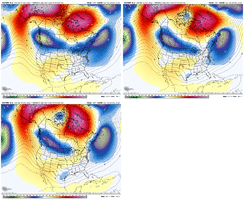
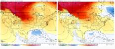
Check out those High pressures; every one is stronger except the Utah HP. That's going to certainly strengthen the cold push.
NBAcentel
Member
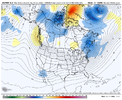
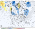
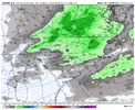
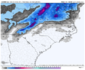
MehLooks like there might be a nice light snow event associated with the ULTView attachment 126690View attachment 126692
LukeBarrette
im north of 90% of people on here so yeah
Meteorology Student
Member
2024 Supporter
2017-2023 Supporter
Signal is still there, that’s all that matters at this moment
Cary_Snow95
Member
Euro isn’t all that dissimilar from gfs. Just needs to dig more. The northeast gets the same result either way
NBAcentel
Member
Yeah BL was on fire, could luck out with some backside stuff as temps crash but this one ain't it if it doesn't dig more.
accu35
Member
plenty time to improve here on the Euro. Plenty cold tho
mydoortotheworld
Member
Honestly Dr. No has become Dr. Maybe the last few years I feel like. This is honestly not a bad look this far out in the game.

