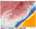
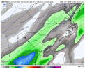
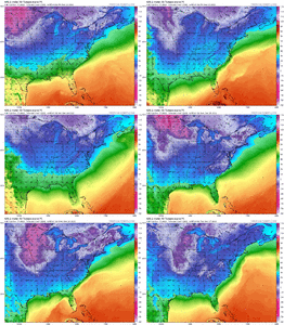
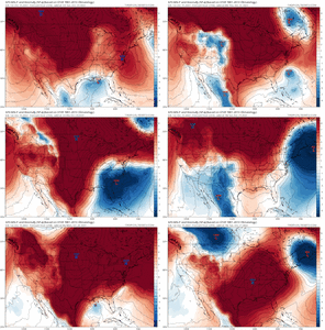
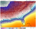
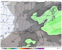
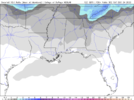
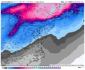
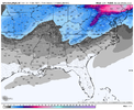
Damn just 5 more inches on top of my 20? This pattern sucks!Here's the 2nd system. Doesn't get the ULL enhancement, but still a good one.
-
Hello, please take a minute to check out our awesome content, contributed by the wonderful members of our community. We hope you'll add your own thoughts and opinions by making a free account!
You are using an out of date browser. It may not display this or other websites correctly.
You should upgrade or use an alternative browser.
You should upgrade or use an alternative browser.
Pattern Dazzling December
- Thread starter Rain Cold
- Start date
Cary_Snow95
Member
An all time run by the GFS. While this will change just goes to show the true nature of this pattern we are entering
NBAcentel
Member
packfan98
Moderator
NC border counties close to 3 feet...Better save this one!


Wow the GFS going for round three. Historic Goofus run.
- Joined
- Jan 23, 2021
- Messages
- 4,601
- Reaction score
- 15,196
- Location
- Lebanon Township, Durham County NC
Last January type beat View attachment 126609View attachment 126610

Second Round drives the snow line to the FLA panhandle.
NBAcentel
Member
iGRXY
Member

Good Lord
NWMSGuy
Member
Thinking if that low was any more Northwest at Hour 186 than shown, there would be an increase in snow totals for us back west.
Honestly wouldn’t be hard to achieve considering the stronger trend of the +PNA. However I would say the second storm would likely be the best shot for the Deep South.Thinking if that low was any more Northwest at Hour 186 than show there would be an increase in snow totals for us back west.
With that much cold air in place, we could play with anything from a great overrunning look to a phased bomb.
DadOfJax
Member
We are in an absolute perfect position in north MS/AL with how this has been trending. Never want to be bullseye 7 days out…I’m stoked!Thinking if that low was any more Northwest at Hour 186 than shown, there would be an increase in snow totals for us back west.
It's like 2010 on steroids. Where starting to get in the wheelhouse now. Yes there will be changes but it definitely has support.
iGRXY
Member

Oh boy the GEFS is going to be good. Trending with more digging further south
Think about it.. if this were to happen we would still have 2-3 MORE months to produce another semi good pattern. Sheesh.
NBAcentel
Member
NBAcentel
Member
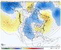
On a completely diff note, we’re gonna start putting lots of pressure on the SPV with the jet extension, especially with lower highs over the Aleutian Islands and Bering sea, and as HM mentioned on Twitter, another round of +SCAND/urals High, this is a SPV killing pattern, we’re increasing the chances of some sort of warming event in jan by doing this
iGRXY
Member
we go below freezing midnight on Thursday night and still aren't above freezing with lows below zero and single digits every nigh through the run so far and that would be Wednesday currently.
iGRXY
Member
Sacrifices must be made for me to get 2 ft of snow on Christmas and 5 straight days of sub freezing temperatures, then oh well. January can kick rocks for all I care, winter would be a success at that point.On a completely diff note, we’re are gonna start putting lots of pressure on the SPV with the jet extension, especially with lower highs over the Aleutian Islands and Bering sea, and as HM mentioned on Twitter, another round of +SCAND/urals High, this is a SPV killing pattern, we’re increasing the chances of some sort of warming event in jan by doing this
NBAcentel
Member
GFS says NC is the new North Pole stays below freezing for a week straight. Now that is something I want to experience just once in my life. With snow on the ground man one can only dream.
iGRXY
Member
NBAcentel
Member
Definitely more members biting on the Op track.
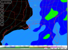
Should be a very decent snow meanHoly woof woof woof View attachment 126626View attachment 126628
NBAcentel
Member
Mean highs during most of the event on the gefs around CLT is in the mid-upper 20s that’s stuff that reminds me of last January. Hot diggity damn
MichaelJ
Member
Very pretty pictures but I caution everyone to stay grounded because it IS the GFS. Yes it is fun to dream and think about this but sooner or later we have to wake up. If the Euro even partially agrees, then we may have something but these totals are always way over done
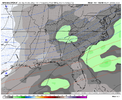
Enemble mean is going to have appreciable snowfall to Northern FL
iGRXY
Member
GFS has support from this with it's on ensembles and this time frame has been barking for a few days now on both the EPS and GEFS. I think we have a legit opportunity to track here. Maybe not exactly what the GFS did, but definitely something.Very pretty pictures but I caution everyone to stay grounded because it IS the GFS. Yes it is fun to dream and think about this but sooner or later we have to wake up. If the Euro even partially agrees, then we may have something but these totals are always way over done
ForsythSnow
Moderator
NBAcentel
Member
Multiple rounds of high pressure in the 1050s and 1040s dropping into the middle of the country. You want big snowstorms in the SE, that's a HUGE ingredient in recipe. What a site to see!You would be hard pressed to find a better run with that much action around Christmas inside 280hr. It probably doesn’t exist View attachment 126620
The thing is this has support from ensembles. Yess it's just one run and will change. But where in the wheelhouse now. Like you said get the euro on board and it's game on.Very pretty pictures but I caution everyone to stay grounded because it IS the GFS. Yes it is fun to dream and think about this but sooner or later we have to wake up. If the Euro even partially agrees, then we may have something but these totals are always way over done
iGRXY
Member


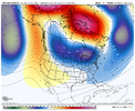
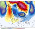
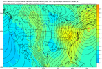
GEFS looks like it's also going to support the multi system possibility with a nice western ridge and energy building in the SW. Those 850's are some of the coldest I've seen around here.
NBAcentel
Member
This gefs run is so cold, sheesh

