• Hello, please take a minute to check out our awesome content, contributed by the wonderful members of our community. We hope you'll add your own thoughts and opinions by making a free account!

Pattern Dazzling December

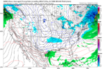
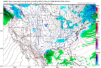
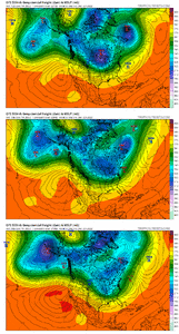
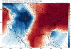
Trend loop of last 4 GFS runs for Dec 16th. We are headed south boys and girls. Closed high along the W Canada coastline - my personal favorite.

The W Atl ridge is caving as the 2 waves are getting closer together. They need to just kiss and make up and get it on, and we'd all be in good shape

KirTEE9.gif
 
Trend loop of last 4 GFS runs. We are headed south boys and girls. Closed high along the W Canada coastline - my personal favorite.

The W Atl ridge is caving as the 2 waves are getting closer together. They need to just kiss and make up and get on and we'd all be in good shape

KirTEE9.gif
Normally the table setter doesn’t produce but we’re really not far away from trending to something, typically models have a tendency to shorten wavelengths under blocks and shove energy South closer to go time under blocky patterns
 
Not adding a lot by saying this but we’ve got a lot of work to do if that 16th time period is going to produce anything for us. Mountains could manage something after it swings through but a bombing low that far north inside 160hr is a tall task. Opportunity comes after that.
 
It's still +200hrs out but a 1050 can do many jobs. Like to see this hold through a few more runs.
 
Don’t be disheartened by the rain look on the gfs .. the trend has been for everything to adjust south including the cold push per the SNE system coming up shortly. I expect this to happen down the road too.. let’s watch ensembles more than we watch operationals right now!
 
That severe threat around the 21st looks ominous! 031EE085-6866-4A1B-B598-96C6B7A3C474.png
 
Don’t be disheartened by the rain look on the gfs .. the trend has been for everything to adjust south including the cold push per the SNE system coming up shortly. I expect this to happen down the road too.. let’s watch ensembles more than we watch operationals right now!
This run of the GFS is a disaster if you want snow or sustained cold for the majority of the SE. Fortunately, it's the GFS.
 
Not adding a lot by saying this but we’ve got a lot of work to do if that 16th time period is going to produce anything for us. Mountains could manage something after it swings through but a bombing low that far north inside 160hr is a tall task. Opportunity comes after that.
Agreed…that storm sets the table for potential goodies that come after it. That being said, there are definitely clear trends that show the potential is there for at least some onset icing for the NW NC Piedmont, Foothills and up into VA. Also the back side looks to possibly set up a good NW flow snow event for the mountains
 
Back
Top