NBAcentel
Member
Unless that western ridge keeps sliding east. Then it will go negative out to sea and we can all enjoy watching a fish storm turn to a Boston banger. ? wompIf any storm system has been somewhat consistent, it's that we are going to have some piece of energy flying with the Arctic front... Which will favor areas West of the apps.
Southeast would rely on a coastal low popping off or getting some Gulf moisture in after cold moves in.

No such thing. We always need the cold air FIRST and I'll take it every time. Mother Nature is not giving us a "cold now or cold later" trade off.Wasting cold air with this…
Starting to look drier and drier but we have time to trend it back or angle it enough to pull some sort of system. It'll either be bitter and mostly dry or we'll be able to pull something. Been noticing overall runs drying up as well.

When's the last time we had that good of a west based -nao that strong?GEFS days 7-10. Cold moving east up under an improving looking west-based block. We're trying to get where we need to go

I love where we are at right now. People don’t realize how much just a few minor tweaks can open the door to a big time winter system in this type of pattern and we have 240 hours to tweak it in our favor. Regardless of the winter weather the cold is coming.GEFS days 7-10. Cold moving east up under an improving looking west-based block. We're trying to get where we need to go

This one has been waffling back and forth so far this month, but the potential is there for it to setup nicelyWhen's the last time we had that good of a west based -nao that strong?
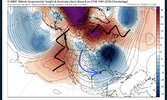
Rex block with a 50/50..thats the best we could ask for honestlyThe looks coming up is almost a blockier version of jan-Feb 2014, but the cutoff subtropical strength ridge over the Arctic is what separates this one coming View attachment 126334View attachment 126335View attachment 126336View attachment 126337

That looks really good. I might be wrong on this, but for SE snowstorms, I seem to remember an old post that Allan made one time that showed that it is ideal to have the negative anomaly center over TN. Regardless, the image above looks quite chilly!The looks coming up is almost a blockier version of jan-Feb 2014, but the cutoff subtropical strength ridge over the Arctic is what separates this one coming View attachment 126334View attachment 126335View attachment 126336View attachment 126337
Brutal. It's nice to see better placement and deeper cold as we work in. Still have to get down the home stretch, but we are usually trending in the opposite direction.CMC Ens 5-day mean for Dec 22-27. Run 2 days ago vs. today's run

The looks coming up is almost a blockier version of jan-Feb 2014, but the cutoff subtropical strength ridge over the Arctic is what separates this one coming View attachment 126334View attachment 126335View attachment 126336View attachment 126337


I wouldn’t be surprised if there would be a little sleet mixed in if precipitation were heavier12z euro has a little slug of precipitation with the Saturday system. 850’s at the time suggest it would be a close call on precip type if anything can fall View attachment 126341View attachment 126342


This looks like it will allow shortwave amplitude into the southeast via the gulf w/o just jutting up the coast?
Nothing like a good ole death star sitting right above you

