-
Hello, please take a minute to check out our awesome content, contributed by the wonderful members of our community. We hope you'll add your own thoughts and opinions by making a free account!
You are using an out of date browser. It may not display this or other websites correctly.
You should upgrade or use an alternative browser.
You should upgrade or use an alternative browser.
Pattern Dazzling December
- Thread starter Rain Cold
- Start date
A few thoughts on the pattern ahead...
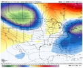
On the EPS, the 1st ridge goes up in the western Aleutian Islands here beginning at hour 24...

At hour 24 when that 1st ridge goes up, the Pacific Jet speed max is along and just off the E Asia coast, and its endpoint is along 180 deg (the Dateline)...

The 2nd ridge goes up in the eastern Gulf of Alaska here beginning at hour 156 (this is the ridge that kicks the SW Canada PV southeast - if modeled correctly)

At hour 156 when that 2nd ridge goes up, the Pac Jet speed max is now located in the western Pacific, and its endpoint is along 160 deg W (Hawaii longitude), which is an optimal location for -EPO / +PNA ridging...

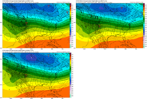
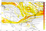
In terms of mechanisms for extending the jet, we have tropical forcing moving east out of the Indian Ocean and toward the W Pac. You can see here how the Pac jet is currently in the process of extending (Dec 9 to Dec 14 shown)...

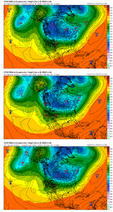
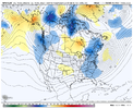
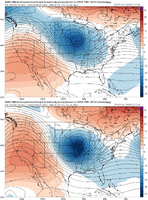
And this should continue as the tropical forcing moves further east into the W Pac, as seen here...Week 2 for Dec 22-28 is at the bottom...

We also have a significant +EAsiaMtnTorq event that will occur in the next few days as strong high pressure descends into SE Asia. This process will also aid in extending the Pac Jet 1-3 weeks later (i.e. Dec 24 - Jan 14)…

So, going forward, we have mechanisms in place to extend the Pac Jet to a location that fosters -EPO / +PNA ridging.
The fail scenario that I am personally watching for is that the jet eventually overextends and we end up with ridging in the Western and Central U.S. with cold anomalies confined to the far NE and Mid-Atlantic coast (this is what happened in early Jan last year before the jet retracted a bit and the storm hit the SC Upstate well).
The other fail scenario of the Pac Jet not extending enough, and we get troughs dumping into the U.S. West is less likely IMO as we move into Christmas and the 1st week of Jan.
But the broader point goes like this.....
If you are a golfer and you never practice, and you then go out and play, you can't get mad when you don't shoot even par. Same thing applies here....if the Pac Jet has yet to extend, it's not logical to get mad / disappointed for seeing ridging going up out west that isn't in a favorable location for central and eastern U.S. troughing and colder temperatures
On the EPS, the 1st ridge goes up in the western Aleutian Islands here beginning at hour 24...

At hour 24 when that 1st ridge goes up, the Pacific Jet speed max is along and just off the E Asia coast, and its endpoint is along 180 deg (the Dateline)...

The 2nd ridge goes up in the eastern Gulf of Alaska here beginning at hour 156 (this is the ridge that kicks the SW Canada PV southeast - if modeled correctly)

At hour 156 when that 2nd ridge goes up, the Pac Jet speed max is now located in the western Pacific, and its endpoint is along 160 deg W (Hawaii longitude), which is an optimal location for -EPO / +PNA ridging...

In terms of mechanisms for extending the jet, we have tropical forcing moving east out of the Indian Ocean and toward the W Pac. You can see here how the Pac jet is currently in the process of extending (Dec 9 to Dec 14 shown)...

And this should continue as the tropical forcing moves further east into the W Pac, as seen here...Week 2 for Dec 22-28 is at the bottom...

We also have a significant +EAsiaMtnTorq event that will occur in the next few days as strong high pressure descends into SE Asia. This process will also aid in extending the Pac Jet 1-3 weeks later (i.e. Dec 24 - Jan 14)…

So, going forward, we have mechanisms in place to extend the Pac Jet to a location that fosters -EPO / +PNA ridging.
The fail scenario that I am personally watching for is that the jet eventually overextends and we end up with ridging in the Western and Central U.S. with cold anomalies confined to the far NE and Mid-Atlantic coast (this is what happened in early Jan last year before the jet retracted a bit and the storm hit the SC Upstate well).
The other fail scenario of the Pac Jet not extending enough, and we get troughs dumping into the U.S. West is less likely IMO as we move into Christmas and the 1st week of Jan.
But the broader point goes like this.....
If you are a golfer and you never practice, and you then go out and play, you can't get mad when you don't shoot even par. Same thing applies here....if the Pac Jet has yet to extend, it's not logical to get mad / disappointed for seeing ridging going up out west that isn't in a favorable location for central and eastern U.S. troughing and colder temperatures
Last edited:
iGRXY
Member

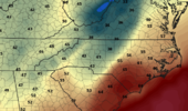
That's a serious gradient tomorrow. certain locations will be upper 40's while 20 miles away will be in the lower 70's.
Thank you for this. Great breakdown!!A few thoughts on the pattern ahead...
On the EPS, the 1st ridge goes up in the western Aleutian Islands here beginning at hour 24...

At hour 24 when that 1st ridge goes up, the Pacific Jet speed max is along and just off the E Asia coast, and its endpoint is along 180 deg (the Dateline)...

The 2nd ridge goes up in the eastern Gulf of Alaska here beginning at hour 156 (this is the ridge that kicks the SW Canada PV southeast - if modeled correctly)

At hour 156 when that 2nd ridge goes up, the Pac Jet speed max is now located in the western Pacific, and its endpoint is along 160 deg W (Hawaii longitude), which is an optimal location for +EPO / +PNA ridging...

In terms of mechanisms for extending the jet, we have tropical forcing moving east out of the Indian Ocean and toward the W Pac. You can see here how the Pac jet is currently in the process of extending (Dec 9 to Dec 14 shown)...

And this should continue as the tropical forcing moves further east into the W Pac, as seen here...Week 2 for Dec 22-28 is at the bottom...

We also have a significant +EAsiaMtnTorq event that will occur in the next few days as strong high pressure descends into SE Asia. This process will also aid in extending the Pac Jet 1-3 weeks later (i.e. Dec 24 - Jan 7)...

So, going forward, we have mechanisms in place to extend the Pac Jet to a location that fosters -EPO / +PNA ridging.
The fail scenario that I am personally watching for is that the jet eventually overextends and we end up with ridging in the Western and Central U.S. with cold anomalies confined to the far NE and Mid-Atlantic coast (this is what happened in early Jan last year before the jet retracted a bit and the storm hit the SC Upstate well).
The other fail scenario of the Pac Jet not extending enough, and we get troughs dumping into the U.S. West is less likely IMO as we move into Christmas and the 1st week of Jan.
But the broader point goes like this.....
If you are a golfer and you never practice, and you then go out and play, you can't get mad when you don't shoot even par. Same thing applies here....if the Pac Jet has yet to extend, it's not logical to get mad / disappointed for seeing ridging going up out west that isn't in a favorable location for central and eastern U.S. troughing and colder temperatures
The NW trend appears to have commenced. RGEM is next up. Minor deal, but it's all we have for now.


Ron Burgundy
Member
Really appreciate the effort you put into this - very informative!A few thoughts on the pattern ahead...
On the EPS, the 1st ridge goes up in the western Aleutian Islands here beginning at hour 24...

At hour 24 when that 1st ridge goes up, the Pacific Jet speed max is along and just off the E Asia coast, and its endpoint is along 180 deg (the Dateline)...

The 2nd ridge goes up in the eastern Gulf of Alaska here beginning at hour 156 (this is the ridge that kicks the SW Canada PV southeast - if modeled correctly)

At hour 156 when that 2nd ridge goes up, the Pac Jet speed max is now located in the western Pacific, and its endpoint is along 160 deg W (Hawaii longitude), which is an optimal location for +EPO / +PNA ridging...

In terms of mechanisms for extending the jet, we have tropical forcing moving east out of the Indian Ocean and toward the W Pac. You can see here how the Pac jet is currently in the process of extending (Dec 9 to Dec 14 shown)...

And this should continue as the tropical forcing moves further east into the W Pac, as seen here...Week 2 for Dec 22-28 is at the bottom...

We also have a significant +EAsiaMtnTorq event that will occur in the next few days as strong high pressure descends into SE Asia. This process will also aid in extending the Pac Jet 1-3 weeks later (i.e. Dec 24 - Jan 7)...

So, going forward, we have mechanisms in place to extend the Pac Jet to a location that fosters -EPO / +PNA ridging.
The fail scenario that I am personally watching for is that the jet eventually overextends and we end up with ridging in the Western and Central U.S. with cold anomalies confined to the far NE and Mid-Atlantic coast (this is what happened in early Jan last year before the jet retracted a bit and the storm hit the SC Upstate well).
The other fail scenario of the Pac Jet not extending enough, and we get troughs dumping into the U.S. West is less likely IMO as we move into Christmas and the 1st week of Jan.
But the broader point goes like this.....
If you are a golfer and you never practice, and you then go out and play, you can't get mad when you don't shoot even par. Same thing applies here....if the Pac Jet has yet to extend, it's not logical to get mad / disappointed for seeing ridging going up out west that isn't in a favorable location for central and eastern U.S. troughing and colder temperatures
NBAcentel
Member
iGRXY
Member
I think we have signals out there for a couple timeframes, but as you've seen there's improvement on the models showing up in the day 3-6 range even right now. I have a suspicion that we won't start seeing legit trend run by run storms show up until we are under 150 hours. Hopefully we can land one of these things and as it stands now, there's a legit chance at that over the next 2 weeks.
LukeBarrette
im north of 90% of people on here so yeah
Meteorology Student
Member
2024 Supporter
2017-2023 Supporter
NBAcentel
Member
accu35
Member
12z RGEM may try again
LukeBarrette
im north of 90% of people on here so yeah
Meteorology Student
Member
2024 Supporter
2017-2023 Supporter
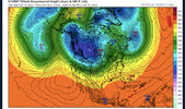
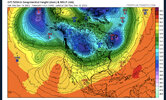
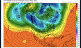
And a completely different look than the other models in terms of ridging out west.. I’ve always believed as we get closer we will see more of this ridge building out west than the other models are showing right now. (Kind of like the trend we saw last winter) obviously like grit said we don’t want this sliding too far east but at this juncture I like what I see. I expect other models to bring up that ridge with time. 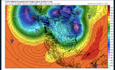


LukeBarrette
im north of 90% of people on here so yeah
Meteorology Student
Member
2024 Supporter
2017-2023 Supporter
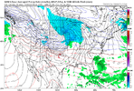
Yeah I’ve never been a fan of this threat .. if anything watch the 20th but even then I’m eh about itView attachment 126310
Looks a lot worse boooo
LukeBarrette
im north of 90% of people on here so yeah
Meteorology Student
Member
2024 Supporter
2017-2023 Supporter
Wasting cold air with this…Yeah I’ve never been a fan of this threat .. if anything watch the 20th but even then I’m eh about it
NBAcentel
Member
Yep, good call by Ollie on this one, just a lakes vortex so it has a higher then average chance of shearing out, even tho setups like that have worked in the past, no true cold air with this eitherView attachment 126310
Looks a lot worse boooo
The 18th system has always been more of an N. Ala/N. Ga. hope and a prayer thing. The key player to watch is the Great Lakes vortex's position and orientation. A little further NW opens the door for a little more moisture, but too much and it's just sprinkles.Yep, good call by Ollie on this one, just a lakes vortex so it has a higher then average chance of shearing out, even tho setups like that have worked in the past, no true cold air with this either
- Joined
- Jan 2, 2017
- Messages
- 1,566
- Reaction score
- 4,279
U can include NW Sc in there. We often get novelty flizzards or a snow/sleet shower out of these. I believe it peaked burrels interest earlier so it peaked mine as wellThe 18th system has always been more of an N. Ala/N. Ga. hope and a prayer thing. The key player to watch is the Great Lakes vortex's position and orientation. A little further NW opens the door for a little more moisture, but too much and it's just sprinkles.
NBAcentel
Member
NBAcentel
Member
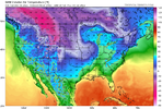
I like the look of it better so far. Looks better on the Atlantic side and I think it’s going to get blocked up a bit more overall eventually. Let’s see thoughNot as good this run honesty , slightly farther SW so farView attachment 126313
NBAcentel
Member
Yep it’s sliding under the block from what I see so farI like the look of it better so far. Looks better on the Atlantic side and I think it’s going to get blocked up a bit more overall eventually. Let’s see though
NBAcentel
Member
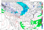
LOL, look at the logjam of isobars as shallow artic air has to pile up and get across the apps


Found a unicorn to chase


Bad angle of cold. It never makes it in time for us. Ever
- Joined
- Jan 2, 2017
- Messages
- 1,566
- Reaction score
- 4,279
That would prob lead to some intense upslope for the mountainsFound a unicorn to chase


NBAcentel
Member
Its GFS at 10 days out. But most likely we will see a reinforcing shot of Cold air come down at some point. It always has a speed bump to navigate across the NC mtns
- Joined
- Jan 23, 2021
- Messages
- 4,601
- Reaction score
- 15,196
- Location
- Lebanon Township, Durham County NC
GFS was juuuuuuuust a bit outside from a white christmas that run.
If any storm system has been somewhat consistent, it's that we are going to have some piece of energy flying with the Arctic front... Which will favor areas West of the apps.
Southeast would rely on a coastal low popping off or getting some Gulf moisture in after cold moves in.
Southeast would rely on a coastal low popping off or getting some Gulf moisture in after cold moves in.
- Joined
- Jan 23, 2021
- Messages
- 4,601
- Reaction score
- 15,196
- Location
- Lebanon Township, Durham County NC
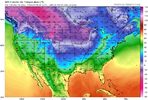
15:1 ratios on the pivotal maps. I can see it.Couple Christmas Eve snow showers would be beautiful! View attachment 126321
If we can trend the ridge out west to go further west that would be ideal for us. Would lead to some more than just clipper threats. Ensembles time!

