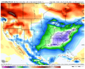
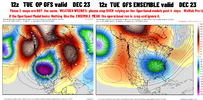
No i think he coldest air is likely centered on Christmas eve/day or just afterSo your saying warm after Christmas
-
Hello, please take a minute to check out our awesome content, contributed by the wonderful members of our community. We hope you'll add your own thoughts and opinions by making a free account!
You are using an out of date browser. It may not display this or other websites correctly.
You should upgrade or use an alternative browser.
You should upgrade or use an alternative browser.
Pattern Dazzling December
- Thread starter Rain Cold
- Start date
Met1985
Member
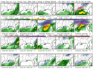
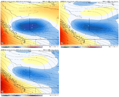
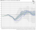
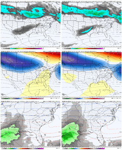
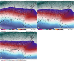
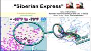
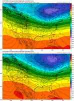
Yep the gefs absolutely drops the hammer on us with the cold air around hour 200.This gefs run is way colder and moves the cold in way quicker then any other run. thanks to a way more +PNA. these means gonna be insane and temp spreads about to be below 0 in some spots View attachment 126182View attachment 126183
Cary_Snow95
Member
Kind of reminds me of December 2017 into January 2018. Absolutely frigid Christmas and week after. And we cashed in multiple times in between warm ups
Yep and if you’re lucky to get snow that’s going to support single to below zero temps with this type of arctic blast.. crazy we’re talking about this in late December .. usually we’re still sun bathing right nowThis gefs run is way colder and moves the cold in way quicker then any other run. thanks to a way more +PNA. these means gonna be insane and temp spreads about to be below 0 in some spots View attachment 126182View attachment 126183
- Joined
- Jan 23, 2021
- Messages
- 4,603
- Reaction score
- 15,199
- Location
- Lebanon Township, Durham County NC
EPS had decent agreement on 12/23 today as well
NBAcentel
Member
If i was to go with something, it would be similar to Shane, inland runner before Christmas, maybe something with that or before that, then cold settles in, then watch for energy moving in with cold vortex in place, Gefs probably to fast, euro to slow, geps/eps more on point
D
Deleted member 609
Guest
Not often you see snow modeled that far into the gulf. Very cold.
thing you like to see . This View attachment 126180
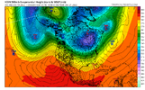
Day 8-10, close but maxes needs to be adjusted east, eastern WA/western MT. -dPVA should come in just south for the money shot looking west. Not going to work, IMO, especially the way the isohypses hook back west above 55N.
packfan98
Moderator
We have gotten a few runs with some decent looks and potential storms, but definitely no slam dunk, can't miss systems. However, the bigger question is how the pattern sets up after the initial cold blast around 23rd. Looks like the eastern trough will continue to push east and we will need another pattern reload/reset. The runs today have seemed to speed up the trough progression which may limit our initial chances at a winter system. There are some good signs with the Pac jet and Aleutian Low with favorable teleconnections too.
No matter what the models show or what we want to happen, the weather is going to do what it's going to do. We are just making a hobby out of it. Have fun with it!
No matter what the models show or what we want to happen, the weather is going to do what it's going to do. We are just making a hobby out of it. Have fun with it!
in retrospect i think this take was a bit knee jerky, but euro family still left an alkaline taste in my mouth. How I see the field:really don't like how large of a jolt that was, ensembles are aircraft carriers, takes a lot to jolt them like that. family of euro runs has left me much more pessimistic this afternoon
- the s/w's in the 4-7 day period can still trend towards more consolidation/ampiness, i'm interested, but time is ticking.
- the cold dump coming in 10 days out, and the vortex tied with it, are preposterous. someone will get a wicked storm, depending on the tilt. where does that vortex go? as euro demonstrates, still a lot of places on the table. i think the euro op from this afternoon would generally just delay the cold a few days, but tbh who wants their package to be delayed a few days?
- period after the vortex dump is super intriguing. i try soooo hard to not make dec 1989 references... i think it is wilmington weenie behavior. but the setup, some mega-high getting set in the plains with a big trough in the vicinity, is close.
Oh boy ? What a run ??
NBAcentel
Member
DadOfJax
Member
It’s about time mods stepped in with this kind of nonsenseSo your saying warm after Christmas
Yes sir bossIt’s about time mods stepped in with this kind of nonsense
packfan98
Moderator
We respond to every report.It’s about time mods stepped in with this kind of nonsense
Met1985
Member
A lot of the moderators and administrators are originals from the old sight. We go waaaay back don't we fellas. This group does a great job managing what they do. As for the weather it looks really wet coming in tomorrow night. A lot of rainfall is going to be dropped.
NBAcentel
Member
NBAcentel
Member
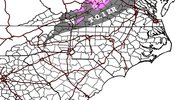
Wouldn’t be at all suprised to see a few sleet pellets in the NC Piedmont tomorrow as the atmosphere starts to moisten upMost of this will fall on the lighter side of the totals I put up, but here’s my thoughts View attachment 126194
- Joined
- Jan 23, 2021
- Messages
- 4,603
- Reaction score
- 15,199
- Location
- Lebanon Township, Durham County NC
That’s the thing. Gotta figure out the first system because that will effect later systems.Don’t sleep on the first system, and also hard to tell if 18z EPS was better for part 2, looks like more of the TPV got strung out east under the block, which is what we want
Don’t sleep on the day 7 storm View attachment 126191View attachment 126193
At the end of the day that's what we all want to know. How will these short wave systems behave behind the huge induction of CAAThat’s the thing. Gotta figure out the first system because that will effect later systems.
A+ I really like Escarpment area looks professional. It was freezing fog/drizzle all day in Blowing Rock. I'll have obs in the morning I think for areas in NC tomorrow morning is how quick the precip moves in and Wednesday night on cad.Most of this will fall on the lighter side of the totals I put up, but here’s my thoughts View attachment 126194
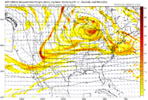
This is what I was saying earlier about seeing ice as a big threat for someone on these runs.That one has potential.. biggest question will be whether or not we can manage to get cold enough air for winter weather, either at the surface in the form of ZR or otherwise in the form of SN.. the upper air setup almost looks like a classic ZR storm across the southeast.
DT’s wording says GFS, but he is showing the Euro maps, another and whole separate lol
Going to be a heck of a wedge gradient around here Thursday afternoon
Webberweather53
Meteorologist
Brent
Member
Our TV met just said he hopes it's not as cold as some of the models have ???
29 outside, stars around and Ground frozen. Beatifull winter evening
NBAcentel
Member
NBAcentel
Member
LukeBarrette
im north of 90% of people on here so yeah
Meteorology Student
Member
2024 Supporter
2017-2023 Supporter
LukeBarrette
im north of 90% of people on here so yeah
Meteorology Student
Member
2024 Supporter
2017-2023 Supporter
View attachment 126217
Still watching the short range changes to this system, shortwave looks a tad better this run.
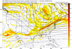
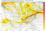
18z vs 00z GFS, it looks a lot better but I’m not sure if we have enough time to trend this to something.
LukeBarrette
im north of 90% of people on here so yeah
Meteorology Student
Member
2024 Supporter
2017-2023 Supporter
View attachment 126220
View attachment 126223
18z vs 00z GFS, it looks a lot better but I’m not sure if we have enough time to trend this to something.
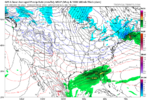
Tough to watch something be so close for parts of this board.
We still got time for the NW trend.View attachment 126224
Tough to watch something be so close for parts of this board.
Northwest trend is your friend?View attachment 126224
Tough to watch something be so close for parts of this board.
LukeBarrette
im north of 90% of people on here so yeah
Meteorology Student
Member
2024 Supporter
2017-2023 Supporter
Need the vorticity to strengthen big time in a short amount of time or get better tilt as it drops south into Texas. Idk…We still got time for the NW trend.


