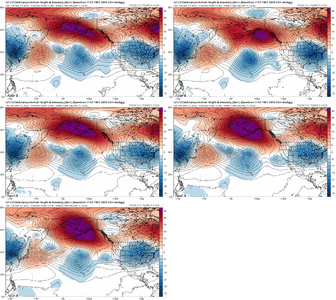
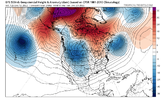
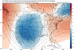
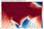
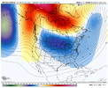
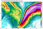
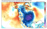
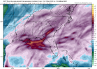
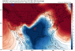
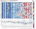
Definitely different from last year at this time when we had that Aleutian death ridge up. Anyway… things still looking great with teleconnections going forward… it actually appears now that we’re going to have a substantial period of -AO/-NAO/+PNA coming up… it’s been awhileLike I said before. It’s a good thing we have a strong Aleutian low entering the picture because otherwise, we’d be on our way to failing lol View attachment 125780
-
Hello, please take a minute to check out our awesome content, contributed by the wonderful members of our community. We hope you'll add your own thoughts and opinions by making a free account!
You are using an out of date browser. It may not display this or other websites correctly.
You should upgrade or use an alternative browser.
You should upgrade or use an alternative browser.
Pattern Dazzling December
- Thread starter Rain Cold
- Start date
NBAcentel
Member
Yeh same. We do have +EAMT on our side which favors extension, last January had me nervous for the same aspect but that kick happened from the Aleutain low that resulted from +EAMT and it’s associated jet extension. When we should worry is if we quickly start seeing -EAMT and it return quick and feeds back quick, as that’s a retraction phase, but that kick is favored with the subseasonal pattern so there’s that100% agree. It may be our saving grace because it is slowly becoming evident we are going to have to have something to kick the tpv east vs. having it consolidate there initially.
After what happened the past couple of years, I'm still nervous about that prospect but guidance is so far pretty consistent in showing that kick happening.
packfan98
Moderator
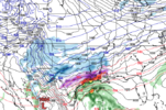
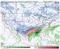
Not a bad look at this lead time:


NBAcentel
Member
That SER flex actually coincides with a very brief dip of the MJO into very low amp phase 3… it quickly loops back into COD and heads for low amp phase 8,1 again. We might honestly want to see a bit of a flex at that time as there has been some signals of a storm but suppressed way too far southWe are definitely at least in the beginning stage of a trend to a SE ridge flex around the 20th. But the Icon shows a monster front coming down.
packfan98
Moderator
I'll take my chances. The bagginess in the 4 corners region could pop a storm. If not, then our favorable pattern would be slower to develop with the trough axis further west initially. It's so different than the fast flow of the previous few years, it's almost difficult to figure out what to root for. The slower the pattern to develop, the longer it may hold on when we are historically at our coldest?
Yep I was just about to post this, definite trend north just as @ILMRoss was mentioning earlier. Something to keep an eye on for sureNot a bad look at this lead time:

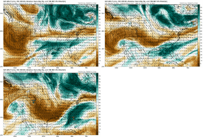
- Joined
- Jan 2, 2017
- Messages
- 1,566
- Reaction score
- 4,279
Absolutely not..6 days out that's where you wanna see the Low track imo.Not a bad look at this lead time:

NBAcentel
Member
This GFS run still looks better then last run lol
NBAcentel
Member
iGRXY
Member
GFS Incoming
iGRXY
Member
iGRXY
Member

Wall to wall storm coming in.
iGRXY
Member

You give me this double barrel banana high look and I will take my chances that this will be plenty cold enough.
NBAcentel
Member
Storm5
Member
?
iGRXY
Member
JLL1973
Member
gfs goes bonkers around christmas for much of the midsouth
WXinCanton
Member
Miller B on the front end .. Miller A on the backend .. wow certainly in the cards with that growing +PNA .. this run just shows the true potential of what can happen.. and this happened with the dumping of energy out west some.. so I like the progression but this will change .. ensembles will be fun to see 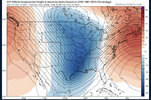
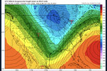
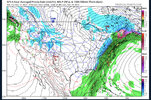


GFS with your standard 1058 parked on top of Montana..big yike west of the apps especially
iGRXY
Member

Yuck
ATLwxfan
Member
Thankfully ATL dodges snowmageddon on that op GFS run! Lot of folks get smoked though.
Sent from my iPhone using Tapatalk
Sent from my iPhone using Tapatalk
iGRXY
Member
Our PV does progress east nicely and sets the stage for the interesting day 9-11 range
NBAcentel
Member
It definitely looks better than the OP.GEFS still looks good lol. Pacific trough is a lifesaver View attachment 125807
Kind of reminds me of February 1994. Watch all day as the artic air bleeds in and plasters those just NW of us. Then get our ice and a bit of snow and go into the freezer.
D
Deleted member 609
Guest
Pattern still looks good for the second half of December. May be able to sneak something around the 18th as well. Looks suppressed right now but that’s a decent look at this range.
On another note, are weenies seriously already overloading the site?? Or is my internet just messing up?
On another note, are weenies seriously already overloading the site?? Or is my internet just messing up?
Flotown
Member
any ensemble support on big dog gfs showed?
- Joined
- Jan 23, 2021
- Messages
- 4,601
- Reaction score
- 15,196
- Location
- Lebanon Township, Durham County NC
It was very slow for me briefly but seems back to normalPattern still looks good for the second half of December. May be able to sneak something around the 18th as well. Looks suppressed right now but that’s a decent look at this range.
On another note, are weenies seriously already overloading the site?? Or is my internet just messing up?
- Joined
- Jan 23, 2021
- Messages
- 4,601
- Reaction score
- 15,196
- Location
- Lebanon Township, Durham County NC

