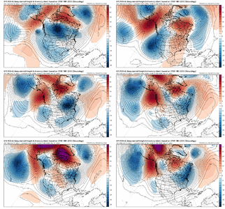
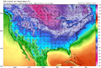
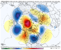
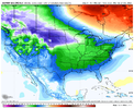
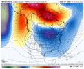
Clipper??View attachment 125697
What a funky looking feature
-
Hello, please take a minute to check out our awesome content, contributed by the wonderful members of our community. We hope you'll add your own thoughts and opinions by making a free account!
You are using an out of date browser. It may not display this or other websites correctly.
You should upgrade or use an alternative browser.
You should upgrade or use an alternative browser.
Pattern Dazzling December
- Thread starter Rain Cold
- Start date
Vodka cold incoming
Brent
Member
What a massive wave break overtop of Alaska. Looked like a hurricane ridge was spinning up there
JLL1973
Member
The gfs has the whole country in the deep freeze around Christmas. That’s some brutal cold
1059 MB high sliding down into US! ???What a massive wave break overtop of Alaska. Looked like a hurricane ridge was spinning up there
D
Deleted member 609
Guest
NBAcentel
Member
From my perspective we’re starting to see where our potentials are. 18-20 is our first shot at something. Most models are suppressed we also lack a big time table setter so marginal cold air possibly but definitely could be enough to get it done. Next is 23-26 where our cold air should theoretically be established where we will then look for overrunning or CAD set up of sorts. (Keep in mind there are fail potentials here especially with our second chance) but that’s what I’m seeing right now. After or during that round we have the potential for vodka cold plunging in. If anyone read Allan Hoffmanns write up earlier he talks about how analogs put the coldest anomalies over us at the beginning of January.
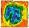
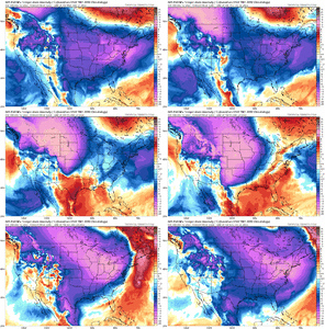
The CMC Ensembles too! They went in the opposite direction than the Operational.GEFS looks amazing !!!View attachment 125716
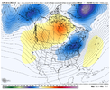
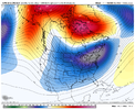
NBAcentel
Member
NBAcentel
Member
NBAcentel
Member
NBAcentel
Member
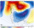
CMCE parks a low over the Aleutian Islands till the end of the run
accu35
Member
Wow!! At the gefs on the first storm for the Deep South.
NBAcentel
Member
Brent
Member
Euro is very cold... But also very dry by then
BufordWX
Member
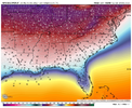
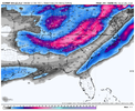
Coastal Carolinas (Jan 2018 vibes). I would like to see the precip and temp during this time.Just for kicks the Euro control was pretty active. Gulf coast, Atlantic coast, and a big storm further north. 2nd half of December looking like fun times ahead.
View attachment 125732
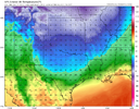
However the EPS as a whole is just crazy cold. 10 day average with practically the whole country solidly below average.View attachment 125733
AJ1013
Member
65F and foggy here at 5am.
London looks gorgeous today
London looks gorgeous today
AJ1013
Member
Winter Storm Warning posted for the higher elevations around Tucson
Where PNA go?


iGRXY
Member
AJ1013
Member
Fog so dense here I can barely see the next gate over. Surprised flight isn’t delayed
SimeonNC
Member
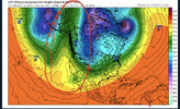
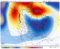
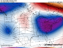
204Hours? In agreement with the CMC. Yeah, that does get my attention. (note the time stamp on the 500mB chart)View attachment 125735
Posting a long range GFS image when it doesn’t even agree with its own ensemble is interesting I guess
You Virginia Boys Gotta still keep an eye on Thursday.


but the CMC doesn’t have support from its ensembles either…. We all loved the 18z run of the GFS last night, but we also know that extreme of a solution is very unlikely. Anything past 5 days right now, attention has to given to ensembles204Hours? In agreement with the CMC. Yeah, that does get my attention. (note the time stamp on the 500mB chart)
What I think I know this morning: Will change by 12z lol:
No upslope after table setter storm Thursday, swings front through. Or put it this way, not even close to what I thought would be possible/ was being advertised.
GFS OP is pure garbage/useless. So its up to the ensembles, Euro Op, Ukmet and Canadian op to try and get a clue.
Looks like next Mon/Tues is the 1st legit chance of frozen here. Can and Euro ops want to front end (ice would be best bet. Long way to go on this one as any frozen will be dictated by CAD Northeast HP/confluence etc.
Outside of that Cold/Dry/Suppress may end up being the theme rest of December. Cold will be there, its the moisture and timing some at the right time. But really who knows or what model can pin that down outside of 5 days.
Still feel great about the pattern. Really all you can ask for.
AJ1013
Member
London winning today
NBAcentel
Member
Surprised no one mention this, but the 00z EPS was a pretty nice improvement, improving the tilt of the ridge and having a faster start time of the colder pattern, all the ensembles took trends for the better last night 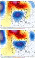
That pacific trough seems to be our saving grace, in the past they have heavily been associated with +PNA

That pacific trough seems to be our saving grace, in the past they have heavily been associated with +PNA

