NBAcentel
Member
The CMC stinks and so does the GFS. Ensembles people. That’s what you need to be focusing on204Hours? In agreement with the CMC. Yeah, that does get my attention. (note the time stamp on the 500mB chart)
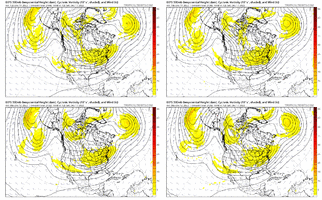
This is what we want. Slide some moisture over the region right after this and we’re in business for days. That’s the scenario that shut ATL down for a week in 2011.That gefs run was coldddd, Christmas Eve stays below freezing, mean highs in the 30s and low in the upper teens/low 20s already ?View attachment 125742View attachment 125743View attachment 125744View attachment 125745
Remember that weeklies run from Dec 1st… yeah we bash it but it might be right on the money if this holds.. ?Lol the weeklies View attachment 124539
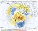
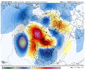


I was just thinking in the back of my head that not too many significant periods lead off with a big dog. Usually there's a small one or two leading up to the main event. Of course, thats purely anecdotal evidence.View attachment 125761
i think there's still a little time to trend this into a sneaky thing to track
View attachment 125762
GFS ens shows a nascent northward trend. no threat to be a big dog i'm keeping an eye on things
it always does feel like we need to dip our toe into things. we have so many folks in this thread doing yeoman's work in the long range game that this little system, which is our bread and butter (little shortwave that trends into a more amped/more defined and further north solution) is sliding under the radar some. could be nothing but i'm looking forward to the 12zs. would somebody do me a favor and pull up the 0z euro ensembles for some place like, jackson msI was just thinking in the back of my head that not too many significant periods lead off with a big dog. Usually there's a small one or two leading up to the main event. Of course, thats purely anecdotal evidence.
it always does feel like we need to dip our toe into things. we have so many folks in this thread doing yeoman's work in the long range game that this little system, which is our bread and butter (little shortwave that trends into a more amped/more defined and further north solution) is sliding under the radar some. could be nothing but i'm looking forward to the 12zs. would somebody do me a favor and pull up the 0z euro ensembles for some place like, jackson ms
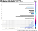
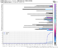
It *appears* as though we are going to avoid the first hurdle I mentioned.
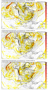
Hurdle #2 (as Fro has mentioned also) looks to be where the injection of the second TPV and consolidation of the trapped vortex under the block locates. Further east would be much more ideal as that would establish the mean trough axis further east as we head into the week of Christmas where our first real potential likely exists.
Last night's 00z EPS was dumping in the west, but today's 12z took a step east. We need another one or two of those to match the 12z GEFS.
View attachment 125607
View attachment 125608
View attachment 125609
This may be the next crucial hurdle to traverse to get where we want to go.
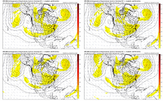
interesting look, not "save to photos for future reference" worthy but signals a lot of mild ambient potential D6-onward.Tupelo looks better
This is all op run of the gfs. Have we not learned to not really trust the op runs of the models currently with the anomalous blocking that is taking place? We need to lean on the ensembles instead. Just my opinion but the damn gfs spits out a different solution every 6 hours. Color me skeptical.Hate to be the downer here, but I'm not liking at all the trends I'm seeing in regard to hurdle #2 that I discussed.
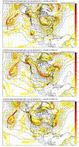
View attachment 125767
View attachment 125768
The 6z GFS just as an example also took another step in that direction at 138 (a borderline usable deterministic forecast hour):
View attachment 125769
Which translated to this trend later:
View attachment 125770
If this energy is going to dig southwest off the Pacific NW instead of congealing with our first system sliding east, it's at best going to delay setting up the favorable west-based -NAO. Not a fan and hope this changes, but once we start getting towards D5 you have to be alarmed at least somewhat at such trends suddenly appearing.
Go back and re-read what I wrote. The first two were the GEFS and EPS trends over the past several runs. The GFS was shown as an example of the downstream effects of changes in the shorter term, where an op can be used with some skill.This is all op run of the gfs. Have we not learned to not really trust the op runs of the models currently with the anomalous blocking that is taking place? We need to lean on the ensembles instead. Just my opinion but the damn gfs spits out a different solution every 6 hours. Color me skeptical.
Kinda got to wonder if we will briefly warm back up in that 20th timeframe before another shot of cold air drops down.Yeah this is concerning View attachment 125772
Ah ok I see. Well I still don't think the models have a good handle on this pattern but we could be completely shut out and be on the mild side. That would go along with Nina. But with the blocking over the top I just have my doubts but yeah we could get skunked.Go back and re-read what I wrote. The first two were the GEFS and EPS trends over the past several runs. The GFS was shown as an example of the downstream effects of changes in the shorter term, where an op can be used with some skill.
Yeah I'm not saying it's a death knell, but it could delay it. There have been several pieces of information (including a post I shared from Allan Huffman yesterday with pattern analogs) along with all of the ensembles still showing support for an eventual favorable pattern setting up, but I never like to see that get delayed because inevitably another fly in the ointment will crop up and before you know it the window of opportunity starts to close.Ah ok I see. Well I still don't think the models have a good handle on this pattern but we could be completely shut out and be on the mild side. That would go along with Nina. But with the blocking over the top I just have my doubts but yeah we could get skunked.
LOL.....The GFS has been the most inconsistent with solution output for this timeframe since it came into its forecast window. Using that as a basis for argument against the Arctic cold that is coming isn't going to age well IMO.Hate to be the downer here, but I'm not liking at all the trends I'm seeing in regard to hurdle #2 that I discussed.
View attachment 125767
View attachment 125768
The 6z GFS just as an example also took another step in that direction at 138 (a borderline usable deterministic forecast hour):
View attachment 125769
Which translated to this trend later:
View attachment 125770
If this energy is going to dig southwest off the Pacific NW instead of congealing with our first system sliding east, it's at best going to delay setting up the favorable west-based -NAO. Not a fan and hope this changes, but once we start getting towards D5 you have to be alarmed at least somewhat at such trends suddenly appearing.
He literally shows the EPS and GEFS doing the same trend lolLOL.....The GFS has been the most inconsistent with solution output for this timeframe since it came into its forecast window. Using that as a basis for argument against the Arctic cold that is coming isn't going to age well IMO.
It’s funny because I posted this as a response to youHate to be the downer here, but I'm not liking at all the trends I'm seeing in regard to hurdle #2 that I discussed.
View attachment 125767
View attachment 125768
The 6z GFS just as an example also took another step in that direction at 138 (a borderline usable deterministic forecast hour):
View attachment 125769
Which translated to this trend later:
View attachment 125770
If this energy is going to dig southwest off the Pacific NW instead of congealing with our first system sliding east, it's at best going to delay setting up the favorable west-based -NAO. Not a fan and hope this changes, but once we start getting towards D5 you have to be alarmed at least somewhat at such trends suddenly appearing.
We’re shortening wavelengths with this trend, worse trend in the PNW but the trough digging around the Aleutians is trending better which is the bootYep, the most difficult one, gotta watch out because we’re in a pattern where wavelengths are short right now due to the intense blocking, if we fail, we would have to wait on a boot in the pacific trough to kick the ridge east and that would Just be another pain
it's not a death knell but it's a legit concern. it's not how i would draw things up. "el paso gets snow houston gets sleet" kinda patternYeah I'm not saying it's a death knell, but it could delay it. There have been several pieces of information (including a post I shared from Allan Huffman yesterday with pattern analogs) along with all of the ensembles still showing support for an eventual favorable pattern setting up, but I never like to see that get delayed because inevitably another fly in the ointment will crop up and before you know it the window of opportunity starts to close.
I am nowhere near giving up, just having a little play by play discussion of what I'm seeing and it is very possible that as the energy is better sampled it could still trend back to a better solution. Just something to keep an eye on that could send us in a less favorable direction.
Good analysis in here Hypso / Fro, I agree. On the opposite end of the spectrum, here's a fail point that I'm watching for...we need the Pac Jet to extend else we stay in this Aleutian High / -PNA pattern. So, the combo of the big +EAsiaMtnTorq episode that is about to go down plus the W Pac tropical forcing are highly likely to extend the jet and move us toward -EPO/+PNA....but it's also possible that the jet extension is too powerful, and it plows west to east into Cali and wrecks the western ridging and we go mild with west to east flow. If this did happen, it would be temporary (i.e. we're not in a strong El Nino). And also, this could even be a good thing as, in a perfect world, we keep some western ridging in Canada combining with -AO/-NAO, and get southern stream into Cali > Texas providing the storm wavesIt’s funny because I posted this as a response to you
We’re shortening wavelengths with this trend, worse trend in the PNW but the trough digging around the Aleutians is trending better which is the boot
Yeah I agree this is a very complex and a very anomalous pattern that has already started. Fun to see it work out either way. Either we get lucky or we see a way we get screwed lol. This has been a fun pattern to track especially with all the modeling inconsistencies.Yeah I'm not saying it's a death knell, but it could delay it. There have been several pieces of information (including a post I shared from Allan Huffman yesterday with pattern analogs) along with all of the ensembles still showing support for an eventual favorable pattern setting up, but I never like to see that get delayed because inevitably another fly in the ointment will crop up and before you know it the window of opportunity starts to close.
I am nowhere near giving up, just having a little play by play discussion of what I'm seeing and it is very possible that as the energy is better sampled it could still trend back to a better solution. Just something to keep an eye on that could send us in a less favorable direction.
100% agree. It may be our saving grace because it is slowly becoming evident we are going to have to have something to kick the tpv east vs. having it consolidate there initially.Like I said before. It’s a good thing we have a strong Aleutian low entering the picture because otherwise, we’d be on our way to failing lol View attachment 125780
