-
Hello, please take a minute to check out our awesome content, contributed by the wonderful members of our community. We hope you'll add your own thoughts and opinions by making a free account!
You are using an out of date browser. It may not display this or other websites correctly.
You should upgrade or use an alternative browser.
You should upgrade or use an alternative browser.
Pattern Dazzling December
- Thread starter Rain Cold
- Start date
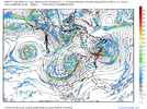
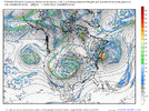
We do really need the cutoff along the west coast to rex with the ridge or even retrograde under it and back toward AK. If it doesn't its likely to help entice the pv west and we end up with an ugly pattern. We need more 12z icon and less 18z gfs
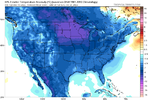
Not impossible then we are waiting for a turn to cold around new years. There are some not so subtle similarities to last December in over all evolution right nowNot that I believe it, but here's the 18z GFS for the same time:
View attachment 125456
That would suck!
L
Logan Is An Idiot 02
Guest
James spann not considering the GFS

Sent from my iPhone using Tapatalk

Sent from my iPhone using Tapatalk
I also thought the NWS was throwing it out as well?James spann not considering the GFS
Sent from my iPhone using Tapatalk
L
Logan Is An Idiot 02
Guest
Yeah. It would shock me if the GFS ends up being correct. If it does it deserves more respectI also thought the NWS was throwing it out as well?
bigstick10
Member
No one will ever pass the January 8th 1973 ice storm in Atlanta,,,It was a very compact isolated event basically right over the core of metro Atlanta,,,2 weeks without power,
Are these 2m anomalies??Not that I believe it, but here's the 18z GFS for the same time:
View attachment 125456
That would suck!
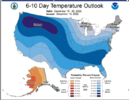
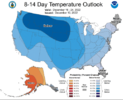
Agreed luckily the gfs is so useless not even the CPC aren’t even regarding it anymore.. and they know a heck of a lot more than anyone here lolNot impossible then we are waiting for a turn to cold around new years. There are some not so subtle similarities to last December in over all evolution right now
ATLwxfan
Member
Not that I believe it, but here's the 18z GFS for the same time:
View attachment 125456
That would suck!
Carolina beaches in the mid 70’s on Christmas? Is that such a bad thing?
Sent from my iPhone using Tapatalk
Drizzle Snizzle
Member
I would love a repeat of that this winter.No one will ever pass the January 8th 1973 ice storm in Atlanta,,,It was a very compact isolated event basically right over the core of metro Atlanta,,,2 weeks without power,
Agreed luckily the gfs is so useless not even the CPC aren’t even regarding it anymore.. and they know a heck of a lot more than anyone here lol
CPC?
Sent from my iPhone using Tapatalk
Hypsometric
Member
We also need more 12z ICON than 18z ICON. It appears there is a crucial period (seen in the loop) where energy moving around the Pacific ridge either consolidates with our big low that sets the Atlantic OR buckles the western ridge by digging southwest under the Pacific ridge and sets up a Rex block and wrecks the Pacific pattern.We do really need the cutoff along the west coast to rex with the ridge or even retrograde under it and back toward AK. If it doesn't its likely to help entice the pv west and we end up with an ugly pattern. We need more 12z icon and less 18z gfs
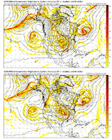
To get where we want to go, this may be the first crucial hurdle we have to clear (probably won't be the last).
Tarheelwx
Member
67F low with clear skies here
What you’re saying is the angle of the cold is wrong? ?I think it’s what that cranky guy rain cold was talking about earlier. We like to see those higher heights through AK but the orientation is less than ideal. It extends diagonal out into the pacific instead of vertical up and down the west coast causing troughs to eject down into the west coast resulting in an unfavorable PNA. It’s a strange pattern. Something’s gonna give here soon on the modeling. I don’t think these things can all exist together unless they are only transient.
TW
John1122
Member
The GFS has been having 40 degree temperature swings imby from run to run since modeling started seeing the block. There's a reason why no actual forecaster is using it in the long range right now. It mishandles the beginning of its evolution and that's throwing the long range further and further off the deeper into the run you go.
Climate prediction centerCPC?
Sent from my iPhone using Tapatalk
Sooooo if the gfs is waffling big time run to run but the ensembles have a 40-50 degree difference between max and min members, is the gfs bad or is the pattern volatile?
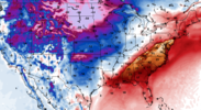
You could have let me live happy and not shown the 18z Icon, I didn't look at it earlier now i feel like thisWe also need more 12z ICON than 18z ICON. It appears there is a crucial period (seen in the loop) where energy moving around the Pacific ridge either consolidates with our big low that sets the Atlantic OR buckles the western ridge by digging southwest under the Pacific ridge and sets up a Rex block and wrecks the Pacific pattern.
View attachment 125457
To get where we want to go, this may be the first crucial hurdle we have to clear (probably won't be the last).

Itryatgolf
Member
Alot of us live and die by every model run it seems like??
You will if you follow the GFS latelyAlot of us live and die by every model run it seems like??
Itryatgolf
Member
That's why I get online once a day unless there is an imminent winter storm coming in and then it's a few more times a dayYou will if you follow the GFS lately
Hypsometric
Member
Well since I'm such a nice guy, I'll share that the 18z Euro (out to 90) is much further east with the energy I was talking about than the 18z GFS AND the upper low off the western US coast is also further west.You could have let me live happy and not shown the 18z Icon, I didn't look at it earlier now i feel like thisView attachment 125458

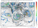
bigstick10
Member
Huge blob of rain headed to Metro Atl, this rain train has been relentless over the last week,
Must be nice. Dry around hereHuge blob of rain headed to Metro Atl, this rain train has been relentless over the last week,
bigstick10
Member
Well it is a bit insane, one run has a low of 16 the next run, is a low of 45, same night????You will if you follow the GFS lately
The latest run through the 26th is a low of 38 and a high of 73 for ATL...LMAO, WTF? Etc////,...
- Joined
- Jan 5, 2017
- Messages
- 3,769
- Reaction score
- 5,966
That rain has mostly been Atlanta north. The south side is still abnormally dry. TN is getting into the flood range with their monthly totals so far.Must be nice. Dry around here
Itryatgolf
Member
Let's pray and hope for a nice southern slider. It's been a while since we have had one?
bigstick10
Member
So are areas north of I-20 in Atl,,I have had over 11 inches in the last 10 days.That rain has mostly been Atlanta north. The south side is still abnormally dry. TN is getting into the flood range with their monthly totals so far.
As long as Alaska is warm, we all win!
Call me once we have some consistency of cross polar flow inside 168hrs on the global ensembles, and a mechanism to lock a cyclone around the Bay of Fundy on said ensembles. Until then, 40N is favored with boarder-line PAC washed cold, vs amplitude south enough to matter. Current ? is west, let alone south.
CHA hasn't had a dry day since December 1st. We'll get our next one on December 12th. quite a streak.
Webberweather53
Meteorologist
I meant to share this with everyone here yesterday, but couldn't find the time to put the finishing touches on it.
I gave the December 8-10 2018 snowfall map I made a few years ago a much needed facelift. Really cool to see the mesoscale banding features on here. The most obvious one goes from northern Durham Co & the northern shore of Falls Lake to Wake Forest, then Wilson & Greenville, basically along US HWY 264 east of Raleigh. You can also see another one from about Elkin (Surry Co.) to Yadkinville & Mocksville, just west of the Triad.
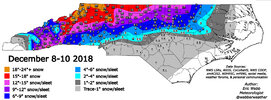
I gave the December 8-10 2018 snowfall map I made a few years ago a much needed facelift. Really cool to see the mesoscale banding features on here. The most obvious one goes from northern Durham Co & the northern shore of Falls Lake to Wake Forest, then Wilson & Greenville, basically along US HWY 264 east of Raleigh. You can also see another one from about Elkin (Surry Co.) to Yadkinville & Mocksville, just west of the Triad.

Hypsometric
Member
That's one heck of a gradient across Wake, even by Wake standards lol.I meant to share this with everyone here yesterday, but couldn't find the time to put the finishing touches on it.
I gave the December 8-10 2018 snowfall map I made a few years ago a much needed facelift. Really cool to see the mesoscale banding features on here. The most obvious one goes from northern Durham Co & the northern shore of Falls Lake to Wake Forest, then Wilson & Greenville, basically along US HWY 264 east of Raleigh. You can also see another one from about Elkin (Surry Co.) to Yadkinville & Mocksville, just west of the Triad.
View attachment 125465
Hypsometric
Member
Webberweather53
Meteorologist
That's one heck of a gradient across Wake, even by Wake standards lol.
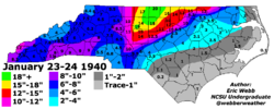
I personally don't recall a storm with a bigger gradient across Wake Co. Jan 1940 probably comes the closest in my mind prior to Dec 2018, but it didn't seem to have much of one across southern Wake. Big gradient between downtown Raleigh & near the airport. The northern edge of the sleet in this storm made it to about RDU/Morrisvile - Falls Lake - Louisburg. South of that, across south-central Wake to the coastal Plain, this storm was apparently primarily sleet (makes sense w/ how strong the coastal low was in reanalysis).
This is definitely another map that could use a facelift (honestly most of them could).
NBAcentel
Member
18z EPS remains consistent, if not slightly better
re: 2018 storm. Wake county? Heck, how about Cary by itself. I was in the 4"accumation zone and could hop in my car for <10mins and see 8" of snow on the ground.I personally don't recall a storm with a bigger gradient across Wake Co. Jan 1940 probably comes the closest in my mind prior to Dec 2018, but it didn't seem to have much of one across southern Wake. Big gradient between downtown Raleigh & near the airport. The northern edge of the sleet in this storm made it to about RDU/Morrisvile - Falls Lake - Louisburg. South of that, across south-central Wake to the coastal Plain, this storm was apparently primarily sleet (makes sense w/ how strong the coastal low was in reanalysis).
This is definitely another map that could use a facelift (honestly most of them could).
View attachment 125468
Blue_Ridge_Escarpment
Member
Also the French broad River valley sticks out like a sore thumb from Madison county down into Greater Asheville. When I was in school for 4 years at UNCA that was brutal several times. Warm air flooding down the valley.I meant to share this with everyone here yesterday, but couldn't find the time to put the finishing touches on it.
I gave the December 8-10 2018 snowfall map I made a few years ago a much needed facelift. Really cool to see the mesoscale banding features on here. The most obvious one goes from northern Durham Co & the northern shore of Falls Lake to Wake Forest, then Wilson & Greenville, basically along US HWY 264 east of Raleigh. You can also see another one from about Elkin (Surry Co.) to Yadkinville & Mocksville, just west of the Triad.
View attachment 125465

