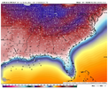
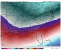
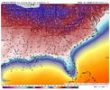
Who cares if there is no wintry precip temps mean nothing. It was obvious weeks ago that cold was coming and even said would be below normal most likely by end of month. If no wintry precip then just a waste.Lol NC boys and girls have a chance to be below normal this month because of all this CAD. We’re sitting at 1 degree above normal right now. This big cold attack is certainly set to tip the scales a bit colder than average I would think.
View attachment 127447
-
Hello, please take a minute to check out our awesome content, contributed by the wonderful members of our community. We hope you'll add your own thoughts and opinions by making a free account!
You are using an out of date browser. It may not display this or other websites correctly.
You should upgrade or use an alternative browser.
You should upgrade or use an alternative browser.
Pattern Dazzling December
- Thread starter Rain Cold
- Start date
GFS generally always caves to Euro during the winter. If Euro not on board I never get excitedNot even entertaining it until the Euro gets on board. GFS has been horrible.
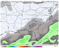
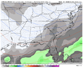
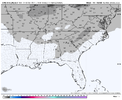
Worth noting the airmass is so cold, even discounting the cold bias on the CMCE, wintry precip could be pretty far south. Like gulf coast south, if we do indeed get something to go our wayCMCE more active then last run, looks like a little more coastal signal View attachment 127449
Pilotwx
Member
I know we all are hoping for snow , but when we are all checking out the wind forecast , things have really taken a turn.
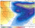
With this type of cold in place, we really don’t need a strong wave to get a solid, widespread overrunning event going, and that’s a type of event that most models won’t pick up well on until 4 or 5 days outWorth noting the airmass is so cold, even discounting the cold bias on the CMCE, wintry precip could be pretty far south. Like gulf coast south, if we do indeed get something to go our way View attachment 127450
I’ll pay more attention to the wind forecast when we’re get into short range models territory. Globals always overdue wind by a lotI know we all are hoping for snow , but when we are all checking out the wind forecast , things have really taken a turn.
Yep won’t be one of those we track 200+ hrs out with clown maps, we will just see the pieces there and hope things trend better as we get within a few days.With this type of cold in place, we really don’t need a strong wave to get a solid, widespread overrunning event going, and that’s a type of event that most models won’t pick up well on until 4 or 5 days out
and if models do start picking up on something like that, you can always expect precip to much more expansive to the north than what is shownYep won’t be one of those we track 200+ hrs out with clown maps, we will just see the pieces there and hope things trend better as we get within a few days.
Yep and honestly we win with these setups more than the big dogs 7-10 days outand if models do start picking up on something like that, you can always expect precip to much more expansive to the north than what is shown
Honestly looking at both GFS and CMC as well as the GEFS; I wouldn’t be surprised if that is where we trend. Even a light overrunning event would bring great joy or annoyance. (1/28/14)With this type of cold in place, we really don’t need a strong wave to get a solid, widespread overrunning event going, and that’s a type of event that most models won’t pick up well on until 4 or 5 days out
We have 2 options. Either speed up the vortex into eastern/SE Canada, and slow the southern stream wave, so you can dig the SS/pacific wave effectively and get some overrunning. or the more iffier way, get the TPV due north of the GLs, flex the WAR, get a southern stream wave to align with a extension/piece of energy from the TPV and phase something up. I like the 1st option better. in between sucks
Lol NC boys and girls have a chance to be below normal this month because of all this CAD. We’re sitting at 1 degree above normal right now. This big cold attack is certainly set to tip the scales a bit colder than average I would think.
View attachment 127447
To your point, KATL probably finishes at +1-3 and the Gulf states west stand no chance of being below normal. 10-12F above average halfway through December is ridiculous and insurmountable.
The biggest problem with option 2 is that if the WAR flexes you have a better chance of pushing a warm nose into the cold air mass and you see a what would be a nice little snow event turn into a sleet fest or ice storm. Hopefully we can trend to something more like February 2010 and get nice widespread snowfall across the southWe have 2 options. Either speed up the vortex into eastern/SE Canada, and slow the southern stream wave, so you can dig the SS/pacific wave effectively and get some overrunning. or the more iffier way, get the TPV due north of the GLs, flex the WAR, get a southern stream wave to align with a extension/piece of energy from the TPV and phase something up. I like the 1st option better. in between sucks
Looks like the Euro may throw us a bone around the 27th.
SnowwxAtl
Member
Is the cold air still going to be there? I noticed a quick moderation in temps.

