-
Hello, please take a minute to check out our awesome content, contributed by the wonderful members of our community. We hope you'll add your own thoughts and opinions by making a free account!
You are using an out of date browser. It may not display this or other websites correctly.
You should upgrade or use an alternative browser.
You should upgrade or use an alternative browser.
Pattern Dazzling December
- Thread starter Rain Cold
- Start date
rburrel2
Member
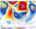
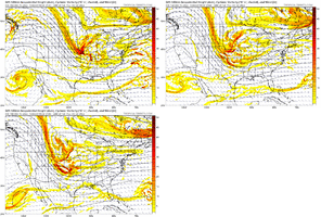
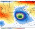
Looks like the trough might dig all the way down to the gulf this run. Could be a huge hit for MS/AL/TN.
Cary_Snow95
Member
Yes it could… and I wouldn’t be shocked to see some CAD ice In favored area east of the mountains. It’s not exactly a warm airmass ahead of this systemLooks like the trough might dig all the way down to the gulf this run. Could be a huge hit for MS/AL/TN.
Cary_Snow95
Member
Apps runner
Let’s see if it transfers to a new low near the coastApps runner
SimeonNC
Member
Yeah, all the talk of severe is honestly weird to me considering we're running sightly below normal temps through the whole week.Yes it could… and I wouldn’t be shocked to see some CAD ice In favored area east of the mountains. It’s not exactly a warm airmass ahead of this system
Another severe event for the deep south/gulf coast could happen but up here, not really.
Sent from my LM-Q730 using Tapatalk
SWVAwxfan
Member
Would work for my area anyways.
NWMSGuy
Member
Could be some more interesting GEFS runs for the Mid-South coming up.
BHS1975
Member
Have we ever had a storm trend back east this far out?
JLL1973
Member
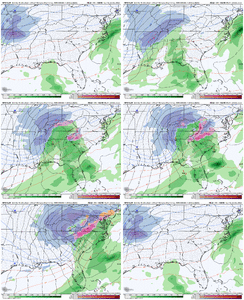
Gfs with a big hit for the midsouth. It is the gfs so I’m not really that excited
NWMSGuy
Member
That low track would do wonders for us folks in Ms and West TN.Gfs with a big hit for the midsouth. It is the gfs so I’m not really that excited
Even though it’s the GFS, this solution is believable. Apps runner with a Miller B transfer to the north. CAD in place brings an ice event to NC Foothills and the escarpment and then a backside NWFS for the mountains and some mood flakes east.
Ron Burgundy
Member
Afternoon disco from FFC fwiw:
Run-to-run consistency, while improving, still differs by model and
between models. Weekend high pressure ridge will shift east of the
area by late Monday as wave traverses the area in near-zonal flow
aloft. Good rain chances are largely limited to middle and south
Georgia with rainfall amounts generally an inch or less and coming
to an end early Wednesday. In the wake of this mid-week event, large
long-wave trough ushers cold continental airmass into the central US
and by early Friday, both the 12Z GFS and Euro show deepening closed
cut off impacting the southeast US. The placement of the low will
greatly dictate the potential for winter precip, with the farther
south GFS showing a more favorable snow setup than the more northern
Euro. Given the wintry precip potential is at Day 7 with a
tremendous amount of uncertainty, at this time, little attention was
provided to detailed snow accumulations.
The more certain forecast concern is with the much-below-normal
temperature potential seems very likely with probabilistic guidance
suggesting 15-25 degree (or more) below normal temperatures and
single-digit wind chills by Friday.
In summary, below-normal, possible record-flirting temperatures look
likely late in the week, and while rain is expected Tuesday into
Wednesday, confidence in any winter precip after Wednesday is
extremely low. Stay tuned.
JLL1973
Member
Yes perfect track especially for you. Eastern arkansas and northwest ms is the sweet spot that runThat low track would do wonders for us folks in Ms and West TN.
JHS
Member
Close to being big problems about 40 miles either side of a Greenville SC to MT Airy NC line, 1st due to ice and then high winds and cold. Could be 1 million plus without power in that zone if this plays out just right.Even though it’s the GFS, this solution is believable. Apps runner with a Miller B transfer to the north. CAD in place brings an ice event to NC Foothills and the escarpment and then a backside NWFS for the mountains and some mood flakes east.
LukeBarrette
im north of 90% of people on here so yeah
Meteorology Student
Member
2024 Supporter
2017-2023 Supporter
It would but wouldn’t be super fun.Would work for my area anyways.


