starsfan68
Member
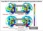
0z is never a good runLock it in. My snow hole is valid ? View attachment 124473
0z is never a good runLock it in. My snow hole is valid ? View attachment 124473
Depressing?Yeah goodnight lol. Evolution around Alaska this gefs run is depressing
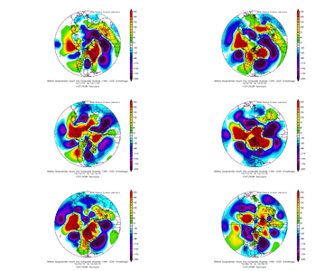
Patterns locked in! West coast trough, Seattle getting a good snow, hard to break that pattern. It’s been pretty stubbornNot a good gefs run View attachment 124472
Especially in the La Niña background state, any episodes of suppressed storm tracks will be transient, and entirely dependent on the strength and location of the block. As it is right now, the blocking is situated quite poleward, so we ridge down here I think.Patterns locked in! West coast trough, Seattle getting a good snow, hard to break that pattern. It’s been pretty stubborn
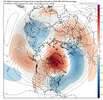
That’s a good looking Miller B! I’ve always been a fan6Z GFS is bedazzling! View attachment 124474
Need a nice 1040 high pressure in Michigan to turn that into a true Miller A snowstorm. Right now there is not a sufficient cold air source. Hope that changes.That’s a good looking Miller B! I’ve always been a fan

This definitely might be a time to watch for I-40 north, but more importantly I think this could be a system that helps out with getting snowpack built up in the Northeast and Mid-AtlanticWatch next Friday-ish, espeacilly if you are along I40 corridor. 6z GFS is getting closer, has a messy lakes low. Euro, CAN and GFS just need a little more press wth the forming Block. See how that trends. Could sneak one in here for a few of us in 7-8 days.

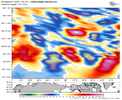
Something that I keep noticing and really like is how the deepest heights are showing up right over Baffin Bay…. that’s a prime location for blocking to do the southeast the most goodDidn’t realize the EPS last night was going for Aleutian low/+PNA/-EPOView attachment 124480
I like the 17th-25th, we’re gonna progress thru a pattern where western energy gets booted each time something dives into the pacific from the NPAC ridge, KU style. 1st and second likely go to the NE/MA and perhaps climo favored areas. that then sets us up later around the 17-25th with those first storms bombing out under the block over the NE US/Atlantic and becoming our confluence so to speak shunting the track South each time. That’s how many NAOs have worked anyways around here . Step down process, need MA/NE to eat first with snow cover and there storms becoming our confluenceThe models continue to build a nice snow pack to our north. Things look really nice for the SE in general as we get later into the month of December. I just hope the rug does not get pulled out from under us with all that beautiful blocking being shown over top.


I agree with this. I think the block is a lock. Eyes on the Pacific evolution, as that will matter to the extent of the cold that makes it into the SE.I like the 17th-25th, we’re gonna progress thru a pattern where western energy gets booted each time something dives into the pacific from the NPAC ridge, KU style. 1st and second likely go to the NE/MA and perhaps climo favored areas. that then sets us up later around the 17-25th with those first storms bombing out under the block over the NE US/Atlantic and becoming our confluence so to speak shunting the track South each time. That’s how many NAOs have worked anyways around here . Step down process, need MA/NE to eat first with snow cover and there storms becoming our confluence
The models continue to build a nice snow pack to our north. Things look really nice for the SE in general as we get later into the month of December. I just hope the rug does not get pulled out from under us with all that beautiful blocking being shown over top.

You just pick the fly out and drink away. Alcohol kills germs! If that block is real, there will be a window for snow somewhere in there. Bottoms up!Yeah, things look great long range. But the reality is all of this is 12+ days away before we actually start seeing real impacts. Lol. Today is just December 1! Soooo much can change. I know the seeds for the big block are already planted and in motion, but being so far out makes me think there's plenty of time for the pacific to put a fly in our chardonnay.

Good point but it certainly has varied. My biggest concern with this blocking pattern is a certain winter, I think 2012? Where KU after KU struck Roxboro and north repeatedly. RDU would be in the crosshairs every storm, only for the northwest trend to tease it away every time. I remember the stat for that winter was Baltimore had 77 inches and RDU had 7. I would have to look back at the H500 maps and think the block then was more east based than what is being shown for the upcoming block, so I’m still optimistic.I like the 17th-25th, we’re gonna progress thru a pattern where western energy gets booted each time something dives into the pacific from the NPAC ridge, KU style. 1st and second likely go to the NE/MA and perhaps climo favored areas. that then sets us up later around the 17-25th with those first storms bombing out under the block over the NE US/Atlantic and becoming our confluence so to speak shunting the track South each time. That’s how many NAOs have worked anyways around here . Step down process, need MA/NE to eat first with snow cover and there storms becoming our confluence

To piggyback on this, February 2021 had the deepest heights centered further east over Greenland. This along with the MJO amping up in a bad phase allowed the SER to flex and the cold never made it east of the Apps. Obviously this why there’s such a big difference between a west based and east based -NAOSomething that I keep noticing and really like is how the deepest heights are showing up right over Baffin Bay…. that’s a prime location for blocking to do the southeast the most good
YesIs the pattern we are potentially looking at good for winter weather down around a Columbia Sc? I know it’s still not likely but does this pattern up the chances that far south? Asking for a friend that lives down that way.
80/70 and sunny basically every day next week. Dazzling!
I would be more concerned about the Pacific messing things up if we had an MJO that was amping up in a bad phase. It now looks to be going through phase 8 and entering COD and quickly turning back towards 7/8, but staying in the circle. That plus the PNA moving very close to neutral tells me that strong blocking to the north will control the pattern for awhileYeah, things look great long range. But the reality is all of this is 12+ days away before we actually start seeing real impacts. Lol. Today is just December 1! Soooo much can change. I know the seeds for the big block are already planted and in motion, but being so far out makes me think there's plenty of time for the pacific to put a fly in our chardonnay.

And? Whether I live in Alaska or Florida it shouldn't always be warmer than normal
Pattern ain’t ripe,,until Bouncycorn is posting!You just pick the fly out and drink away. Alcohol kills germs! If that block is real, there will be a window for snow somewhere in there. Bottoms up!
The nearest station to you is cape Florida and that averages 78 in jan. 80/70 is about normal then .I'm just SE of Miami (yes the climate is tropical). Winter averages at the nearest station (Miami Beach) are Dec: 76/64, Jan: 74/61, Feb: 75/63. Horrible obviously but it's especially bad to be hot even in what are typically the pleasant months. And cool months are possible though rare. December 2010 averaged 69/50 here.
The difference in terms of comfort between a typical December day (76/64 with dews in the 50's) and a day like tomorrow (82/73 with a dew around 70) is massive. And yeah. I do "expect" cool weather here within reason. A normal winter here has ~10 days with a low in the 40's and a coldest day around 58/41.
The nearest station to you is cape Florida and that averages 78 in jan. 80/70 is about normal then .

Obvious troll is obviousThe nearest station to you is cape Florida and that averages 78 in jan. 80/70 is about normal then .
