• Hello, please take a minute to check out our awesome content, contributed by the wonderful members of our community. We hope you'll add your own thoughts and opinions by making a free account!

Pattern Dazzling December

I beleive by this weekend,possible late week Fri into Sat, we will be tracking our first legit threat. We'll see.
Right now just glad to see a very favorable pattern conducive to producing showing up continually. Seems window of opportunity starts to open up mid to late next week.
 

Is this the year we finally break the streak of above average December's? Maybe. But even if the pattern changes by mid month can we erase the warmth of the 1st half? That's seems to be our problem getting below average temps. We can have 20 below average days but the 10 above average cancel it out.
 
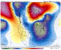
It is going to be humorous watching the models and how they react to the strong blocking. GFS run yesterday had the flow literally moving east to west. Todays run has the cold air actually retrograding north instead of south to get around the block.
 
Is this a good look?
fbb29acd5437a6261547008d2fcbb483.jpg


Sent from my iPhone using Tapatalk
 
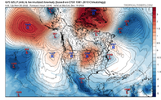
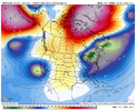
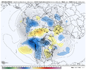
Really nice to see a potential second half December pattern that's not a torch on the horizon. However right now I'm leaning toward the "wish we had a PNA" camp. The -NAO just doesn't seem to get us very cold per model output. Coldest air is still out west. That and thinking about 2021 when we had a decent -NAO but we only managed cold rain after cold rain because it just couldn't get quite cold enough. Maybe this time is different, cold in Canada is better, block is real deal this time, we can CAD better etc....but I'm not really sold until the modeled -NAO can show me some solid cold in the SE with the TPV is Maine. Lol.

1669741219453.png
1669741271190.png
 
Really nice to see a potential second half December pattern that's not a torch on the horizon. However right now I'm leaning toward the "wish we had a PNA" camp. The -NAO just doesn't seem to get us very cold per model output. Coldest air is still out west. That and thinking about 2021 when we had a decent -NAO but we only managed cold rain after cold rain because it just couldn't get quite cold enough. Maybe this time is different, cold in Canada is better, block is real deal this time, we can CAD better etc....but I'm not really sold until the modeled -NAO can show me some solid cold in the SE with the TPV is Maine. Lol.

View attachment 124273
View attachment 124275

Couldn’t agree more. I’ve seen some posts about the PNA trying to get to neutral which would be great. But it’s definitely going to be a battle until then.


Sent from my iPhone using Tapatalk
 
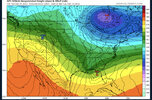
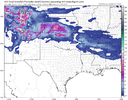
Merry Christmas from the 06z CFS. Should be taken with a grain of salt but I’m holding firm on my idea of a pattern change around December 20th. The models have been trying to rush the cold air.
bb33bc0034522060069f588f34da9058.jpg


Sent from my iPhone using Tapatalk
 
I watch CFS daily for past week plus. Its been consistent. And yes your probably better off studying the wooly worm and farmers almanac. But if it changes its tune, its usualky a red flag. Fortunately it keeps beating sane drum.

Also the GFS will change up an down 4x a day LR. Block or no Block. So never get to hyped or depressed off of the pics it paints.

All that said. Record Negative NAO possible. But if there is a way to screw it up, we will find it guranteed lol. Gonna be fun watching this evolve and seeing how it impacts our local wx good bad indifferent.
 
Back
Top