NBAcentel
Member
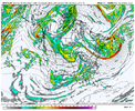
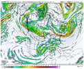
We hold the cold back a little with these trends, but damn since we hold it back we inject more cold into it, for ex the CMCE, the airmass is even colder
OldView attachment 127028
New View attachment 127029
We hold the cold back a little with these trends, but damn since we hold it back we inject more cold into it, for ex the CMCE, the airmass is even colder
OldView attachment 127028
New View attachment 127029

While the signal might not be as strong as last night’s runs, it’s still there… still a good amount of members picking on something. More importantly climo says it’s more likely to happen for us than that first system. Now could it get suppressed? Sure but as others have said don’t get to worried about suppression this far out.I just...
I'm really trying with storm two but there just doesnt seem to be much there on the ensembles. Last night, there was a really good QPF run but not really since.
yeah i get it. the general outline of the ensembles show the fail point being the energy being a little to suppressed, not tilted enough, which are fixable issues to me and probably why the signal isn't that robust. i will say... i think if the euro ensembles don't perk up a little the second threat will begin to smell a little, nothing crazy, not like fish in a hot car, but enoughI just...
I'm really trying with storm two but there just doesnt seem to be much there on the ensembles. Last night, there was a really good QPF run but not really since.
I’ve never heard of this model before. Is this that French model? What does MMFS even stand for?View attachment 127037View attachment 127035
Latest MMFS run looks similar to the last, with a strong cutter.
View attachment 127038
MMFS is a model made by bouncycorn and his friend. Here’s more info: https://mesoscaleforecast.com/I’ve never heard of this model before. Is this that French model? What does MMFS even stand for?
It’s my model, it stands for Mesoscale Model and Forecasting System.I’ve never heard of this model before. Is this that French model? What does MMFS even stand for?
Great post. Difference becomes even more pronounced by 87 hoursCan already see the difference in Euro/GFS at day 3. We need those pieces of energy up near AK to stay separate like GFS and it's not on really any other modeling.
View attachment 127043


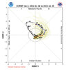
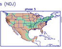
 Something that should be noted is that the MJO is going to be making a run for phase 4 & 5 around the 23rd. The precipitation correlation with that should support a strong, very far inland runner, just like the Canadian and UKMET are indicating. Phase 8 or 1 would have been very much more supportive of the kind of storm the GFS has been spitting out.
No there is a way. This is why I tried to let people know that even in the best patterns we can miss. Because we live in the south and no matter how you slice it it’s hard to get it to snow down here. I still like the second opportunity but anyone who is expecting major winter storms needs to temper expectations so they don’t get their heart broken.Maybe if the Euro/CMC is right then that bodes well for the 12/26 potential...no way we miss both...right
View attachment 127051
- NAO doing wonders for the midwest.Holy Midwest Blizzard
We're really not in phase 5. The MJO doesn't have any effect on this patternView attachment 127056View attachment 127057Something that should be noted is that the MJO is going to be making a run for phase 4 & 5 around the 23rd. The precipitation correlation with that should support a strong, very far inland runner, just like the Canadian and UKMET are indicating. Phase 8 or 1 would have been very much more supportive of the kind of storm the GFS has been spitting out.
Absolutely insane cold shot this run. Wow. This ain’t even far out View attachment 127059View attachment 127060

