Weatherheels
Member
Yeah, looks like ridge is wiped away. Too far out to take much from it at this point, hope its a blip.Fail incoming on GFS Christmas storm.
Yeah, looks like ridge is wiped away. Too far out to take much from it at this point, hope its a blip.Fail incoming on GFS Christmas storm.
Here's GSP's report on it. H500 look similar to the GFS.Yes, Brick alluded to that earlier.

It doesn't take a lot for the gfs suite to be right but nothing agrees with it. The 0z euro was about half way into agreement but not enough
Man what is going on


The gfs is right. Until it flips and shows rain then it's just the gfs being the gfs.
And not by itself. Euro is a no bueno on a #2Could be but the CMC fails on both.
No, the supercold is coming. The question is more of if we can get some snow out of it.Hell I am so confused now with all these maps, but is it safe to say that the supercold that was advertised, is now dead?
Two hundred and forty six hour forecasting is hardView attachment 127012What in the world is wrong with this model...
Two hundred and forty six hour forecasting is hard
The Euro moved a 340 decameter PV 3000 miles east in 24 hours the other day.Just to play devils advocate, the energy at 500MB on the GEFS has moved from roughly the Maryland panhandle to Dulles-ish to roughly Yanceyville in the last three successive runs by 18z on next Friday.
What that tells me is that we’re not gonna have any resolution for that system until we figure out what happens with the firstJust a warning, the 12z GEFS is gonna suck for Christmas.
That may take a weekend's worth of runsWhat that tells me is that we’re not gonna have any resolution for that system until we figure out what happens with the first
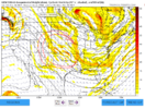
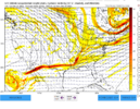
1 isn’t like the others View attachment 127018View attachment 127019

The thing is living and dying by each run is pointless. Honestly I’m more worried about the Christmas storm being too warm knowing the tendencies of modeling.That may take a weekend's worth of runs
Oh.. I agree. Everything that I’ve ever learned about studying the climo of winter storms tells me that the first system should cut and then we get our window for a winter storm several days after. It is hard to take the GFS seriously, but now it’s ensembles come back to it.That may take a weekend's worth of runs
This really would be against climo down this way. Close, right on the edge of where climo say yes, but, yeah, it's a stand alone storm for these parts, and, like you say, given the pattern quite possible. Climo said no way to your storm, for me anyway, but you pulled it off, so strange things do happen, and in this case, make some kind of sense, lol. I remember decent storms between Xmas and New Years Day, but only your storm at Xmas and before. Larry says there were a few pretty good ones scattered in since the late 1800's, even some I should remember, but I'm pretty sure this one, as depicted would push climo pretty far. And anyway, most storms with me, if I didn't sled it, it didn't happen, lol, so it would have to stick out like snow on Xmas. This would be a Jan/Feb type storm way out ahead.Normally, I have one foot out the door when models are showing long range great arctic cold periods and 7 day snowstorms. It makes sense to be skeptical of those things, since like was pointed out earlier, the cold always seems to back off as we head closer and the storm track always seems to shift west and north. That's pretty typical to see, so it's understandable and reasonable to not get too excited about historic patterns showing up.
That said, we have a lot of anomalous blocking showing up, which, if real, makes depictions of anomalous patterns somewhat more believable. Now I'm not going to stand ten toes down in the sand on historic stretches of cold and blizzards. But given the support in the guidance and apparent configuration of teleconnections, an unusually cold and stormy pattern is more likely to be real than normal, IMO. When you couple that with the fact that we usually can't buy a fast start to winter, it's already been plenty cold, and Christmas is just around the corner, we have some exciting times ahead.
Even if it doesn't work out like we all hope, at least we're not waiting until late January to get the party started this year.
Let’s be honest, none of the operationals have been doing a really good job more than about 96 hours out.Quick reminder what the CMC and GFS showed 120 hours ago for today. Niether were exactly right.
CMC:
View attachment 127024
GFS:
View attachment 127025


