smast16
Member
63 back west in the triad. Keep finding ways to get under a thin deck of low clouds. Still haven't gotten in the 50s since spring.

ProbablySo this mega rain band is supposed to fall apart before it gets here? ?
Kinda impressed with its northern progress thus farProbably
I think that is a major stretch...yes, there are some dry areas, but this pattern does not scream drought by any meansIt is time for GSP to back farther off on pops in most of the CWA. Already down from 90% to 60%. The drought will be making a bigtime comeback in much of the Carolinas it seems as we go from summer into fall.


Shetley is always in drought. It's his default. He can have 3 feet of rainfall over a 2 hour period and think a Biblical megadrought is happening.I think that is a major stretch...yes, there are some dry areas, but this pattern does not scream drought by any means
Sent from my SM-G990U using Tapatalk
Dude got more rain in July than I've had since 4/1 and he's talking droughtShetley is always in drought. It's his default. He can have 3 feet of rainfall over a 2 hour period and think a Biblical megadrought is happening.
Flashdrought, FTL?Shetley is always in drought. It's his default. He can have 3 feet of rainfall over a 2 hour period and think a Biblical megadrought is happening.


Well tomorrow is the 20th and I'm sitting at 1.1Tbh if those totals pan out that's not "that much" lol. As wet as July was around here, August has flipped the switch, 10 days in with only .1, had to start back watering my garden yesterday. If the Euro is correct through entire run, 10 days from now on Aug. 20th some of us will still be sitting on either side of an inch. Most likely there will be larger totals sprinkled in of course, as globals obviously struggle with convection qpf


Good. Break the drought there and it helps break the summer for all of us.The Texas drought is about to have a huge dent in it
This is insane for August.... This would be crazy even in October where it's sort of happened before View attachment 120807

These models are terrible. No other way to put it. Can't wait for them to show a major hurricane landfall on the se coast 4 days out causing evacuations from Florida to NC only for it to end up in the gulf or either 300 miles offshore going otsYou'll have to excuse me while I become less and less enthusiastic about this next upcoming wet pattern.
View attachment 120818
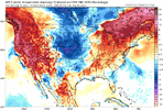
Highest PWs stay off to the south and east, at least on the GFS anyway. Monday evening, you get a favorable juxtaposition of a couple of unimpressive jet streaks over the region and the air isn't dry. So it's possible that the model is underdoing its qpf. But the trend has been for the best rainfall to remain over souththern and eastern zones (in relation to the Triangle), so we'll see.You'll have to excuse me while I become less and less enthusiastic about this next upcoming wet pattern.
View attachment 120818
Shetley??You'll have to excuse me while I become less and less enthusiastic about this next upcoming wet pattern.
View attachment 120818


#DROUGHTBUSTER #SUMMERSOVER
#DROUGHTBUSTER #SUMMERSOVER

Rain is becoming like snow on the modelsHighest PWs stay off to the south and east, at least on the GFS anyway. Monday evening, you get a favorable juxtaposition of a couple of unimpressive jet streaks over the region and the air isn't dry. So it's possible that the model is underdoing its qpf. But the trend has been for the best rainfall to remain over souththern and eastern zones (in relation to the Triangle), so we'll see.
Shetley! His droughts are so horrible, the only thing that can save him is a tropical system

 ?
?