As you mentioned, a very small area of potential severe threat....Unless things change dramatically the severe threat is probably over locally

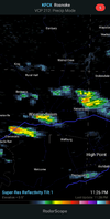
As you mentioned, a very small area of potential severe threat....Unless things change dramatically the severe threat is probably over locally

Except for all those under severe thunderstorm warningsLooks like the storm forecast was a bust for most of NC today.
Except for all those under severe thunderstorm warnings
It was for the level 2 area that saw numerous severe thunderstorm warningsI said for the most of NC. It wasn't nearly enough for a level 2 risk.
Such a broken recordI said for the most of NC. It wasn't nearly enough for a level 2 risk.

Really about 40 miles made all the difference yesterday. Had we not seen the morning disturbance with rain and debris clouds the warm front would have likely been around I40 and overlapped with the best kinematics. I'm still a little surprised there wasn't a cell or 2 elevated over the cool sector but that splitter along the nc/SC border was enough for me to not really want a part of thatIt was for the level 2 area that saw numerous severe thunderstorm warnings
I thought it was all done for, but had a random little cell give me another quarter last night. She was a juicy ol Gal. Poured so loud it worm both my wife and IReally about 40 miles made all the difference yesterday. Had we not seen the morning disturbance with rain and debris clouds the warm front would have likely been around I40 and overlapped with the best kinematics. I'm still a little surprised there wasn't a cell or 2 elevated over the cool sector but that splitter along the nc/SC border was enough for me to not really want a part of that

I’ll be back in Oklahoma on Thursday. Looks like I will miss the worst of summers heat out there.Hopefully will be our last 100
View attachment 120726
If this verifies it probably will because climo is increasingly against it towards September View attachment 120727

The next 10 days look good for us to keep the positive momentum going in the rain deptI thought it was all done for, but had a random little cell give me another quarter last night. She was a juicy ol Gal. Poured so loud it worm both my wife and I View attachment 120729
I’ll be back in Oklahoma on Thursday. Looks like I will miss the worst of summers heat out there.
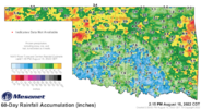
Hopefully we can get in on some of those rain chances late this weekend. Rainfall totals south of I-40 the past 60 days haven’t been been looking so good.View attachment 120728
@Brent this women just moved from my market to Tulsa. Can’t remember if she’s good or notView attachment 120734
Insert "Give me this in Jan.".jpg
This (current) cool down is really early (by average), but it could be the break of summer. As SD showed above, the GFS is hinting at more (stronger) cold frontal passages. And the CFS also shows cold fronts continuing to cross the southeast during the next 30 days. I'm sure we'll see more heat/humidity, but hopefully we see cool breaks continue from this point forward.Really hoping we are seeing the end of Summer approaching quickly. First time I can remember in forever that week 0 high school football games in SC will be in the 70's with no humidity. If the models are to believed, we are switching to very east coast trough like pattern and even if we do switch back to more ridging, averages are dropping and will really drop by the first of September.
The last several years it seems like the seasons have been delayed by roughly 4-6 weeks compared to average. Winter has gone deeper into March and even April, Spring has gone well into June, Summer well into September, and Fall well into December. March and April have been below average, June has been below average, whereas August and September have been much warmer, even the first of October has been really warm at times. Then December has been well above average the last several years. This is the first year that the seasons have been aligned to past years with Summer cranking up in May, and what appears to be fall vastly approaching in August and September.

For KCLT, the most recent 90 degree high was back on 8/6. Right now the pattern showing on the models indicates that there’s at least a chance that it was the last one of the season. Surprisingly this would be only the 4th earliest last occurrence, but the earliest since 1981. The earliest last 90 degree temp was in 1917 on 8/2. Even with what’s showing on models, it would still be surprising to me for us not to see at least 1 or 2 more 90s before the middle of September. I always have felt like not expecting 90s until then is like going through a mild February and not expecting to see anymore freezes… you know they’re coming. If 8/6 is the last one for the year, it’s certainly a big change from the last few years where KCLT has consistently seen 90s into the first week of October.Hopefully most of the south is done with 90s until next year.
55 feels fantasticFeels great this morning. I'm currently at 61. Folks in Roxboro, Oxford, Henderson, Roanoke Rapids, and Louisburg are in the 50s.
57 this AM! You ?55 feels fantastic
