Webberweather53
Meteorologist
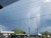
This run shouldn't be interpreted as legitimate, but it's definitely a good example how you get triple phasers (like the Mar 1993 superstorm for ex). Southern stream wave gets out in front of the main long wave axis, causing the whole trough to rapidly tilt negatively & make the most of barotropic energy conversions that allow the trough to lean against the mean westerly shear and convert the background momentum into eddies.


.gif")