-
Hello, please take a minute to check out our awesome content, contributed by the wonderful members of our community. We hope you'll add your own thoughts and opinions by making a free account!
You are using an out of date browser. It may not display this or other websites correctly.
You should upgrade or use an alternative browser.
You should upgrade or use an alternative browser.
Severe 4/4-4/6 Severe Threat
- Thread starter Snowfan
- Start date
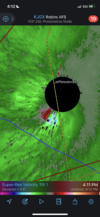
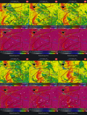
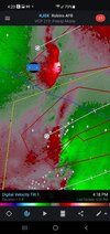
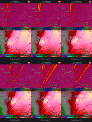
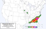
Also everyone likes to say it’s weenie fuel but this product gets ground zero right more times than not and look where the highest probabilities were with this storm in SC .. match up almost eerilyDoesn’t get more classic than this unfortunately View attachment 116815View attachment 116816
HSVweather
Member
gawxnative
Member
Going to need to keep watch on the discrete cells forming near Waycross and Baxley areas of GA
Mesoscale Discussion 0415
NWS Storm Prediction Center Norman OK
0322 PM CDT Tue Apr 05 2022
Areas affected...Portions of east-central GA into SC
Concerning...Tornado Watch 96...98...
Valid 052022Z - 052145Z
The severe weather threat for Tornado Watch 96, 98 continues.
SUMMARY...The greatest threat for strong tornadoes should focus
across parts of east-central Georgia into South Carolina over the
next 1-2 hours.
DISCUSSION...Multiple tornadic circulations with TDS markers have
recently been observed from the KJGX radar with a broken line of
storms in central GA. A separate TDS and very strong low-level
rotation was also noted earlier with a supercell over Allendale
County SC. The core of a 40-50 kt south-southwesterly low-level jet
overlies this region, and ample low-level shear is present to
support updraft rotation and tornado potential. The northern extent
of the surface-based thunderstorm and substantial tornado threat
will likely be constrained by a surface warm front that is draped
southwest to northeast across central SC. The presence of mid to
upper 60s and even some low 70s surface dewpoints with filtered
diurnal heating is supporting MLCAPE from 500-1000 J/kg, which is
more than sufficient for surface-based convection. The threat for
strong tornadoes in the next 1-2 hours will likely be greatest with
any supercells that can mature ahead of the line across east-central
GA into parts of central/coastal SC. Embedded tornadoes within the
line may also be capable of becoming strong given 300-400 m2/s2 of
0-1 km SRH per recent VWPs from KJGX and KCLX.
HSVweather
Member
Not taking very tight couplets to put something on the ground today
Bama Ravens
Member
As it was moving through Allendale, SC


RollTide18
Member
Although we did get tornadoes here in Alabama, seems like we were spared of the stronger tornadoes, unfortunately not the case in GA & SC.
PDS warned near Padgetts & Bramburg
HSVweather
Member
GeorgiaGirl
Member
I just loaded up a stream about 15 minutes ago or so, and there's going to be a tornado hitting Branchville, SC in a few minutes apparently based off the stream.
Edit: May be starting to wrap in rain to boot as well.
Edit: May be starting to wrap in rain to boot as well.
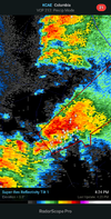
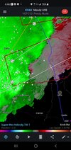
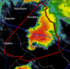
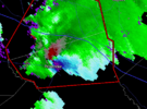
WarnedStrong rotation in the svr-warned cell northeast of Fairfax.View attachment 116828
Drscottsmith
Member
Hello all -
I’m from upstate SC but in Mt Pleasant for a few days.
Why are the polygons in SC so jagged and not following a typical ‘cone’ type shape like we see in Alabama?
It seems that people could easily feel they are safe on the edges of some of these warnings.
I’m from upstate SC but in Mt Pleasant for a few days.
Why are the polygons in SC so jagged and not following a typical ‘cone’ type shape like we see in Alabama?
It seems that people could easily feel they are safe on the edges of some of these warnings.
Another confirmed tornado near Wrightsville
Bama Ravens
Member
Yeah, I think that one at least briefly touchdown around Fairfax. Looked like there was a drop on the CC.Strong rotation in the svr-warned cell northeast of Fairfax.View attachment 116828
Bama Ravens
Member
Pretty strong rotation approaching Bowman, SC. This is the same storm that produced the Allendale tornado.
SWVAwxfan
Member
Georgia?Another confirmed tornado near Wrightsville
David M.
Member
This is a bit banter-ish given the storms ongoing, but Macon TV station WMAZ just had a reporter talk to a lady with a few twigs in her yard when there is actual tornado damage to a neighborhood nearby.
Likely since there's no action in the other Wrightsville.Georgia?
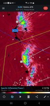
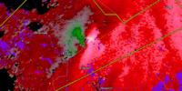
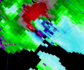
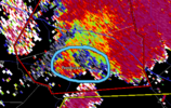
Not again . . .Pembroke cell may have touched down. View attachment 116834 View attachment 116833
It's now confirmed by Law Enforcement
Mannnn. I'm right in line with the path of the TOG west of Savannah. I'm in Beaufort and it's booking its mofo straight this way

