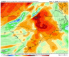
4/24/20-4/26/20 possible severe weather

  • Hello, please take a minute to check out our awesome content, contributed by the wonderful members of our community. We hope you'll add your own thoughts and opinions by making a free account!
The last few Euro runs look very problematic for the Carolinas...

1000-2000+ j/kg CAPE w/ 60-80 kts of deep layer shear could spell big trouble. Odds are the warm sector will be stronger and further north on Saturday vs Thursday given the lack of preceding overrunning convection & cool/stable air that our system on Thu has to overcome in order to put much of the SE US in the warm sector.

1587472208691.png


EWIAI4JXQAAfFgl.jpeg
 
I still don’t like the look on this one, often times when globals already show moderate instability, your gonna get higher in time for the meso models, and those critical angles look good, just LLvL shear ain’t to impressive 71BA4DBD-C51F-4C43-9F36-8A5287D19761.gif11CAA08B-2E38-4CCB-AACA-B760334D27D4.pngF1188DE6-0F3C-4F02-A6BD-5A4075988DC1.png
 
  • Like
Reactions: Webberweather53
I still don’t like the look on this one, often times when globals already show moderate instability, your gonna get higher in time for the meso models, and those critical angles look good, just LLvL shear ain’t to impressive View attachment 40058View attachment 40059View attachment 40061

Low level helicity on the second one is close. If I remember right, at least for AL concern goes, the threshold for significant problems LLH wise is ~ 250. I remember that number when FG and myself discussed AL tornadoes over a decade ago, so don't quote me on that.
 
  • Like
Reactions: Myfrotho704_
Yikes, looks like we have to look out for this one up my way. I was hoping we were going to be able to dodge all the severe chances this week.
 
Taken literally this is one of those rare environments that could support golfball-baseball sized hail around here.

Hodographs are quite similar to what was observed with those large hail events last night/this morning in Oklahoma, CAPE looks the same or even perhaps a little better, definitely a attention grabber for some very large hail
 
Funny how this threat seems bigger around here based on the models than tomorrow's threat, but the SPC has us under a level 3 threat tomorrow. Guess we'll see which one is the real deal.
 
  • Like
Reactions: Myfrotho704_
Hodographs are quite similar to what was observed with those large hail events last night/this morning in Oklahoma, CAPE looks the same or even perhaps a little better, definitely a attention grabber for some very large hail

Yeah those quarter turn, long, straight, zonally elongated hodos coupled w/ large CAPE are usually a big yikes for large hail
 
  • Like
Reactions: Myfrotho704_