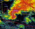
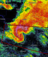
I can see the storms to the South & Southeast
-
Hello, please take a minute to check out our awesome content, contributed by the wonderful members of our community. We hope you'll add your own thoughts and opinions by making a free account!
You are using an out of date browser. It may not display this or other websites correctly.
You should upgrade or use an alternative browser.
You should upgrade or use an alternative browser.
Severe 4/12 - (?) Severe Weather
- Thread starter Iceresistance
- Start date
-
- Tags
- severe
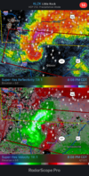
Another Supercell right behind the first one has a hook right over Charleston, AR
HSVweather
Member
HSVweather
Member
They were almost directly under it.
NoSnowATL
Member
They were almost directly under it.
He screams way to much. Surprised he didn’t scream WEDGE!
Darklordsuperstorm
Member
gawxnative
Member
When there is hail in forecast...compliments Jeff Foxworthy

Sent from my SM-G996U using Tapatalk

Sent from my SM-G996U using Tapatalk
Z
Zander98al
Guest
Z
Zander98al
Guest
These storms are moving into better lower level lapse rates
BufordWX
Member
Nice write up for tomorrow by FWD...
000
FXUS64 KFWD 112005
AFDFWD
Area Forecast Discussion
National Weather Service Fort Worth TX
305 PM CDT Mon Apr 11 2022
...New Long Term...
.LONG TERM... /NEW/
/Tuesday through Monday/
While the longwave upper level trough will remain across the
Intermountain West Tuesday before ejecting out in the plains
Wednesday, the primary feature of interest to us is a strong
shortwave trough currently near Baja that will rotate around the
longwave and through Texas on Tuesday. It is rather unusual to be
able to spot and track these shortwave disturbances so clearly on
water vapor this time of the year, but being able to do so in the
current data and in model potential vorticity forecast raises the
confidence that strong forcing will spread over North and Central
Texas Tuesday afternoon.
Lift is just one of three important ingredients for convection.
The second ingredient is moisture, and after a couple days of
strong return flow off of the Gulf, we certainly have enough of
that in place. The final ingredient is instability, and it`s the
linchpin in this forecast. There will be instability below an
inversion or cap, but that cap means the atmosphere is effectively
stable and thus the 3rd ingredient is missing...that is unless
the stable layer/cap can be eroded. There are a few ways to break
a cap, one through heating and moistening of the surface airmass
which is easy to predict and anticipate. The other is through
dynamic lift, much harder for forecasters and computer models
alike to predict. This explains why there are a variety of
forecast solutions - ranging from widespread convection erupting
over the region during the afternoon to nothing happening at all.
(The models just don`t know how much of the cap to erode.) For the
forecast I am leaning toward the more convectively active
forecast solutions. The reason for this is that lifting of a cap
is easier when the lapse rates above the cap are nearly dry
adiabatic, which they will be tomorrow. This means that the lift
tomorrow isn`t spent lifting/modifying a thermodynamically stable
mid level. Instead the lift more effectively reaches down to the
level of the capping inversion and cools that layer...allowing
the very unstable air residing in the lowest part of the
atmosphere to be realized in the form of convection.
Given the strength of the forcing/lift and its timing, our storms
may not wait for peak heating and may not initially form on the
dryline like in our usual spring time severe weather events.
Storms could form as early as 1 or 2 pm. Increasing wind fields
ahead of the approaching shortwave trough will result in organized
wind shear, meaning that once storms develop they will be capable
of becoming supercells and producing a variety of severe weather.
Very large hail (baseball or larger) is the primary threat, but
damaging winds and tornadoes are also possible. Storms will
rapidly move east and northeast through the afternoon and early
evening hours. As the forcing from the shortwave trough moves out
of the region during the evening hours we should see activity
track east and the region may be in a lull for a few hours Tuesday
night. An arriving cold front may spark up some additional
showers and storms early Wednesday morning mainly across East and
Central Texas. Severe weather is possible with this activity too,
but the more linear storm mode and diminishing wind shear and
instability suggest it`s a lower end threat.
BufordWX
Member
TORNADO EMERGENCY!View attachment 117133
This just went off in the last five minutes.
HSVweather
Member
That’s going to be really close to the Airport
HSVweather
Member
champal3003
Member
KATV live link

 katv.com
Watch
KATV ABC 7 in Little Rock, Arkansas covers news, sports, weather and the local community in the city and the surrounding area, including Hot Springs, Conway, Pine Bluff, Jacksonville, Sherwood, Stuttgart, Benton, Bauxite, East End, Scott, Pinnacle, Maumelle, Gibson, Landmark and Hensley.
HSVweather
Member
HSVweather
Member
NBAcentel
Member
Yeah today is living up to its potential lol and still is
HSVweather
Member
VegasEagle
Member
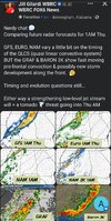
Models have consistently shown a weak MCV tracking across East Central TX and Western LA during peak heating tomorrow, which (if legit) should help to trigger fairly extensive activity down there.
That said, it might it up leaving somewhat of a "lull" in the coverage of activity to the north of it and to the south of the areas closer to the main trough in KS / IA / NE / MO.
Just as I suspected, confirmed by the NWS offices in OK...
000
FXUS64 KTSA 120856
AFDTSA
Area Forecast Discussion
National Weather Service Tulsa OK
356 AM CDT Tue Apr 12 2022
...New SHORT TERM, LONG TERM...
The prospects for severe storms forming to the west along the
dryline late this afternoon and migrating into our area this
evening appear low due to subsidence behind the subtropical wave
mentioned above.
.LONG TERM...
(Tonight through Monday)
Issued at 338 AM CDT Tue Apr 12 2022
Lingering storms with the wave this evening will
be moving out early, and most of the night is then likely to be
quiet.
000
FXUS64 KOUN 120844
AFDOUN
Area Forecast Discussion
National Weather Service Norman OK
344 AM CDT Tue Apr 12 2022
...New SHORT TERM, LONG TERM...
.SHORT TERM...
(Today and tonight)
Issued at 319 AM CDT Tue Apr 12 2022
Severe Weather: A highly conditional risk for severe weather exists
to the east of the dryline this afternoon, with uncertainty higher
than normal regarding storm initiation. Much of the uncertainty is
related to the degree of capping as well as the degree of subsidence
that will be over our area in the wake of a southern stream wave
clearly evident on water vapor imagery currently ejecting out of
northern Mexico. The timing and positioning of the wave will be such
that much of our area will be too far north and west to benefit from
any lift associated with the wave and will instead be in the
subsident region of the wave during peak heating this afternoon.
With the parent upper trough still well to our west across the
Rockies we do not expect much in the way of broader large scale
ascent or mid-level cooling to help initiate storms. It will
therefore be mainly up to the dryline circulation as our main
forcing mechanism for convective initiation this afternoon. Models
have been fairly consistent in their lack of support for
convective initiation across much of the area (outside of the ECM
model) for days now, which does not add confidence we will see
much activity at all this afternoon. However, models are not
infallible (see yesterday`s convection across southeast OK) and
forecast soundings show little to no CIN remaining along the
dryline by 21z this afternoon. It would not take much more than
some localized backing/convergence along the dryline to lead to
initiation. So while we are currently not expecting widespread
coverage of storms, it is entirely possible we see one or two
thunderstorms along the dryline by late this afternoon. Perhaps
the most likely scenario will be thunderstorms developing and
moving into our area out of north Texas on the northern periphery
of the southern stream wave, with little to no activity developing
across portions of north-central Oklahoma.
HSVweather
Member
- Joined
- Jan 5, 2017
- Messages
- 3,769
- Reaction score
- 5,966
Metal roofing sucks. What was that, an EF0? Looked more like an EF-1.
NWMSGuy
Member
Memphis WFO already mentioning the atmosphere will recover here in the Midsouth in wake of the morning activity. Hoping I'm wrong but tomorrow could be a long day for this area:
Area Forecast Discussion
National Weather Service Memphis TN
647 AM CDT Tue Apr 12 2022
.UPDATE...
See aviation discussion.
&&
.PREV DISCUSSION... /issued 453 AM CDT Tue Apr 12 2022/
DISCUSSION...Surface analysis early this morning places a cold
front/quasi-stationary boundary from the Ohio Valley back through
Southeast Missouri, Northwest Arkansas, and the Red River Valley
of Oklahoma and Texas. GOES-16 satellite and KNQA WSR-88D radar
trends still indicate showers and thunderstorms occurring over
portions of Northeast Arkansas, the Missouri Bootheel, West
Tennessee near the Tennessee River and extreme Northeast
Mississippi. These showers and thunderstorms are associated with a
mid-level shortwave trough that is about to depart the Mid-South.
As of 3 AM CDT, temperatures across the Mid-South are in the 60s
across most locations. Severe thunderstorm potential tonight
through Wednesday evening remain the predominant concern in this
morning`s forecast issuance.
Shortwave ridging is expected to gradually build into the Mid-
South this morning as the shortwave departs the Mid-South. This
will result in showers and thunderstorms gradually coming to an
end this morning. Thus, a relatively dry forecast for much of the
area through at least early to perhaps mid-afternoon due to
lacking triggering mechanism. Temperatures this afternoon will
warm into the upper 70s to lower 80s.
Short term models indicate a shortwave embedded within southwest
flow aloft will move into the Lower Mississippi Valley tonight.
This shortwave combined with an 850 low level jet increasing to
50 kts, 0-6 km bulk shear values around 45 kts, moderately steep
to steep 700-500 mb layer mid level lapse rates, 0-1 km storm
relative helicity values at or above 300 m2/s2, and mixed layer
CAPE values between 1000-1500 J/kg support the potential for
severe thunderstorms across the Mid-South this evening into early
Wednesday morning. Large hail and damaging winds will be the
primary severe weather threats along with the potential for a
tornado or two especially along and west of the Mississippi River.
Localized heavy rainfall will also be possible.
Models continue to indicate the potential for a significant
severe weather episode across much of the Mid-South Wednesday
afternoon into Wednesday evening as a strong upper level trough
and associated cold front move through the Lower Mississippi
Valley. This morning`s short term and Convective Allowing Model
runs suggest a mixed mode of a Quasi-Linear Convective System
(QLCS) along the front and supercell thunderstorms out ahead of
the front.
Showers and thunderstorms from tonight`s convection is
expected to depart the Mid-South by Wednesday morning. This will
allow the atmosphere to recover with surface based CAPE values
increasing to or above 2000 J/kg. This instability combined with
steep mid-level lapse rates, 0-1 km storm relative helicity values
above 300 m2/s2, favorable upper level divergence and
speed/directional shear support the potential for severe
thunderstorms and tornadoes. A few of the tornadoes could be
strong. Large to very large hail, damaging winds and tornadoes
will will be threats for thunderstorms that become severe. In
addition, localized heavy rainfall will also possible. In
addition, a Wind Advisory may be needed for strong south winds
along and west of the Mississippi River Wednesday afternoon into
Wednesday evening.
Long term models indicate cooler and drier air will filter in
behind the cold front for Thursday and Thursday night bringing a
break in the active weather pattern. This will be short lived as
showers and thunderstorm chances will return for Friday into the
Easter weekend as the front attempts to work its way back north as
a warm front on Easter Sunday and a trailing cold front Sunday
night across the Lower Mississippi Valley. At this time, it
appears the best instability and strong/severe thunderstorm
potential may reside over Southern Mississippi with this late
weekend system but will continue to be monitored in subsequent
model runs for any progression to the north and inclusion into the
Hazardous Weather Outlook.
HSVweather
Member
Yeah, definitely a smaller tornado but pretty coolMetal roofing sucks. What was that, an EF0? Looked more like an EF-1.
Z
Zander98al
Guest
12z hrrr looks stupid for Mississippi tommorow
Z
Zander98al
Guest
NWMSGuy
Member
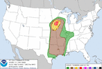
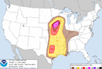
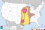
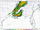
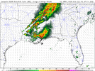
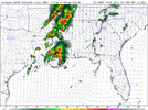
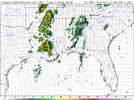
That 33 hour frame has me curious for my area.That focal point of convection intiation is looking likely on the delta like I thought yesterday. That MCS that forms along with the more inland stuff will complicate things a decent bit. View attachment 117147View attachment 117148View attachment 117149View attachment 117150
Z
Zander98al
Guest
Still not in 18 hours so forecast will probably still change a bit. And a lot of stuff is just going to be tough to forecast with so many boundaries possibly being over MississippiThat 33 hour frame has me curious for my area.
BufordWX
Member
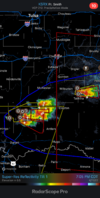
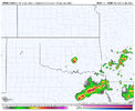
Sometimes develop Supercells in Oklahoma, sometimes does not.I see you 14z hrrr…View attachment 117152
Latest Mesoanalysis has the CINH weakening rather rapidly.
That’s a winning look right there!

