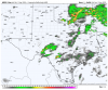
The key for the Carolinas tomorrow:
The main question with this outlook is convective mode. There are
two possibilities. The first is that the band of thunderstorms will
have discrete elements and gaps that will be favorable for
supercells and tornadoes. Forecast soundings at 15Z from southern
Virginia southward into northern South Carolina show looped
hodographs with 0-3 km storm relative helicities in the extreme
catogory, generally near or above 600 m2/s2. This would support a
threat for strong tornadoes associated with the more dominant
supercells. A wind damage and hail threat would be likely with
supercells and with the more organized line segments.
The second scenario would be that a squall-line is ongoing at 12Z
from eastern Georgia northward into the western Carolinas and
Virginia. In that case, widespread wind damage would be likely. A
QLCS tornado threat would exist with the stronger bowing line
segments. Hail would also be possible with the more intense parts of
the line.
The questions is which one will it be?


.png")


