NWMSGuy
Member

THAT CELL IN T-TOWN AND THE ONES SOUTH OF IT HAVE ME CONCERNED AS FAR AS THE TORNADO THREAT GOES.Mother of God, make it stop!

Sent from my iPhone using Tapatalk

WHERE IS THIS SOUNDING FROM BUD???
Northern Mississippi.WHERE IS THIS SOUNDING FROM BUD???
I actually pulled it from this guys tweet. I went to the model on pivotal and it would not display a point and click sounding. I’ve been having issues with it producing soundings lately.WHERE IS THIS SOUNDING FROM BUD???
I actually pulled it from this guys tweet. I went to the model on pivotal and it would not display a point and click sounding. I’ve been having issues with it producing soundings lately.


CORRECT .. MANY AREAS COULD SEE 80+ DURING THE STORMSo 50-60 wind gust before the storm and 70+ during the storm?
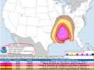
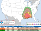
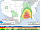
Not high enough to warrant a high risk, you'd have to have A 45% hatched tornado risk to warrant it. You could see a high wind risk though. But not out of the question for a 30% hatched tornado risk. Even so the large 15% is pretty impressive.With the SPC wording for tornadoes, I'm surprised there isn't an upgrade to a high risk.
Think 30 percent hatched tornado risk warrants a high risk category 30 percent plus is the thresholdNot high enough to warrant a high risk, you'd have to have A 45% hatched tornado risk to warrant it. You could see a high wind risk though. But not out of the question for a 30% hatched tornado risk. Even so the large 15% is pretty impressive.
Oh lol I thought it was 45%Think 30 percent hatched tornado risk warrants a high risk category 30 percent plus is the threshold
There is our line producing tornadoes early this morning in west Arkansas.
Yup, just wait till conditions ripen and you move into Mississippi and Alabama. You'll probably have tornado warning left and right with spin ups if the NWS can even catch them in time.Waking up to tornado warnings is usually a feature of the bad severe days in the south.
Not in Tuscaloosa/Birmingham.........53/54Dewpoints have dropped from low 50s to mid 40s since sunrise
Yep, it rises up into the 50s south and west of my location, currently in mid 40s around Huntsville, Decatur, Athens area. I see 60s over in northeast MS around Corinth and Booneville.Not in Tuscaloosa/Birmingham.........53/54
