-
Hello, please take a minute to check out our awesome content, contributed by the wonderful members of our community. We hope you'll add your own thoughts and opinions by making a free account!
You are using an out of date browser. It may not display this or other websites correctly.
You should upgrade or use an alternative browser.
You should upgrade or use an alternative browser.
Severe 3/30-4/2 Severe Weather
- Thread starter SD
- Start date
HSVweather
Member
And the SBCAPE in that tweet is an hour old, it has increased on the post above, even a 2k spot in the delta
HSVweather
Member
81/54 here with bright sun and a wind with kick.
In colombous ms
Z
Zander98al
Guest
HSVweather
Member
Z
Zander98al
Guest
A lot of discrete showers in Mississippi and into Alabama.
HSVweather
Member
The line is moving slower than expected.
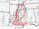
@SD @Myfrotho704_ thoughts? I see slight risk has been expanded back south into mostly central/northern NC for tomorrow and some of the hi res models do hint at some better dynamics for a tornado or two across N/NE part of state.
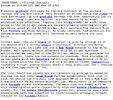
This from Rah:
The primary threat will be from
damaging wind gusts with a mostly linear mode with some embedded
cells organizing into supercells capable of producing a brief or
isolated tornado. The 12Z HREF shows a few longer UH tracks, mainly
across the northeast Piedmont.
This from Rah:
The primary threat will be from
damaging wind gusts with a mostly linear mode with some embedded
cells organizing into supercells capable of producing a brief or
isolated tornado. The 12Z HREF shows a few longer UH tracks, mainly
across the northeast Piedmont.
thanksgivingbrown
Member
I was just thinking the same thing. Line has just now crossed the Mississippi River and was forecasted to be in my neck of the woods by 8pm.The line is moving slower than expected.
I didn't watch the video, but I bet Timmer was screaming loudly in a panic.
HSVweather
Member
HSVweather
Member
It's messy and conditional. I've been tied up with end of quarter stuff at work but I'll look tonight. Just a quick glance I think there might be 2 opportunities@SD @Myfrotho704_ thoughts? I see slight risk has been expanded back south into mostly central/northern NC for tomorrow and some of the hi res models do hint at some better dynamics for a tornado or two across N/NE part of state.
This from Rah:
The primary threat will be from
damaging wind gusts with a mostly linear mode with some embedded
cells organizing into supercells capable of producing a brief or
isolated tornado. The 12Z HREF shows a few longer UH tracks, mainly
across the northeast Piedmont.
HSVweather
Member

Sent from my iPhone using Tapatalk
Z
Zander98al
Guest
Wind is absolutely roaring here just northeast of Birmingham.
Sent from my iPhone using Tapatalk
Z
Zander98al
Guest
Z
Zander98al
Guest
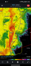
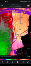
That's one of my most impressive qcls rotations I ve ever seemDude that rotation near Lexington Mississippi is no joke!View attachment 116501View attachment 116502
Z
Zander98al
Guest
Z
Zander98al
Guest
Z
Zander98al
Guest
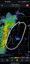
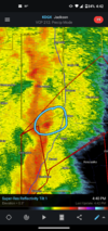
Tornado about to hit Jackson Mississippi
Z
Zander98al
Guest
HSVweather
Member
severestorm
Member
That's two major us metros in under month. wow!
HSVweather
Member
Watching WJTV livestream, it’s rain wrapped, still confirmed and there was a power flash. In pearl and flowood
severestorm
Member
Wow!
HSVweather
Member
Per WJTV, headed toward Jackson international airport
Z

