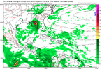
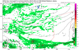
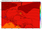
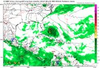
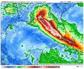
Mjo gets less bad in the Caribbean and gulf around the first of August
-
Hello, please take a minute to check out our awesome content, contributed by the wonderful members of our community. We hope you'll add your own thoughts and opinions by making a free account!
You are using an out of date browser. It may not display this or other websites correctly.
You should upgrade or use an alternative browser.
You should upgrade or use an alternative browser.
Tropical 2024 Tropical Thread
- Thread starter lexxnchloe
- Start date
- Status
- Not open for further replies.
lexxnchloe
Member
Brent
Member
Enjoy the break is all I'm gonna say
I want to go on the record and say we will have 1 to 2 hurricane emergencies. I haven’t brought the term/presentation up at any conferences but I believe we need to have a discussion on this. A strong major hurricane ramming into a fish bowl (New Orleans) or flood city (Charlestown or Houston) on an election year requires an official act of Hurricane Emergency Warning Declaration. This means a serious threat of long term power outages or people moving long term that could have years of impact to society, government, life or property. It would also allow aid in without states requesting and trigger our allies abroad to come in for rescues and relief operations with no debates. It would be prevent another Katrina.  I do believe we have not learned or prepared.
I want to go on the record and say we will have 1 to 2 hurricane emergencies. I haven’t brought the term/presentation up at any conferences but I believe we need to have a discussion on this. A strong major hurricane ramming into a fish bowl (New Orleans) or flood city (Charlestown or Houston) on an election year requires an official act of Hurricane Emergency Warning Declaration. This means a serious threat of long term power outages or people moving long term that could have years of impact to society, government, life or property. It would also allow aid in without states requesting and trigger our allies abroad to come in for rescues and relief operations with no debates. It would be prevent another Katrina.I do believe we have not learned or prepared.
Whereas season to date ACE is still quite strong due to Beryl, the forecasts with (near) record #s of NS are increasingly looking dicey regarding coming in close. The latest Euro weeklies, though they could be off obviously, have well BN Atlantic activity for the next 3 weeks with NN not starting til the week 8/11-18! So, there could very well be just 3 NS through Aug 11.
Highest # of NS 8/11+:
21: 2020, 05
16: 2021, 19, 10, 1969, 50
15: 2023, 1933
Opinions?
Highest # of NS 8/11+:
21: 2020, 05
16: 2021, 19, 10, 1969, 50
15: 2023, 1933
Opinions?
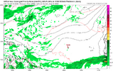
Seems legit with the mjo unfavorable until around 8/1 or after. We might see something try to get going in the central or western MDR the first week of August but that might be rushing itWhereas season to date ACE is still quite strong due to Beryl, the forecasts with (near) record #s of NS are increasingly looking dicey regarding coming in close. The latest Euro weeklies, though they could be off obviously, have well BN Atlantic activity for the next 3 weeks with NN not starting til the week 8/11-18! So, there could very well be just 3 NS through Aug 11.
Highest # of NS 8/11+:
21: 2020, 05
16: 2021, 19, 10, 1969, 50
15: 2023, 1933
Opinions?
lexxnchloe
Member
That high is going to have to retreat some! Looks straight west atm!
lexxnchloe
Member
It certainly isnt as advertised by all the predictions. Very very dry.That high is going to have to retreat some! Looks straight west atm!
Brent
Member
It certainly isnt as advertised by all the predictions. Very very dry.
I mean I hope the season busts tbh because we don't need what may happen but it's hard to draw any conclusions in July... Now if it's not better in a month then we can discuss
I've seen things flip overnight out there....in fact a week before Beryl I thought it was gonna be awhile too
PvilleWeather
Member
Agreed. It’s simply too early in the season to say the season is trending one way or the other. I also hope the season forecast busts. However, I fully expect things to really ramp up in September and October based on the indices and the overall pattern shaping up.I mean I hope the season busts tbh because we don't need what may happen but it's hard to draw any conclusions in July... Now if it's not better in a month then we can discuss
I've seen things flip overnight out there....in fact a week before Beryl I thought it was gonna be awhile tooand Beryl being that strong in the Caribbean is a very bad sign
Even IF there are no more NS before Aug 11th (a huge if), analogs of seasons with no Aug NS prior to Aug 11th still suggest 3-6 Aug NS. And that’s not even taking into account how warm the MDR is. (2022 had none but that was an extreme).
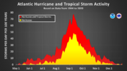
We’re now in a climatologically slow period. It is supposed to be quiet in mid July with SAL often dominating. It is often so slow that it has been called “season cancel” season. I picked 21/10/5 before the season started and still feel good about that prediction, which would mean a very active to hyperactive season.
But OTOH it is going to be quite the challenge for those predicting (near) record #s of NS (upper 20s+) to be close. The largest # of NS on record forming 8/11+ is 21, set in 2020 and 2005. But even if a ridiculous # of NS were not to occur, a bad season would unfortunately still be likely.
lexxnchloe
Member
From Larry Cosgrove

Jul 20, 2024, 11:14:56 PM
Overview
Aside from two smaller tropical cyclones in the western Pacific theater, the weather in the lower latitudes remains generally inactive. There is a disturbed area in the Sargasso Sea approaching the Bahamas, but Saharan Air Layer ingestion and hostile flow aloft should prevent further organization.
While the SAL is pervasive and getting a new surge on hot/dry/dusty air from northwestern Canada, climatology and some model forecasts are showing the Saharan heat ridge lifting northward into the Mediterranean countries in mid-August. Given the volatile, impulse-laden ITCZ in the equatorial zone, it is only a matter of time before a "Cape Verde" disturbance is able to travel westward, under the Bermuda High, with chances for intensification, to threaten the various Atlantic Basin islands and North America.
Keep in mind the linkage of the Asian monsoon trough. Madden-Julian Oscillation and the polar westerlies strongly favors extension and strengthening of a conjoined Sonoran + Bermudan heat ridge complex across the USA in another week or so. The weakness between the two subtropical highs, which can serve as a conduit for tropical features off of the Gulf of Mexico, will probably return after the hotter outcome in the lower 48 states during the 6-10, 11-15 and 16-20 day time frames.
Sea surface temperatures in the equatorial Pacific Basin are dropping again. Two of the model collections favor a negative/neutral or weak La Nina outcome. The CFS series is alone now in prediction of a moderate to strong -ENSO signature in sector 3.4. It makes sense that a threshold of -1.9 to -1.2 deg C below normal oceanic values will occur. If so, the potential for 18 additional named storms, 9 hurricanes and 5 new major hurricanes should be verified between now and November 30.
Larry Cosgrove
Jul 20, 2024, 11:14:56 PM
Overview
Aside from two smaller tropical cyclones in the western Pacific theater, the weather in the lower latitudes remains generally inactive. There is a disturbed area in the Sargasso Sea approaching the Bahamas, but Saharan Air Layer ingestion and hostile flow aloft should prevent further organization.
While the SAL is pervasive and getting a new surge on hot/dry/dusty air from northwestern Canada, climatology and some model forecasts are showing the Saharan heat ridge lifting northward into the Mediterranean countries in mid-August. Given the volatile, impulse-laden ITCZ in the equatorial zone, it is only a matter of time before a "Cape Verde" disturbance is able to travel westward, under the Bermuda High, with chances for intensification, to threaten the various Atlantic Basin islands and North America.
Keep in mind the linkage of the Asian monsoon trough. Madden-Julian Oscillation and the polar westerlies strongly favors extension and strengthening of a conjoined Sonoran + Bermudan heat ridge complex across the USA in another week or so. The weakness between the two subtropical highs, which can serve as a conduit for tropical features off of the Gulf of Mexico, will probably return after the hotter outcome in the lower 48 states during the 6-10, 11-15 and 16-20 day time frames.
Sea surface temperatures in the equatorial Pacific Basin are dropping again. Two of the model collections favor a negative/neutral or weak La Nina outcome. The CFS series is alone now in prediction of a moderate to strong -ENSO signature in sector 3.4. It makes sense that a threshold of -1.9 to -1.2 deg C below normal oceanic values will occur. If so, the potential for 18 additional named storms, 9 hurricanes and 5 new major hurricanes should be verified between now and November 30.
I guess the Saharan dust is the “X’ factor for this blockbuster season?? Especially as we transition to the Cape Verde season? Looks to really be a fly in the ointment currently!?
Seems that way every July and early August. Seems midish August that the conditions improve if that’s what you want to call it!I guess the Saharan dust is the “X’ factor for this blockbuster season?? Especially as we transition to the Cape Verde season? Looks to really be a fly in the ointment currently!?
https://www.tallahassee.com/story/n...s-forecast-2024-hurricane-season/74452324007/
Here's an interesting write up about the lull we are experiencing now. I still believe that we will experience an busy hurricane season once the Saharan dust abates and the wind shear lets up which will probably occur just in time for the traditional Cape Verde season.
Here's an interesting write up about the lull we are experiencing now. I still believe that we will experience an busy hurricane season once the Saharan dust abates and the wind shear lets up which will probably occur just in time for the traditional Cape Verde season.
Do you think it correlates to MJO phase or just happen chance?https://www.tallahassee.com/story/n...s-forecast-2024-hurricane-season/74452324007/
Here's an interesting write up about the lull we are experiencing now. I still believe that we will experience a busy hurricane season once the Saharan dust abates and the wind shear lets up which will probably occur just in time for the traditional Cape Verde season.
Brent
Member
A combination of both to be honest. The MJO is going into phases 1 and 2 which are favorable for tropical development in the Atlantic during the first week of August. The Saharan dust should be abating coming off the coast of Africa and wind shear will be relaxing soon. The environment is going to be more favorable for tropical development in August and with the bathtub warm ocean water out there there should be some activity once the wave train gets rolling off of Africa.Do you think it correlates to MJO phase or just happen chance?
lexxnchloe
Member
lexxnchloe
Member
JB joins the reboot crowd
lexxnchloe
Member
lexxnchloe
Member
Hello?
lexxnchloe
Member
Hi SDHello?
lexxnchloe
Member
Henry2326
Member
See if the ICON follows in the next couple days.
lexxnchloe
Member
lexxnchloe
Member
lexxnchloe
Member
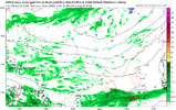
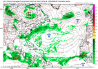
Im looking at that and i still see no green anywhere in the ATL basin thru AUG31. It still shows a bit of sinking if anything. He still sees dry air as a problem as well. Aug-early oct is the only period of interesting weather here and it looks to be a slow august. Taking another look the green that gets into the GOM and west carib evaporates by the end of Aug. I cant see how a hyperactive season is possible now.
Sounds like a Fab Feb Forecast to me.
lexxnchloe
Member
https://www.wral.com/story/sahara-d...-doses-during-thursday-s-heavy-rain/21538509/
The Saharan dust over the Atlantic has been thick to say the least. It has helped put a lid on tropical development and has many forecasters revisiting their predictions of a record hurricane season. I don't believe I've ever seen any mention of Saharan dust reaching the Carolinas.
The Saharan dust over the Atlantic has been thick to say the least. It has helped put a lid on tropical development and has many forecasters revisiting their predictions of a record hurricane season. I don't believe I've ever seen any mention of Saharan dust reaching the Carolinas.
lexxnchloe
Member
One way or another something always goes wrong with the atlantic.https://www.wral.com/story/sahara-d...-doses-during-thursday-s-heavy-rain/21538509/
The Saharan dust over the Atlantic has been thick to say the least. It has helped put a lid on tropical development and has many forecasters revisiting their predictions of a record hurricane season. I don't believe I've ever seen any mention of Saharan dust reaching the Carolinas.
Whether or not one wants the Atlantic to return to active (I’m fine with inactive being that I’m in a vulnerable location), model signals still appear to me to suggest activity will likely start in either the 1st or 2nd week of August.
lexxnchloe
Member
Oh hell no. Im not committing suicide over those mountains.
Forecast track vs actual track
Forecast track vs actual track
lexxnchloe
Member
lexxnchloe
Member
- Status
- Not open for further replies.

