• Hello, please take a minute to check out our awesome content, contributed by the wonderful members of our community. We hope you'll add your own thoughts and opinions by making a free account!

Tropical 2024 Tropical Thread

Status
Not open for further replies.
ZCZC MIATWOAT ALL
TTAA00 KNHC DDHHMM

Tropical Weather Outlook
NWS National Hurricane Center Miami FL
800 AM EDT Sat Jul 27 2024

For the North Atlantic...Caribbean Sea and the Gulf of Mexico:

1. Near the Lesser and Greater Antilles:
An area of disturbed weather over the central tropical Atlantic
Ocean is expected to interact with an approaching tropical wave
during the next several days. Development of this system is possible
while it approaches the Lesser Antilles during the early to middle
part of next week and moves generally west-northwestward near or
over the Greater Antilles towards the latter part of next week.
* Formation chance through 48 hours...low...near 0 percent.
* Formation chance through 7 days...low...30 percent.


Forecaster Berg
 
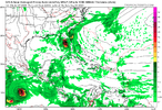
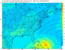
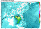
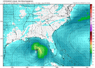
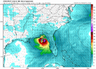
6Z gfs shifted from Texas to a Irma like track up the west side of Florida. Only thing that far out to focus on is the signal for a storm. Details come later
The 6z GFS would be rough in my area and probably bring several tornados to the Carolinas. But this is 10 days out and will change. We may not even have a storm at all.


Eric Webb

@webberweather

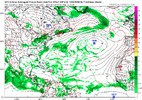
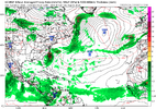
The tropical wave off the coast of Africa is another classic case where old fashioned pattern recognition is superior to model forecast consensus w/ medium range potential for tropical development. In addition to the CCKW passage, favorable SSTs, & shear, this wave has the classic precipitable water structure associated w/ "developing" AEWs (from Brammer & Thorncroft (2015)). Note the dipole of high PWATs to the NW of the wave axis, and drier air on the equatorward side. This type of PWATa distribution protects the tropical wave from dry air/SAL intrusions that typically come from the NW & is indicative of an active/unstable & poleward shifted monsoon trough that's more likely to eventually produce TCs.

 
Yeah split the difference in the Euro and GFS track and the SE got problems especially given the full rivers and saturated ground, hopefully we can dry out enough this week to prevent any real issues if this thing does end up forming and coming into the SE...
 
Euro is very consistent at least. If things are really favorable i like to look to see if the model develops anything behind a cane and the Euro doesnt. Back to seeing if they agree on something or nothing tonight.

1722107465403.png


JB says buckle up


This is why i am hesitant to say the Euro is right. There isnt even a hint of anything behind it. Even Beryl had a strong wave following that likely would have been a storm except beryl got too strong and it was too close to Beryl

1722112073473.png

Of course the 18z GFS could have a cane again
 
Last edited:
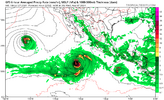
No comeback on 18Z GFS. Most likely its going to be dropped tonite on the Euro. Right now ive lowered my expectations and would be delighted if we had another 1986 Charley. We will have to wait till all this slows down. Usually Aug/sept are slow in the east pac.

1722120587587.png
 
Last edited:
No comeback on 18Z GFS. Most likely its going to be dropped tonite on the Euro. Right now ive lowered my expectations and would be delighted if we had another 1986 Charley. We will have to wait till all this slows down. Usually Aug/sept are slow in the east pac.

View attachment 148863
No worries....it will be back. Strong message from Euro ensemble means something is coming....typical response from operational models.
 
I think this one is dead. Not even a strong wave on the 06GFS and weaker and further east on Euro. If there is good news the east pac is much less busy

1722165070104.png
 
Last edited:
Just after the least active GEFS run in awhile (the 0Z with only 1 member (3%) having a TC) and despite the 6Z GFS being still another run without a TC from the central MDR wave, the 6Z GEFS with 5 TCs from 31 members (16%) is the most active GEFS to this point. All 5 members landfall in the CONUS (4 E coast, 1 FL Keys and panhandle) with 3 of these 5 landfalling twice. And this is with a still very active EPAC.

IMG_0024.png
 
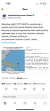
NHC

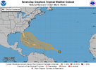
Tropical Weather Outlook
NWS National Hurricane Center Miami FL
800 PM EDT Sat Jul 27 2024

For the North Atlantic...Caribbean Sea and the Gulf of Mexico:

1. Near the Lesser and Greater Antilles:
An area of disturbed weather over the central tropical Atlantic
Ocean is expected to interact with an approaching tropical wave
during the next several days. Environmental conditions are forecast
to become conducive for some development in a day or two, and a
tropical depression could form around midweek while the system is
near or over the northern Leeward Islands, Greater Antilles or
southwestern Atlantic Ocean.
* Formation chance through 48 hours...low...near 0 percent.
* Formation chance through 7 days...medium...40 percent.

two_atl_7d0.png
 
I think this one is dead. Not even a strong wave on the 06GFS and weaker and further east on Euro. If there is good news the east pac is much less busy

View attachment 148870
It’s really not smart to be basing that on the operational runs. Just looking at both the GEFS and EPS, there is still a very strong storm signal there. Also the NHC is now up to a 40-60% chance of development in the next 7days.
 
Just like is the case for the 12Z ICON, the 12Z UKMET is the first run with a TC from this C MDR disturbance (may be due to it just coming in range since TCG isn’t til the end of the run). It is in the NW Bahamas:

NEW TROPICAL CYCLONE FORECAST TO DEVELOP AFTER 168 HOURS
FORECAST POSITION AT T+168 : 25.0N 77.6W

LEAD CENTRAL MAXIMUM WIND
VERIFYING TIME TIME POSITION PRESSURE (MB) SPEED (KNOTS)
-------------- ---- -------- ------------- -------------
1200UTC 04.08.2024 168 25.0N 77.6W 1012 29
 
The GFS has it again too 1005MB on central gulf coast at hour 213.

The 12Z GFS is the first GFS with a TC from this since yesterday’s 6Z.

Edit: 12Z CMC also has this again with a strong TS hitting the FL panhandle. That means that the most recent runs of the 5 most followed globals now have this.
 
Last edited:
It looks to me on the GFS the atlantic wave doesnt develop and recurves. This is from something different

1722187274057.png
 
It looks to me on the GFS the atlantic wave doesnt develop and recurves. This is from something different

View attachment 148881

I don’t think so. Look closely at the path of the 850 mb vorticity. It looks to me like the same disturbance all of the other models are developing.

The 12Z GEFS is less active than the most active to date 6Z GEFS, which had 5 TCs (all of which hit the CONUS). This run has 3 TCs, all of which either hit the E coast of FL or stay offshore the E coast. So, no Gulf TCs on the 12Z GEFS. The 6Z had one.
It is less active than the 6Z, but it is at least as active as any of the other GEFS runs to date. So, not a trend.
 
How about this change on the 12Z Euro?! It is much weaker (maybe a TD at most/1008 mb) that goes up the E seaboard from NC.
 
AW CRAP HERE WE GO AGAIN
Now I am scared. REALLY scared. Possible Florence remake?
Too early to see what happens. Anything from a Gulf Coast impact, East Coast impact, and OTS is on the table. The strength on the possible Debby depends on how it does this week.
 
How about this change on the 12Z Euro?! It is much weaker (maybe a TD at most/1008 mb) that goes up the E seaboard from NC.
Yea, with the ensembles not showing much and the Euro just about gone. Doesnt look like much now for sure


1722190052360.png
 
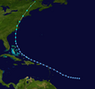
Exact path of doria 1971 only much weaker

1722192603065.png


1722192713759.png


After reaching tropical storm status, Doria quickly intensified as its wind field expanded while moving northward. The minimum central pressure quickly dropped, as well, and late on August 27, Doria reached its peak intensity of 65 mph (105 km/h) while making landfall on North Carolina near Morehead City. The storm maintained its peak winds as it moved north-northeastward through North Carolina, and weakened slightly to a 60 mph (97 km/h) tropical storm after entering Virginia on August 28. Doria turned to the northeast, passing through the Chesapeake Bay and Delmarva Peninsula before entering southern New Jersey. It paralleled the state a short distance inland, and after moving through New York City Doria became extratropical over northwestern Maine on August 29. The extratropical remnant continued northeastward until losing its identity near the border of New Brunswick and Quebec in Canada.[2]
 
Exact path of doria 1971 only much weaker

View attachment 148883


View attachment 148884


After reaching tropical storm status, Doria quickly intensified as its wind field expanded while moving northward. The minimum central pressure quickly dropped, as well, and late on August 27, Doria reached its peak intensity of 65 mph (105 km/h) while making landfall on North Carolina near Morehead City. The storm maintained its peak winds as it moved north-northeastward through North Carolina, and weakened slightly to a 60 mph (97 km/h) tropical storm after entering Virginia on August 28. Doria turned to the northeast, passing through the Chesapeake Bay and Delmarva Peninsula before entering southern New Jersey. It paralleled the state a short distance inland, and after moving through New York City Doria became extratropical over northwestern Maine on August 29. The extratropical remnant continued northeastward until losing its identity near the border of New Brunswick and Quebec in Canada.[2]
And Isaias
 
Exact path of doria 1971 only much weaker

View attachment 148883


View attachment 148884


After reaching tropical storm status, Doria quickly intensified as its wind field expanded while moving northward. The minimum central pressure quickly dropped, as well, and late on August 27, Doria reached its peak intensity of 65 mph (105 km/h) while making landfall on North Carolina near Morehead City. The storm maintained its peak winds as it moved north-northeastward through North Carolina, and weakened slightly to a 60 mph (97 km/h) tropical storm after entering Virginia on August 28. Doria turned to the northeast, passing through the Chesapeake Bay and Delmarva Peninsula before entering southern New Jersey. It paralleled the state a short distance inland, and after moving through New York City Doria became extratropical over northwestern Maine on August 29. The extratropical remnant continued northeastward until losing its identity near the border of New Brunswick and Quebec in Canada.[2]

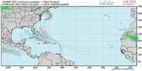
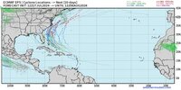
Despite the 12Z Euro being much weaker, the more reliable ensembles (12Z EPS) are still quite active and still are heavily favoring either near or offshore the US E coast with just a couple of members with a TC in the E GOM.
 
Last edited:
Status
Not open for further replies.
Back
Top