• Hello, please take a minute to check out our awesome content, contributed by the wonderful members of our community. We hope you'll add your own thoughts and opinions by making a free account!

Tropical 2024 Tropical Thread

Status
Not open for further replies.
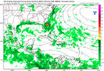
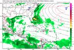
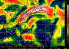
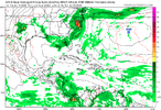
If anything the signal on the GFS for some kind of eastern GOM tropical storm is consistent. Looks like a wet over all period for the SE which isnt a terrible thing for MBY>
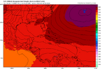
Not there for NC and SC on the 12z GFS. Less than. 25 through 384 for many of us.
 
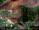
The 0Z UKMET has a borderline TD/TS making landfall in W LA a week from now. This is the 2nd UKMET run in a row with this. The prior run aimed for middle to upper TX but was still offshore at 168.

NEW TROPICAL CYCLONE FORECAST TO DEVELOP AFTER 162 HOURS
FORECAST POSITION AT T+162 : 28.6N 91.8W

LEAD CENTRAL MAXIMUM WIND
VERIFYING TIME TIME POSITION PRESSURE (MB) SPEED (KNOTS)
-------------- ---- -------- ------------- -------------
0000UTC 17.06.2024 168 29.5N 92.3W 1002 34
 
000
ABNT20 KNHC 111125
TWOAT

Tropical Weather Outlook
NWS National Hurricane Center Miami FL
800 AM EDT Tue Jun 11 2024

For the North Atlantic...Caribbean Sea and the Gulf of Mexico:

Eastern Gulf of Mexico and Offshore Southeast U.S.:
A trough of low pressure over the eastern Gulf of Mexico is
producing a large area of disorganized showers and thunderstorms.
This system is expected to move northeastward across Florida during
the next day or so and offshore of the U.S. Southeast coast later
this week. Environmental conditions are expected to be generally
unfavorable, although some slow development is possible when the
system is offshore of the U.S. Southeast coast. Regardless of
development, heavy rainfall is expected across portions of Florida
during the next few days. For more information, see products issued
by the Weather Prediction Center and local National Weather Service
Forecast Offices.
* Formation chance through 48 hours...low...near 0 percent.
* Formation chance through 7 days...low...20 percent.
Lemon for the disturbed weather in the GOM
that the models are signaling that it could develop off the East Coast.
 
every single year in june the gfs prints out long range bangers in the western caribbean that never materialize. do not fall for this scam.

a much more reasonable outcome is the first tc forming along a stalled out front in the gulf stream. if fanduel offered odds on "method of first tc genesis" every year, then stalled front off the atlantic has the highest odds at something like +425

Just to add to this there were numerous fantasy storms on the GFS last year that never verified even at peak season 🤣 as I was reminded of when I brought up the GFS elsewhere
 
Status
Not open for further replies.
Back
Top