• Hello, please take a minute to check out our awesome content, contributed by the wonderful members of our community. We hope you'll add your own thoughts and opinions by making a free account!

Tropical 2024 Tropical Thread

Status
Not open for further replies.
IMG_2220.png
Maybe not worth posting but this second one has been very consistent.
 
CMC with two storms in the Gulf in the next 10 days 🤣 that's not including anything off the east coast in the short term

The second one goes to Mexico just FYI it's not a big US threat like the GFS has hinted
 
Last edited:


Related:
12Z UKMET has TD at 150 just off GA that moves NNE to Tybee/lower SC

GLOBAL MODEL DATA TIME 1200UTC 15.06.2024

NEW TROPICAL CYCLONE FORECAST TO DEVELOP AFTER 150 HOURS
FORECAST POSITION AT T+150 : 31.1N 81.1W

LEAD CENTRAL MAXIMUM WIND
VERIFYING TIME TIME POSITION PRESSURE (MB) SPEED (KNOTS)
-------------- ---- -------- ------------- -------------
0000UTC 22.06.2024 156 31.9N 80.9W 1012 24
1200UTC 22.06.2024 168 33.8N 80.3W 1014 25
 
Definitely next area to watch.
Euro and now the GFS show strengthening til landfall View attachment 148002
In addition to the 18Z GFS, the 18Z Euro and ICON both have this. The ICON has this as a nearly closed off surface low just off NE FL at the end of the run (hour 120) moving WNW toward Jacksonville.

Also, the 12Z and 18Z GEFS both have moderate support for this with 5-6 of the 31 members landfalling as a surface low along the SE coast late next week.

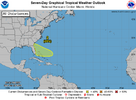
This is now a 20% 7 day lemon (actually looks more like a squash) on the newest TWO:

2. Southwestern Atlantic Ocean:
An area of low pressure could form by the middle part of next week
a few hundred miles northeast of the central Bahamas. Some slow
development of this system is possible thereafter while the system
moves westward or west-northwestward.
* Formation chance through 48 hours...low...near 0 percent.
* Formation chance through 7 days...low...20 percent.


Forecaster Blake

IMG_9764.png
 
Last edited:
In addition to the 18Z GFS, the 18Z Euro and ICON both have this. The ICON has this as a nearly closed off surface low just off NE FL at the end of the run (hour 120) moving WNW toward Jacksonville.

Also, the 12Z and 18Z GEFS both have moderate support for this with 5-6 of the 31 members landfalling as a surface low along the SE coast late next week.

This is now a 20% 7 day lemon (actually looks more like a squash) on the newest TWO:

2. Southwestern Atlantic Ocean:
An area of low pressure could form by the middle part of next week
a few hundred miles northeast of the central Bahamas. Some slow
development of this system is possible thereafter while the system
moves westward or west-northwestward.
* Formation chance through 48 hours...low...near 0 percent.
* Formation chance through 7 days...low...20 percent.


Forecaster Blake

View attachment 148003
1718503978218.png
 
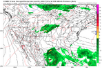
The ICON went from virtually nothing on the 12Z to a nearly closed off low on the 18Z to a TS on the 0Z. It landfalls as what I think is a TD (due to slight weakening) near Brunswick.
 
If you believe the icon we could have two storms threatening the US at the same time midweek with the BOC area possibly in Texas
 
That thing in the SW Atlantic is the classic tail end of a front you have to wait for it to pinch off to really see what you have system.

Looking at visible this morning you can already see low clouds heading W and WSW on the W side of the plume of persistent convection way E of jax so this area is certainly going to make a run at getting going. It'll be interesting to see just how far S and E it drifts over the next 36 hours before the ridge over the top yanks it west. Also how much dry air does it pull in with the continental air to its north.
 
This ridge over the Northeast is the first heat ridge in quite a few years there. The last few years a trof has resided there all summer.

If that becomes the norm this summer we are in trouble.


Sent from my iPhone using Tapatalk
 
12Z models so far for low off SE US coast:

-ICON has the low further west than prior runs and this leads to a further SW track into C FL. It is a tad stronger than the open wave of 6Z, but is much weaker than the 0Z TS and is likely not quite a TD.

-GFS similarly comes in further SW into C FL; similar to 6Z with a TD but weaker than the TS of the 0Z

-GEFS consistent with its operational has its mean further S, less active, and not as wet as prior two runs

-CMC weaker than the barely closed 0Z with nothing closed into SC (similar track to 0Z)

-UKMET no TC just like 0Z and unlike the TD that formed on yesterday’s 12Z just offshore Brunswick on Fri moving N to GA/SC border
 
The 12Z Euro is weaker than the prior 3 runs with an open wave at hour 108. The associated pretty unimpressive rain is headed toward N SC/NC.
 
Gfs the strongest it's been for a few runs with the east coast system for this weekend. We need the rain badly but being the Euro and cmc are much weaker with it its likely just more gfs bias
 
Gfs the strongest it's been for a few runs with the east coast system for this weekend. We need the rain badly but being the Euro and cmc are much weaker with it its likely just more gfs bias

Yeah now no other model has anything even close to a TC, the trend is further east (go back and compare to earlier runs for the same time), and GEFS mean is less active/not as much qpf as the more active weekend runs. This is starting to look to me like GFS convective feedback fakeness. I now don’t think this will generate a TC. I’d lower the TWO chance. Now it is 10%/30%. If they thought this was going to result in TCG, the 7 day would likely be rising as we get closer.
 
Unlike the SW Atlantic (imo), the SW Gulf system is getting closer to TCG potential (likely with it at 70%/70%) with much better model support. The only thing about that is the broadness. Will the broadness of the low allow it to become a TS?? Opinions?

Last few UKMET runs do have a TS:

NEW TROPICAL CYCLONE FORECAST TO DEVELOP AFTER 54 HOURS
FORECAST POSITION AT T+ 54 : 23.6N 94.4W

LEAD CENTRAL MAXIMUM WIND
VERIFYING TIME TIME POSITION PRESSURE (MB) SPEED (KNOTS)
-------------- ---- -------- ------------- -------------
1200UTC 19.06.2024 60 23.5N 94.7W 998 35
0000UTC 20.06.2024 72 23.4N 95.6W 997 39
1200UTC 20.06.2024 84 24.9N 97.9W 999 38
0000UTC 21.06.2024 96 CEASED TRACKING

This is now Invest 91L.
 
Last edited:
Can a admin/mod start the thread for Invest 91L?
Southwestern Gulf of Mexico (AL91):
Satellite and surface observations indicate that a broad area of
low pressure is located over the Bay of Campeche with winds of
35-40 mph occurring in an area well to the northeast of the center
over the southern Gulf of Mexico. Environmental conditions appear
conducive for gradual development, and a tropical depression or
tropical storm is likely to form by midweek while the low moves
slowly west-northwestward toward the western Gulf coast.

Regardless of development, several more days of heavy rainfall are
expected across portions of southern Mexico and Central America, and
these rains are likely to cause life-threatening flooding and flash
flooding. Locally heavy rainfall is also expected to spread over
portions of Texas and Louisiana by the middle of the week. In
addition, gale warnings have been issued for portions of the Gulf of
Mexico, and more information on those warnings is available in High
Seas Forecasts issued by the National Weather Service. Interests
along the western and northwestern Gulf coasts should monitor the
progress of this system, as tropical storm watches and warnings may
be required for portions of this area later this afternoon or
tonight. An Air Force Reserve Hurricane Hunter aircraft is
currently en route to investigate the system.
* Formation chance through 48 hours...high...70 percent.
* Formation chance through 7 days...high...70 percent.
 
11:00 PM EDT 999mb
AL012024_5day_cone_with_line_and_wind+png


Editing to add: I somehow missed seeing the PTC 1 thread until now.
 
Last edited:
Wouldn’t surprise me to see it upgraded to a Potential Potential Tropical Cyclone in the next day or so.

Not a PTC, but they just designated this as Invest 92L though the TWO chances remain low:

Southwestern Atlantic Ocean:
An area of showers and thunderstorms located a few hundred miles
east of the Bahamas is associated with a surface trough of low
pressure. Environmental conditions are marginally conducive for some
gradual development of this system during the next few days while it
moves westward or west-northwestward. The system is forecast to
approach the coast of the southeastern United States by Friday.
* Formation chance through 48 hours...low...20 percent.
* Formation chance through 7 days...low...20 percent.

Currently, no model has a TC from this. At most they have a very weak low and more like a trough. I’m not been expecting a TC from this since the models became weaker but you never know for sure.
 
Last edited:
Based on the TWO image, it appears that the NHC is raising the chance from 20% to 30%. I didn’t expect that. I don’t see the text yet.

Here’s the text:
Southwestern Atlantic Ocean (AL92):
A small area of low pressure has formed about 300 miles east of
the northwestern Bahamas this evening with disorganized shower and
thunderstorm activity. While environmental conditions are only
marginally conducive due to nearby dry air, further development of
this system is possible while the low moves west-northwestward and
approaches the northeastern coast of Florida or Georgia early on
Friday.
* Formation chance through 48 hours...low...30 percent.
* Formation chance through 7 days...low...30 percent.
 
Status
Not open for further replies.
Back
Top