-
Hello, please take a minute to check out our awesome content, contributed by the wonderful members of our community. We hope you'll add your own thoughts and opinions by making a free account!
You are using an out of date browser. It may not display this or other websites correctly.
You should upgrade or use an alternative browser.
You should upgrade or use an alternative browser.
Tropical 2024 Tropical Thread
- Thread starter lexxnchloe
- Start date
- Status
- Not open for further replies.
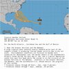
Tropical Weather Outlook
NWS National Hurricane Center Miami FL
200 AM EDT Tue Jul 30 2024
For the North Atlantic...Caribbean Sea and the Gulf of Mexico:
1. Near the Greater Antilles and the Bahamas:
A large tropical wave centered several hundred miles east of the
Leeward Islands is producing limited shower activity due to dry air
aloft. Environmental conditions are forecast to become more
conducive for development over the warmer waters of the southwestern
Atlantic Ocean during the next day or two, and a tropical depression
could form late this week while the system is in the vicinity of the
Greater Antilles or the Bahamas. Interests in the Greater Antilles,
the Bahamas, and the southeastern U.S. should monitor the progress
of this system.
* Formation chance through 48 hours...low...near 0 percent.
* Formation chance through 7 days...medium...60 percent.
accu35
Member
- Joined
- Jan 5, 2017
- Messages
- 8,447
- Reaction score
- 9,967
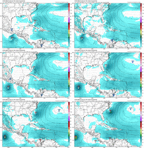
Euro0Z Euro has a weak low on E coast of FL that moves offshore NE FL and strengthens to 1006 (possible TD) off SC moving toward NC at 240. So, Euro is closer to CMC/ICON than UKMET and nothing like GFS.
Gfs
UK
Shifted west. To see the Euro start shifting west is concerning. I’ve heard the Euro is good for the track more than the intensity. Few more runs and this could easily get into the gulf
NoSnowATL
Member
Henry2326
Member
lexxnchloe
Member
My guess is if this afternoons euro shows anything it will be developing in the GOM now, again assuming it shows anything
lexxnchloe
Member
Lets not forget, Camille started the same way
Henry2326
Member
I think the odds of that happening are going down everyday. Watch NHC, not the individual operational models.My guess is if this afternoons euro shows anything it will be developing in the GOM now, again assuming it shows anything
weather bubba
Member
The Saharan dust that has effectively put a lid on tropical development in the Atlantic for the past thirty days or so is starting to lighten up. The disturbance that is being watched now will be slow to develop. Once it gets closer to the islands in the Carribean water temperatures will be warmer and if shear isn't an issue then we might have something to start paying close attention to for those that live along the Southeast coast.
Henry2326
Member
lexxnchloe
Member
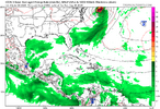
12z Icon....that's a stout High moving it along the coast. Depending position of the high will determine if it comes ashore or if the storm is stronger. Typical coastal run.....
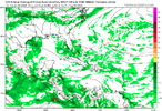
View attachment 148949
actually quite a big difference from 0Z
Here 12 z where it seems to get stuck Due east of the va/nc border
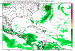
0Z last night which gives it 12 more hours of movement today.
jeremyt
Member
Once again it’s too early to watch individual model runs. Nothing has formed! Wait about 5 days before assuming anything.
lexxnchloe
Member
lexxnchloe
Member
ITCZ very weak and dry
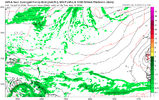
This is just a reminder of what was forecasted. A well above normal amount of moisture in the MDR Jul-Sept. July was bone dry there and the GFS shows thru Aug 15 virtually no moisture whatsoever. Just my opinion but 25 named storms cant happen now.
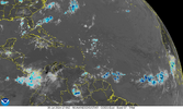
Todays sat pic. Dry and an ITCZ depressed well south

Last edited:
12Z UKMET: similar to 0Z but weaker (TD vs TS) with trip from Key West vicinity into far E Gulf followed by turn into N FL; run ends with it near Jacksonville
NEW TROPICAL CYCLONE FORECAST TO DEVELOP AFTER 108 HOURS
FORECAST POSITION AT T+108 : 25.0N 81.8W
LEAD CENTRAL MAXIMUM WIND
VERIFYING TIME TIME POSITION PRESSURE (MB) SPEED (KNOTS)
-------------- ---- -------- ------------- -------------
0000UTC 04.08.2024 108 25.0N 81.8W 1008 29
1200UTC 04.08.2024 120 26.8N 83.2W 1007 30
0000UTC 05.08.2024 132 28.0N 83.4W 1007 26
1200UTC 05.08.2024 144 29.2N 83.3W 1010 24
0000UTC 06.08.2024 156 30.2N 81.6W 1011 26
1200UTC 06.08.2024 168 30.0N 80.9W 1012 30
Tropical Weather Outlook
NWS National Hurricane Center Miami FL
200 PM EDT Tue Jul 30 2024
For the North Atlantic...Caribbean Sea and the Gulf of Mexico:
1. Near the Greater Antilles and the Bahamas:
A large tropical wave centered several hundred miles east of the
Lesser Antilles is producing limited shower activity due to
environmental dry air. Conditions are forecast to become a little
more conducive for development over the warmer waters of the
southwestern Atlantic Ocean, and a tropical depression could form
late this week while the system is in the vicinity of the Greater
Antilles or the Bahamas. Interests in the Greater Antilles, the
Bahamas, and the southeastern U.S. should monitor the progress of
this system.
* Formation chance through 48 hours...low...near 0 percent.
* Formation chance through 7 days...medium...60 percent.
Forecaster Cangialosi
lexxnchloe
Member
Andy Hazelton sounding less bullish
Finally starting to bubble some convection today. It'll be interesting to see how the overall circulation and envelope manages the close pass to the islands in the coming days.
Henry2326
Member
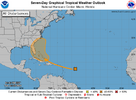
This is what I've been waiting on. NHC giving more odds to a southeast coast run.Tropical Weather Outlook
NWS National Hurricane Center Miami FL
200 PM EDT Tue Jul 30 2024
For the North Atlantic...Caribbean Sea and the Gulf of Mexico:
1. Near the Greater Antilles and the Bahamas:
A large tropical wave centered several hundred miles east of the
Lesser Antilles is producing limited shower activity due to
environmental dry air. Conditions are forecast to become a little
more conducive for development over the warmer waters of the
southwestern Atlantic Ocean, and a tropical depression could form
late this week while the system is in the vicinity of the Greater
Antilles or the Bahamas. Interests in the Greater Antilles, the
Bahamas, and the southeastern U.S. should monitor the progress of
this system.
* Formation chance through 48 hours...low...near 0 percent.
* Formation chance through 7 days...medium...60 percent.
Forecaster Cangialosi
- Status
- Not open for further replies.


