-
Hello, please take a minute to check out our awesome content, contributed by the wonderful members of our community. We hope you'll add your own thoughts and opinions by making a free account!
You are using an out of date browser. It may not display this or other websites correctly.
You should upgrade or use an alternative browser.
You should upgrade or use an alternative browser.
Tropical 2024 Tropical Thread
- Thread starter lexxnchloe
- Start date
- Status
- Not open for further replies.
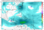
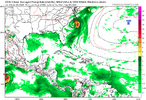
This thing at some point is going to need clouds or these model reports are useless
Brent
Member
Strong wording from the NHC
Interests in the
Greater Antilles, the Bahamas, and the southeastern U.S. should
monitor the progress of this system.
Interests in the
Greater Antilles, the Bahamas, and the southeastern U.S. should
monitor the progress of this system.
This thing at some point is going to need clouds or these model reports are useless
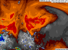
Oh it will get clouds and then convection and then a post by JB will kill it dead for good.
lexxnchloe
Member
Shaggy
Member
This cyclonic envelop is massive. Should take a lot of work to get anything consolidatedThis thing at some point is going to need clouds or these model reports are useless
lexxnchloe
Member
Henry2326
Member
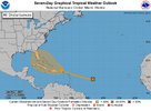
Tropical Weather Outlook
NWS National Hurricane Center Miami FL
200 PM EDT Mon Jul 29 2024
For the North Atlantic...Caribbean Sea and the Gulf of Mexico:
1. Near the Greater Antilles and the Bahamas:
An area of disturbed weather over the central tropical Atlantic
Ocean is expected to interact with an approaching tropical wave
during the next day or two. Environmental conditions are forecast to
become conducive for gradual development thereafter, and a tropical
depression could form late this week while the system is in the
vicinity of the Greater Antilles or the Bahamas. Interests in the
Greater Antilles, the Bahamas, and the southeastern U.S. should
monitor the progress of this system.
* Formation chance through 48 hours...low...near 0 percent.
* Formation chance through 7 days...medium...50 percent.
BHS1975
Member
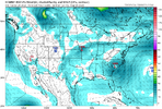
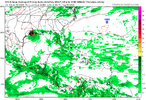
Euro very Florence like.
Sent from my iPhone using Tapatalk
Sent from my iPhone using Tapatalk
lexxnchloe
Member
Henry2326
Member
Henry2326
Member
Bubble leaning more to the east side....
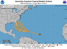
Tropical Weather Outlook
NWS National Hurricane Center Miami FL
800 PM EDT Mon Jul 29 2024
For the North Atlantic...Caribbean Sea and the Gulf of Mexico:
1. Near the Greater Antilles and the Bahamas:
An area of disturbed weather over the central tropical Atlantic
Ocean is expected to interact with an approaching tropical wave
during the next day or two. Environmental conditions are forecast to
become conducive for gradual development thereafter, and a tropical
depression could form late this week while the system is in the
vicinity of the Greater Antilles or the Bahamas. Interests in the
Greater Antilles, the Bahamas, and the southeastern U.S. should
monitor the progress of this system.
* Formation chance through 48 hours...low...near 0 percent.
* Formation chance through 7 days...medium...50 percent.
lizajane
Member
Only if it becomes a cat 4 before land fall. I live in Wilmington. Grew up here. I'm not a meteorologist. But the remnants of Cat 4s that come through are more powerful than a developing storm. Hurricane Matthew comes to mind and Florence.Euro very Florence like.
Sent from my iPhone using Tapatalk
The old rule of thumb is if the system hasn’t formed yet with a center then modeling is biased too far east. If that’s the case we making be looking at OBX landfall or a scrape up the east coast for all states or Canada strike again. The signal is there for development and that’s all we can really go on. Intensity and track won’t be known. I.E the cat 5 we already had this year. The NHC has been doing a good job on cyclone genesis and that’s really the first step to help these models run.
Downeastnc
Member
Only if it becomes a cat 4 before land fall. I live in Wilmington. Grew up here. I'm not a meteorologist. But the remnants of Cat 4s that come through are more powerful than a developing storm. Hurricane Matthew comes to mind and Florence.
I agree, Irene was a beast of a storm even though she was much weaker than her former glory because she had a large well developed wind field and smack us around for hours with the center a good 75-100 miles east of us.....seems like the local home grown storms tend to stay on the smaller size with tighter cores....storms like Alex and Arthur....the center of Arthur was as close as Irene and officially 100 mph versus Irene's 85 and we got no wind from Arthur because he did not have the well established wind field she did.
lexxnchloe
Member
lexxnchloe
Member
For C MDR system:
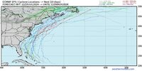
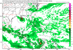
1. 0Z CMC forms TC off SE coast, center stays a little offshore SC/NC, and then becomes a H well offshore; ends run just off NE Nova Scotia as significant storm
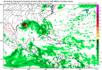
2. 0Z UKMET: large shift SW from 12Z run and much earlier TCG just N of C Cuba with TS near Key West then turns into FL Big Bend followed by NNE motion into SC/SE GA, NE into coastal SC and then ENE move to offshore CHS; TS nearly the entire track
NEW TROPICAL CYCLONE FORECAST TO DEVELOP AFTER 102 HOURS
FORECAST POSITION AT T+102 : 22.8N 79.2W
LEAD CENTRAL MAXIMUM WIND
VERIFYING TIME TIME POSITION PRESSURE (MB) SPEED (KNOTS)
-------------- ---- -------- ------------- -------------
1200UTC 03.08.2024 108 23.3N 79.9W 1007 37
0000UTC 04.08.2024 120 24.8N 81.8W 1004 39
1200UTC 04.08.2024 132 26.9N 83.2W 1003 37
0000UTC 05.08.2024 144 28.9N 83.0W 1003 33
1200UTC 05.08.2024 156 31.4N 82.5W 1008 36
0000UTC 06.08.2024 168 32.8N 79.4W 1006 35
- Status
- Not open for further replies.

