• Hello, please take a minute to check out our awesome content, contributed by the wonderful members of our community. We hope you'll add your own thoughts and opinions by making a free account!

Tropical 2024 Tropical Thread

Status
Not open for further replies.
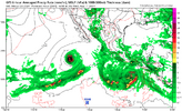
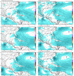
Despite the 12Z Euro being much weaker, the more reliable ensembles (12Z EPS) are still quite active and still are heavily favoring either near or offshore the US E coast with just a couple of members with a TC in the E GOM.
Got thatvon the plots image or is that not out yet?
 
Got thatvon the plots image or is that not out yet?
1. 12Z EPS is out on Pivotal.

2. Though not one of top 5 most followed globals, the JMA, which along with the ICON was best with Beryl's track in the W GOM, has a TC for the first time with it in the NW Bahamas moving NNW (TD at 1013 mb). Thus, counting this, that means 3 in GOM (ICON/GFS/CMC) and 3 in SW Atlantic (UKMET/Euro/JMA). So, this run has a TC for the first time on the JMA, UKMET, and ICON.
 
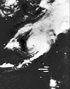
August hurricane 1970
1722197926791.png


1722197949409.png


A tropical depression developed off the west coast of Africa on August 7, with organized convection and banding features. A day later, the depression passed south of Cabo Verde as it moved across the tropical Atlantic. On August 10, it intensified into a tropical storm, after the thunderstorms became more concentrated. However, a Hurricane Hunters flight two days later observed a weak system, suggesting the storm weakened back to a tropical depression. While approaching the Lesser Antilles, the depression turned to the northwest and re-intensified back into a tropical storm, with hurricane-force wind gusts north of the center. Late on August 14, the circulation opened into a trough. On August 15, a circulation reformed, and the system became a tropical depression again as it bypassed the eastern Bahamas. A day later, the system re-intensified into a compact tropical storm while turning northward. On August 17, the storm made landfalls along the Outer Banks of North Carolina, first on Atlantic Beach and later at Rodanthe. As the storm accelerated northeastward, it intensified into a hurricane, with peak winds of 80 mph (130 km/h), based on the well-defined eye and a report from a nearby ship. On August 18, the system became extratropical south of Newfoundland, and subsequently it slowed and shifted its track back to the sou
 
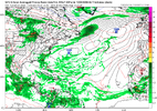
Similar GFS

1722206886045.png


Big difference is it holds together enough to develop alomg the NC coast.


1722207805733.png


Possibly becoming a hurricane with a big high to the north.

1722208042666.png
 
Last edited:
I know this is a weather board and that’s what is discussed. That said, and I say it during the winter, I don’t see the point in the highs and lows of individual long range model run reactions. A signal has been shown, the conditions could be favorable but no one knows what’s going to happen. The models are going to flip back and forth until there is better data in a closer timeframe. Peak is still like 5 weeks away.
 
0Z GFS no TC/just weak Gulf low

0Z CMC/ICON TS into FL panhandle

0Z Euro 1006 mb TD/TS into NC OB

0Z UKMET: TS just off FL E coast that then turns NNE

NEW TROPICAL CYCLONE FORECAST TO DEVELOP AFTER 132 HOURS
FORECAST POSITION AT T+132 : 24.8N 77.9W

LEAD CENTRAL MAXIMUM WIND
VERIFYING TIME TIME POSITION PRESSURE (MB) SPEED (KNOTS)
-------------- ---- -------- ------------- -------------
1200UTC 03.08.2024 132 24.8N 77.9W 1009 42
0000UTC 04.08.2024 144 26.3N 79.5W 1005 47
1200UTC 04.08.2024 156 28.2N 80.2W 1006 33
0000UTC 05.08.2024 168 30.0N 79.6W 1006 34
For a hyper active season this is a letdown so far. GFS up to aug 14. At least the GFS shows the east pac calming down.

1722242561806.png
 

Attachments

  • 1722242524768.png
    1722242524768.png
    462 KB · Views: 5
06GFS has nothing but it has the East pac active once again. If that is right things will be delayed even longer

1722251910111.png
 
UHC..... says too soon to tell......
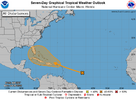

two_atl_7d0 (1).png

Tropical Weather Outlook
NWS National Hurricane Center Miami FL
800 AM EDT Mon Jul 29 2024

For the North Atlantic...Caribbean Sea and the Gulf of Mexico:

1. Near the Leeward Islands and Greater Antilles:
An area of disturbed weather over the central tropical Atlantic
Ocean is expected to interact with an approaching tropical wave
during the next couple of days. Environmental conditions are
forecast to become conducive for some development thereafter, and a
tropical depression could form later this week while the system is
in the vicinity of the Greater Antilles or the Bahamas.
* Formation chance through 48 hours...low...near 0 percent.
* Formation chance through 7 days...medium...50 percent.
 
1) 12Z UKMET: still has a TD though not as strong as the 0Z’s TS that had skimmed the SE FL coast at Palm Beach. The new run delays TCG til it is 50 miles NE of Cape Canaveral. It then moves NE to 150 miles E of Amelia Island, FL:

NEW TROPICAL CYCLONE FORECAST TO DEVELOP AFTER 156 HOURS
FORECAST POSITION AT T+156 : 29.0N 80.1W

LEAD CENTRAL MAXIMUM WIND
VERIFYING TIME TIME POSITION PRESSURE (MB) SPEED (KNOTS)
-------------- ---- -------- ------------- -------------
0000UTC 05.08.2024 156 29.0N 80.1W 1008 31
1200UTC 05.08.2024 168 30.6N 79.0W 1008 34

————————-

2) 12Z CMC is further E and much weaker with just a weak low over SE FL/NW Bahamas. But then it gets stronger as it moves NE offshore NC and becomes a TS moving further OTS.
 
Status
Not open for further replies.
Back
Top