• Hello, please take a minute to check out our awesome content, contributed by the wonderful members of our community. We hope you'll add your own thoughts and opinions by making a free account!

Tropical 2024 Tropical Thread

Status
Not open for further replies.
12Z EPS: more spread out than 0Z but with mean path a little to the left of 0Z. The operational was fairly close to the EPS mean path. There’s still very little in the Gulf, a few at or near SE FL, some that hit further up the US E coast, and the majority still staying offshore the E US. A decent % of those, however, later hit SE Canada. Still a long way to go and lots of uncertainty this far out.
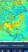
 
Just looking at this with the trof well to the west and a strong high to the east Long Island should watch out. Lets see what happens


1723243649550.png
 
12Z EPS: more spread out than 0Z but with mean path a little to the left of 0Z. The operational was fairly close to the EPS mean path. There’s still very little in the Gulf, a few at or near SE FL, some that hit further up the US E coast, and the majority still staying offshore the E US. A decent % of those, however, later hit SE Canada. Still a long way to go and lots of uncertainty this far out.
18z gfs is slightly spread out Screenshot_20240809_194909_Chrome.jpg
 
Invest 98L now
1. Near the Lesser and Greater Antilles:
Shower activity associated with a tropical wave located about 900
miles west-southwest of the Cabo Verde Islands has become a little
better organized since yesterday. Slow development of this system
is possible during the next couple of days while it moves westward
to west-northwestward across the central tropical Atlantic.
Conditions are expected to become more conducive for development
thereafter, and a tropical depression is likely to form by early
next week while the system approaches and then moves near or over
the Lesser Antilles. The system is forecast to continue moving
generally west-northwestward and could approach portions of the
Greater Antilles by the middle part of next week.
* Formation chance through 48 hours...low...10 percent.
* Formation chance through 7 days...high...70 percent.
 
Do the models have a better hold on this than Debby? I remember those keeping off of the EC and it ended up in the gulf. I’m not saying it will be an EC storm or even wanting that but it still hasn’t formed.
 
Do the models have a better hold on this than Debby? I remember those keeping off of the EC and it ended up in the gulf. I’m not saying it will be an EC storm or even wanting that but it still hasn’t formed.
Right now its too early to say no threat to the east coast. I cant imagine it getting in the GOM.
 
Going over the islands if that happens doesn't really scream recurve to me but we'll see... still gonna be a high chance of it that far east. Very few storms make it across
 
Once there was a center they pretty much nailed it. Before a center formed though it was favored to go east of Florida and up the coast. This is from 7/30View attachment 149830

Yeah true just have to wait and see here but like I said the odds alone will favor a recurve. Gonna need to stay south and weaker probably to make it across
 
1. Near the Lesser and Greater Antilles (AL98):
Shower and thunderstorm activity has increased since yesterday in
association with a tropical wave located roughly midway between the
Cabo Verde Islands and the Lesser Antilles. Gradual development of
this system is possible during the next couple of days while it
moves westward to west-northwestward across the central tropical
Atlantic. Afterwards, conditions are expected to become more
conducive for development, and a tropical depression is likely to
form by the early to middle part of next week while the system
approaches and then moves near or over the Lesser Antilles. The
system is forecast to continue moving generally west-northwestward
and could approach portions of the Greater Antilles by the middle to
latter part of next week.
* Formation chance through 48 hours...low...30 percent.
* Formation chance through 7 days...high...80 percent.
 
HWFI has it as a cat4 and it's the furthest west track.
If that should happen, watch closely.
Stronger goes west.

98L_tracks_latest.png
98L_intensity_latest.png
 
The ATL doesnt seem to be able to put out more than 1 at a time with long intervals inbetween. Hyperactive to me is 3 storms at once with 1 directly effecting the US. The good news is this is a great pattern for a early autumn and cooler drier weather.

1723310451718.png
 
The ATL doesnt seem to be able to put out more than 1 at a time with long intervals inbetween. Hyperactive to me is 3 storms at once with 1 directly effecting the US. The good news is this is a great pattern for a early autumn and cooler drier weather.

View attachment 149876
Thst is a broad statement to make based on an operational model thst performs poorly at hour 378. Take it for what it is....a wild ass guess. Every once in awhile even a blind squirrel finds a nut.
 
1. Near the Lesser and Greater Antilles (AL98):
Shower and thunderstorm activity continues to increase in
association with a tropical wave located roughly midway between the
Cabo Verde Islands and the Lesser Antilles. Environmental conditions
appear conducive for gradual development of this system during the
next several days while it moves westward to west-northwestward at
15 to 20 mph across the central tropical Atlantic. A tropical
depression is likely to form by the early to middle part of next
week while the system approaches and then moves near or over the
Lesser Antilles, and interests there should monitor the progress of
this system. Then, the system is forecast to move generally
west-northwestward and could approach portions of the Greater
Antilles by the middle to latter part of next week.
* Formation chance through 48 hours...medium...40 percent.
* Formation chance through 7 days...high...80 percent.
 
Other 12Z:

ICON: TC PR on 8/14, recurves 69W, heading NE S of Berm at 180

CMC: misses Caribb, recurves 64W, no land hit

Euro: TS E PR, recurve 67W, just SE of Berm. as cat 2, goes SE of Canada

UK: recurve 69W; turns NW at 28N:

NEW TROPICAL CYCLONE FORECAST TO DEVELOP AFTER 108 HOURS
FORECAST POSITION AT T+108 : 20.8N 68.7W

LEAD CENTRAL MAXIMUM WIND
VERIFYING TIME TIME POSITION PRESSURE (MB) SPEED (KNOTS)
-------------- ---- -------- ------------- -------------
0000UTC 15.08.2024 108 20.8N 68.7W 1009 32
1200UTC 15.08.2024 120 24.0N 68.7W 1008 40
0000UTC 16.08.2024 132 25.4N 68.4W 1005 48
1200UTC 16.08.2024 144 26.7N 67.5W 1003 44
0000UTC 17.08.2024 156 28.0N 67.2W 1001 44
1200UTC 17.08.2024 168 28.7N 67.9W 1001 41
 
The models are suggesting a shot at the highest daily SOIs in 2 yrs with +35+ possible in 7-10 days. This is largely due to strong HP S of Tahiti. The GFS suite is saying there could be a 1019+ mb peak there though others are ~1018.

There’s some lagging correlation between SOI and Atlantic activity/US landfalls. I fear that this in combo with the near record warm MDR and the very active early season leading indicator could mean a very active and dangerous late Aug and Sept. are on the way.
Add the fact that the MJO is headed towards phases 2-3, and we could be setting up for multiple US hits.
 
The ATL doesnt seem to be able to put out more than 1 at a time with long intervals inbetween. Hyperactive to me is 3 storms at once with 1 directly effecting the US. The good news is this is a great pattern for a early autumn and cooler drier weather.

View attachment 149876
Your take on a hyperactive season is very construed. As many have previously stated we are a ways from peak season and a lot can still and most likely will happen. It’s not 100% at any rate but your reasoning this early is asinine. No disrespect intended but maybe have some patience!
 
18z GFS with two US landfalls in Puerto Rico and Maine. We are currently at 100% of the named storms hitting land for the 2024 hurricane season. IMG_3384.jpeg
 
Your take on a hyperactive season is very construed. As many have previously stated we are a ways from peak season and a lot can still and most likely will happen. It’s not 100% at any rate but your reasoning this early is asinine. No disrespect intended but maybe have some patience!

I mean I hope the season busts for a lot of reasons(trust me if this is as bad as it could be we're gonna have so many problems and we dont need them) but yeah things can flip overnight out there and a lot of times it's not til after the 20th and then we got about 6 weeks
 
Status
Not open for further replies.
Back
Top