-
Hello, please take a minute to check out our awesome content, contributed by the wonderful members of our community. We hope you'll add your own thoughts and opinions by making a free account!
You are using an out of date browser. It may not display this or other websites correctly.
You should upgrade or use an alternative browser.
You should upgrade or use an alternative browser.
Tropical 2024 Tropical Thread
- Thread starter lexxnchloe
- Start date
- Status
- Not open for further replies.
lexxnchloe
Member
lexxnchloe
Member
NoSnowATL
Member
fishy
NoSnowATL
Member
lexxnchloe
Member
lexxnchloe
Member
lexxnchloe
Member
We need some fish storms? I haven’t looked but haven’t every single storm hit land so far?! Waves is enough for me. Enough action this year for the US. Give Canada a little storm or Bermuda and call it.
lexxnchloe
Member
Yes some will go fish but unlike the last few years some wont. Looks like the general track this season if west of bermuda while the last many years its been well east of BermudaWe need some fish storms? I haven’t looked but haven’t every single storm hit land so far?! Waves is enough for me. Enough action this year for the US. Give Canada a little storm or Bermuda and call it.
accu35
Member
lexxnchloe
Member
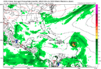
Good news on the 0Z UKMET, which has this for the first time: at the end it is moving N at 73W implying it would very likely miss the CONUS on this run. Please stay far away!
NEW TROPICAL CYCLONE FORECAST TO DEVELOP AFTER 162 HOURS
FORECAST POSITION AT T+162 : 22.5N 73.1W
LEAD CENTRAL MAXIMUM WIND
VERIFYING TIME TIME POSITION PRESSURE (MB) SPEED (KNOTS)
-------------- ---- -------- ------------- -------------
0000UTC 16.08.2024 168 23.1N 73.2W 1008 31
NEW TROPICAL CYCLONE FORECAST TO DEVELOP AFTER 162 HOURS
FORECAST POSITION AT T+162 : 22.5N 73.1W
LEAD CENTRAL MAXIMUM WIND
VERIFYING TIME TIME POSITION PRESSURE (MB) SPEED (KNOTS)
-------------- ---- -------- ------------- -------------
0000UTC 16.08.2024 168 23.1N 73.2W 1008 31
lexxnchloe
Member
accu35
Member
Safely OUT TO SEA
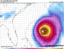
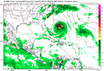
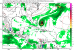
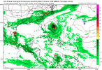
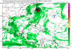
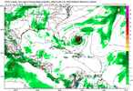
GFS 959mb scraping outer banks. For a storm that hasn’t formed yet and checked the other Herbert boxes, US certainly at risk of a major landfall including Florida/Gulf etc.
lexxnchloe
Member
lexxnchloe
Member
lexxnchloe
Member
Shaggy
Member
Yeah Imagine there will be great jumps in the op runs as this gets picked up sometimes and gets close and sometimes it doesn't and recurves safely.the timing means a lot with this system. there's a real chance it gets picked up and crashes into the SE.
View attachment 149789
Last edited:
lexxnchloe
Member
BHS1975
Member
GFS with a LF now for NC.
Sent from my iPhone using Tapatalk
Sent from my iPhone using Tapatalk
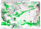
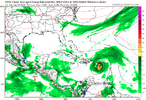
12Z CMC: recurve E of Bermuda
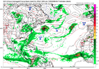
12Z UKMET: forms NE of SE Bahamas moving N but shortly after turns NW:
NEW TROPICAL CYCLONE FORECAST TO DEVELOP AFTER 150 HOURS
FORECAST POSITION AT T+150 : 23.1N 71.7W
LEAD CENTRAL MAXIMUM WIND
VERIFYING TIME TIME POSITION PRESSURE (MB) SPEED (KNOTS)
-------------- ---- -------- ------------- -------------
0000UTC 16.08.2024 156 23.9N 71.7W 1007 37
1200UTC 16.08.2024 168 24.7N 72.5W 1005 36
lexxnchloe
Member
The AI Euro did a great job with Debby.
lexxnchloe
Member
lexxnchloe
Member
Will be interesting to see which camp the Euro goes in.The AI Euro did a great job with Debby.
lexxnchloe
Member
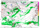
Probably time to write this off in that case.12Z Euro recurves up 70W and then at 240 heading direction of SE Canada.
Probably time to write this off in that case.
Believe me I’d love to be able to write it off and get a much needed break, but unfortunately it is too far out and so one op run even from the King is hardly reliable. Ensembles have much more credibility this far out.
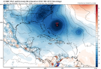
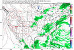
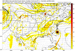
Looks like the Euro has it following the weakness left by the weak LP that forms over the SE and moves out to sea. Guess the track will partially depend on whether this LP actually forms and, if so, the timing of it. UKMET also shows the same LP forming.
Last edited:
snowc
Member
Welp, Here we go again?! Another storm going to impact us?!
Doubtful. It’s always more likely for nothing to happen. I think we will see many storms form but no impact here again until October.Welp, Here we go again?! Another storm going to impact us?!
lexxnchloe
Member
- Status
- Not open for further replies.

