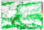
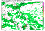
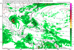
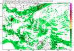
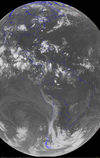
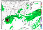
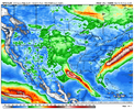
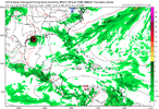
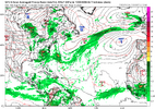
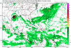
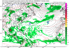
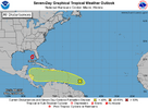
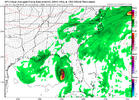
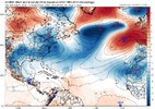
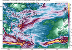
That and the Saharan dust which has been more dense than normal have kept things in check in the Atlantic thus far.Meanwhile there is still no sign of hyper-active
View attachment 149066
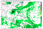
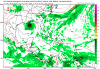
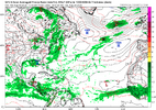
What is showing up on the Euro is also a feature on the GFS. I may be the only one but these low pressures north of the CV islands are killing tropical waves
View attachment 149068
I would think the opposite is needed for waves to amount to anything. High pressure north of CV, Low pressure south.
-
Hello, please take a minute to check out our awesome content, contributed by the wonderful members of our community. We hope you'll add your own thoughts and opinions by making a free account!
You are using an out of date browser. It may not display this or other websites correctly.
You should upgrade or use an alternative browser.
You should upgrade or use an alternative browser.
Tropical 2024 Tropical Thread
- Thread starter lexxnchloe
- Start date
- Status
- Not open for further replies.
lexxnchloe
Member
Debby might be the catalyst to jumpstart the season. Huge cool high has dropped down behind Debby. The place to look will be the SW ATL with a big high north and stalled front south. Also, it might get the CV season going.
View attachment 149127
If this does verify 54/55 comes to mind
lexxnchloe
Member
lexxnchloe
Member
lexxnchloe
Member
lexxnchloe
Member
NoSnowATL
Member
JHS
Member
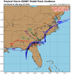
Advisories started. Forecast to track up the Atlantic coast.
lexxnchloe
Member
lexxnchloe
Member
lexxnchloe
Member
lexxnchloe
Member
Brent
Member
lexxnchloe
Member
lexxnchloe
Member
lexxnchloe
Member
JHS
Member
It looks like the models shifted west a little overnight. Several of them now showing wind and rain as far west as GSP and HKY. The Euro actually brings the center almost into upstate SC now, before it only slowly moves northeast from there.
lexxnchloe
Member
lexxnchloe
Member
There is a separate thread now for TD4It looks like the models shifted west a little overnight. Several of them now showing wind and rain as far west as GSP and HKY. The Euro actually brings the center almost into upstate SC now, before it only slowly moves northeast from there.
JHS
Member
I do not see any separate thread.There is a separate thread now for TD4
https://southernwx.com/community/threads/td-4.1316/unread Here it isI do not see any separate thread.
accu35
Member
There isI do not see any separate thread.
MichaelAndrews
Member
Not even a week ago people were saying this season is a bust, no patience lol
Won’t be surprised if we’re tracking a low almost every day until October now
Won’t be surprised if we’re tracking a low almost every day until October now
weatherboyy
Member
I Hope SoNot even a week ago people were saying this season is a bust, no patience lol
Won’t be surprised if we’re tracking a low almost every day until October now
lexxnchloe
Member
It doesnt seem like the season is ready to be active at all. Other than the sloppy raintorm hitting the SE next week no model shows anything else. Nothing says hyperactive now.I Hope So
JHS
Member
Thank you. Thread was made a few days ago and I could not see it for some reason.
lexxnchloe
Member
Not everything has to be a cat5. This one may produce 2 feet of rain and still hit the US as a hurricane, maybe more than once. We could have had a fist storm instead of thats your cup of tea. It’s not good that all the storms are hitting land and causing damage. Record early cat5 and people are still complaining. Like what do you want? CAT 5 into nyc or your backyard?It doesnt seem like the season is ready to be active at all. Other than the sloppy raintorm hitting the SE next week no model shows anything else. Nothing says hyperactive now.
Brent
Member
Yep, season is dead
Downeastnc
Member
Henry2326
Member
Brent
Member
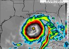
Been quite a few runs with another Gulf storm for sure
Henry2326
Member
Henry2326
Member
As well, another in the train at 40w, 20n. Typical cape verde.Been quite a few runs with another Gulf storm for sure
lexxnchloe
Member
lexxnchloe
Member
NoSnowATL
Member
So the big bend area went like a million years without a H landfall and its been a magnet the last 2 years. crazy.
NoSnowATL
Member
lexxnchloe
Member
Just goes to show SST's really dont matter much. 82F is all you need. I will be happy with 12/6/2 now.
- Status
- Not open for further replies.

