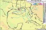
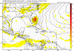
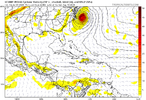
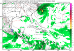
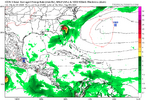
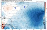
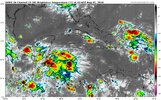
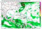
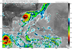
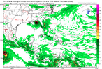
As far as models go I still say wait until a llc forms. Weaker is west, stronger will go north. That was the issue I had with the euro being east previously!Is there any model that doesn’t at least get into the Gulf now? Euro, GFS, ICON, UKMET, CMC, and JMA all do with at least GFS and UKMET never going back into the Atlantic
-
Hello, please take a minute to check out our awesome content, contributed by the wonderful members of our community. We hope you'll add your own thoughts and opinions by making a free account!
You are using an out of date browser. It may not display this or other websites correctly.
You should upgrade or use an alternative browser.
You should upgrade or use an alternative browser.
Tropical 2024 Tropical Thread
- Thread starter lexxnchloe
- Start date
- Status
- Not open for further replies.
NoSnowATL
Member
Brent
Member
NoSnowATL
Member
Bunch of weak nothings.GFS ensembles are all over the placeView attachment 149034
accu35
Member
But in the gulf lolGFS ensembles are all over the placeView attachment 149034
Brent
Member
Bunch of weak nothings.
That is yeah a common theme so far
lexxnchloe
Member
Henry2326
Member
You have wayyyyy too much faith in the operational models. Take them all with a grain of salt until something develops. For Beryl, none of them were right this far out or close in. The NHC averages all the models.
I watch everything I can get my hands on and then shrug.
The global tropics outlook reviews what's sitting over Africa now and will be coming into the Atlantic....it's not just make believe climatology.
Henry2326
Member
Hurricane Kate in 1985 did something similar in that areaGFS is very weird. it gets up here and tries to develop
View attachment 149025
Then goes SE then NW and ends up here
View attachment 149026
lexxnchloe
Member
Don't develop it and then get it tangled up with an old front with some weak jet energy 
weatherboyy
Member
Like I'm going to be right I said that the other computer models were going to curve to the GFS model and it looks like it.
WRAL hyping the Euro and saying the system goes in the Gulf.
lexxnchloe
Member
lexxnchloe
Member
NoSnowATL
Member
weak is good
lexxnchloe
Member
I dont think so, If it were 945mb passing that close to land it might pull in a nice cool dry airmass behind it.weak is good
NoSnowATL
Member
Weak is always better. Nobody wants their house damaged.I dont think so, If it were 945mb passing that close to land it might pull in a nice cool dry airmass behind it.
Henry2326
Member
Weak is always good. But again, the operational models are horrible at strength before a storm actually happens and many times afterward. Beryl was a cat4 and the models had it at a 2, other than HWRF which performed exceptionally well.I dont think so, If it were 945mb passing that close to land it might pull in a nice cool dry airmass behind it.
Brent
Member
Weak is always good. But again, the operational models are horrible at strength before a storm actually happens and many times afterward. Beryl was a cat4 and the models had it at a 2, other than HWRF which performed exceptionally well.
Yeah not saying this will blow up but nobody or any model thought Beryl would be a Cat 5
Henry2326
Member
It's just an example of many in the past.Yeah not saying this will blow up but nobody or any model thought Beryl would be a Cat 5
Yeah I think we’ve learned over the years that models are not very accurate on strength when a system is still forming. I’ll never forget seeing those GFS/EURO runs with the wave that would become Michael in 2018 that were only maxing it out as a strong TS/minimal hurricaneYeah not saying this will blow up but nobody or any model thought Beryl would be a Cat 5
NoSnowATL
Member
Congratulations Mexico
Henry2326
Member
Omg....NHC moves cone to the west. Lol
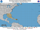
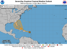
Tropical Weather Outlook
NWS National Hurricane Center Miami FL
800 PM EDT Wed Jul 31 2024
For the North Atlantic...Caribbean Sea and the Gulf of Mexico:
1. Southwestern Atlantic and Eastern Gulf of Mexico:
A tropical wave is producing a large area of disorganized showers
and thunderstorms over Puerto Rico, the Virgin Islands, the Leeward
Islands, and the adjacent waters of the southwestern Atlantic and
northeastern Caribbean Sea. Development of this system is not
anticipated during the next few days while it moves
west-northwestward over portions of the Greater Antilles. However,
environmental conditions are forecast to be more conducive for
development after the wave passes the Greater Antilles, and a
tropical depression could form this weekend or early next week over
the eastern Gulf of Mexico or far southwestern Atlantic Ocean,
including in the vicinity of Florida. Interests across the Greater
Antilles, Bahamas, and Florida should continue to monitor the
progress of this system.
* Formation chance through 48 hours...low...near 0 percent.
* Formation chance through 7 days...medium...60 percent.
Really interested to see what happens with that convection north of PR tonight. If that takes over or starts to bias the vorticity north the NE tracks may be more likely. If it dies out and this stays relatively open there's not as much ability to draw the wave north as the mid level trough isn't that strong over the weekend so a gulf track is more likely. Either way when that trough in the east boots out if this isn't picked up its not going anywhere. I think the biggest concern here is a festering healthy wave either in the Bahamas or west of Florida Sunday with no where to go. There may be some continental air that tries to wrap in as it starts interacting with the front but these waves moving into decaying fronts have a tendency to spice up quickly
Just my opinion/thoughts. Weaker is in the gulf , the longer it takes the more southern . It will strengthen faster in the gulf though!
Last edited:
lexxnchloe
Member
I wonder if this is why waves are so streched out and cloudless this season. Pressures are well below normal north of th CV islands not allowing them to consolidate. I assume that is also pulling alot of hot dusty air into the MDR
View attachment 149051
This is common for July into early August. They’re often dry with SAL dominating.
Looks like the wave we are watching was able to erode the Sal layer around it
This is common for July into early August. They’re often dry with SAL dominating.
Looks like the wave we are watching was able to erode the Sal layer around it
how is that possible? I thought this season was a let down, I mean we haven’t came close to climatological peak but this season sucks?
Savannah cannot hold anymore water. A tropical storm would be deadly. The flooding near Daffin Park has been wild. Even a gulf hit would be bad.This is common for July into early August. They’re often dry with SAL dominating.
Brent
Member
lexxnchloe
Member
Brent
Member
lexxnchloe
Member
LickWx
Member
The people of Alabama do not need this, let’s pray for their safety and that this storm safely avoids every square mile of the state of Alabama. I’m hoping my friend @NoSnowATL gets a nice storm though. Nice cat 1
accu35
Member
Yes I don’t need thisThe people of Alabama do not need this, let’s pray for their safety and that this storm safely avoids every square mile of the state of Alabama. I’m hoping my friend @NoSnowATL gets a nice storm though. Nice cat 1
accu35
Member
Wow gfs
- Status
- Not open for further replies.


