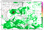
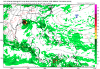
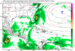
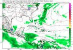
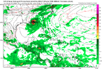
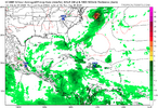
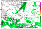
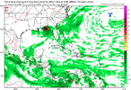
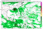
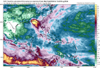
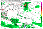
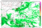
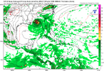
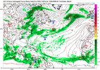
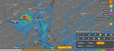
There are some EPS members that look like they want to slow it down just off the coast.I'd be concerned about any system getting left behind and either drifting or taking a brief hard west turn
-
Hello, please take a minute to check out our awesome content, contributed by the wonderful members of our community. We hope you'll add your own thoughts and opinions by making a free account!
You are using an out of date browser. It may not display this or other websites correctly.
You should upgrade or use an alternative browser.
You should upgrade or use an alternative browser.
Tropical 2024 Tropical Thread
- Thread starter lexxnchloe
- Start date
- Status
- Not open for further replies.
I remember that storm just come to a stop and basically drifted around just east of the Outer Banks for a week before the steering finally pulled it into the coast near the NC/SC border. Dianne in 1983 I think stalled out for a couple days as wellDennis 99 comes to mind
lexxnchloe
Member
One thing that there seems to consensus is that’s gonna be a stout high… making a recurve prior to at least approaching the coast unlikely.GFS refuses to join the crowd. Forms in the NE GOM then strong high pushes it SW
View attachment 148985
Then turns NW and hits LA
View attachment 148986
lexxnchloe
Member
weatherboyy
Member
Sooner or later the UK the euro and other computer models will follow the GFS model watch and see it always happens if I'm wrong or wrong but I just got that feeling
Dennis was one of the most bizarre storms to ever approach the East Coast. I remember that it helped set the stage for the flooding in Eastern North Carolina that Floyd caused later that year.I remember that storm just come to a stop and basically drifted around just east of the Outer Banks for a week before the steering finally pulled it into the coast near the NC/SC border. Dianne in 1983 I think stalled out for a couple days as well
One of the most unusual fishing experiences I have ever had occurred when Dennis was approaching the coast on its first run. Me and one of my friends took a john boat out to a pond we regularly fished back then. I have never seen fish bite like that before. Every cast we made we caught a fish with the beetle spins and rooster tails we were using. I had laid one of my fishing rods in the boat with the lure hanging out of the water and fish were jumping out of the water trying to grab it! We must have caught over 100 fish in a hour that day. We threw them all back. The fish in that pond knew something was in the air weather wise.
Last edited:
I remember that storm just come to a stop and basically drifted around just east of the Outer Banks for a week before the steering finally pulled it into the coast near the NC/SC border. Dianne in 1983 I think stalled out for a couple days as well
Dianna … I was in college in Wilmington … wasn’t t that like 84-85?
Sent from my iPhone using Tapatalk
lexxnchloe
Member
1984Dianna … I was in college in Wilmington … wasn’t t that like 84-85?
Sent from my iPhone using Tapatalk
Even though we haven’t seen the GoM style rapid intensification on the Atlantic seaboard this kind of potential track makes me nervous. A storm developing close to the coast and coming from the south could make for a very bad day in the coastal SC counties. Poor building practices until 2012-2014 and over 50% of the population in Horry and Charleston counties are products of internal migration and have never experienced anything beyond a decaying Category 1 storm at the coast. Add in a naturally panic-prone aging population and it’s a recipe for disaster. We all still remember the Floyd evacuation fiasco. We don’t have any new east-west roads and population has doubled.
Henry2326
Member
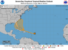
Tropical Weather Outlook
NWS National Hurricane Center Miami FL
800 PM EDT Tue Jul 30 2024
For the North Atlantic...Caribbean Sea and the Gulf of Mexico:
1. Near the Greater Antilles and the Bahamas:
A large tropical wave centered a few hundred miles east of the
Lesser Antilles is producing some shower and thunderstorm activity.
While development has been slow to occur due to dry air,
environmental conditions are forecast to gradually become more
conducive over the warmer waters of the southwestern Atlantic
Ocean, and a tropical depression could form late this week while
the system is in the vicinity of the Greater Antilles or the
Bahamas. Interests in the Greater Antilles, the Bahamas, and the
southeastern U.S. should monitor the progress of this system.
* Formation chance through 48 hours...low...near 0 percent.
* Formation chance through 7 days...medium...60 percent.
JHS
Member
1984I remember that storm just come to a stop and basically drifted around just east of the Outer Banks for a week before the steering finally pulled it into the coast near the NC/SC border. Dianne in 1983 I think stalled out for a couple days as well
Hurricane Diana September 13 1984
www.weather.gov
Thanks for the correction. I knew it was sometime around then. I remember going down to Wilmington after the storm because my Dad had to help his sister clean up from all the trees she had down in her yard
GFS refuses to join the crowd. Forms in the NE GOM then strong high pushes it SW
Then turns NW and hits LA
lexxnchloe
Member
0Z UKMET: well W of 12Z run with it stalling in NE Gulf 50 miles S of Destin:
NEW TROPICAL CYCLONE FORECAST TO DEVELOP AFTER 108 HOURS
FORECAST POSITION AT T+108 : 24.2N 85.0W
LEAD CENTRAL MAXIMUM WIND
VERIFYING TIME TIME POSITION PRESSURE (MB) SPEED (KNOTS)
-------------- ---- -------- ------------- -------------
1200UTC 04.08.2024 108 24.2N 85.0W 1009 30
0000UTC 05.08.2024 120 25.9N 86.0W 1008 29
1200UTC 05.08.2024 132 28.1N 86.3W 1008 34
0000UTC 06.08.2024 144 28.8N 86.3W 1007 39
1200UTC 06.08.2024 156 29.5N 86.6W 1007 38
0000UTC 07.08.2024 168 29.7N 86.5W 1005 28
The 12Z JMA was also NE Gulf with landfall of weak low in FL panhandle.
0Z GFS a H in AL/W FL panhandle.
So, 3 of 6 latest models’ runs in NE Gulf: UK, JMA, GFS.
My gut says this will end up an exclusively Gulf storm.
0Z GFS a H in AL/W FL panhandle.
So, 3 of 6 latest models’ runs in NE Gulf: UK, JMA, GFS.
My gut says this will end up an exclusively Gulf storm.
Brent
Member
GFS is near Mobile Pensacola
accu35
Member
CMC was west a little alsoThe 12Z JMA was also NE Gulf with landfall of weak low in FL panhandle.
0Z GFS a H in AL/W FL panhandle.
So, 3 of 6 latest models’ runs in NE Gulf: UK, JMA, GFS.
My gut says this will end up an exclusively Gulf storm.
lexxnchloe
Member
lexxnchloe
Member
lexxnchloe
Member
lexxnchloe
Member
lexxnchloe
Member
Brent
Member
Probably too far west yeah
I'm still waiting for this storm to get it's act together first though
lexxnchloe
Member
True. ICON and Euro seem less impressive each runProbably too far west yeah
I'm still waiting for this storm to get it's act together first though
Henry2326
Member
lexxnchloe
Member
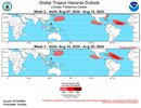
That looks like climatology for mid Aug and could have been put out in April. Nothing in the MDR thru Aug16 on GFS
lexxnchloe
Member
lexxnchloe
Member
12Z UKMET: way west (TCG 150 miles S of LA tip and moves NNW into LA) and pretty weak:
NEW TROPICAL CYCLONE FORECAST TO DEVELOP AFTER 120 HOURS
FORECAST POSITION AT T+120 : 27.0N 89.3W
LEAD CENTRAL MAXIMUM WIND
VERIFYING TIME TIME POSITION PRESSURE (MB) SPEED (KNOTS)
-------------- ---- -------- ------------- -------------
1200UTC 05.08.2024 120 27.0N 89.3W 1011 31
0000UTC 06.08.2024 132 28.6N 90.2W 1009 29
1200UTC 06.08.2024 144 30.0N 90.5W 1011 30
0000UTC 07.08.2024 156 30.8N 91.0W 1009 27
1200UTC 07.08.2024 168 31.5N 90.7W 1010 28
lexxnchloe
Member
Meanwhile the MDR is still bone dry
accu35
Member
It’s hard to ignore the GFS and UKMET that brings it further west into the gulf. Both has been consistent just like the Euro has on the east coast.12Z UKMET: way west (TCG 150 miles S of LA tip and moves NNW into LA) and pretty weak:
NEW TROPICAL CYCLONE FORECAST TO DEVELOP AFTER 120 HOURS
FORECAST POSITION AT T+120 : 27.0N 89.3W
LEAD CENTRAL MAXIMUM WIND
VERIFYING TIME TIME POSITION PRESSURE (MB) SPEED (KNOTS)
-------------- ---- -------- ------------- -------------
1200UTC 05.08.2024 120 27.0N 89.3W 1011 31
0000UTC 06.08.2024 132 28.6N 90.2W 1009 29
1200UTC 06.08.2024 144 30.0N 90.5W 1011 30
0000UTC 07.08.2024 156 30.8N 91.0W 1009 27
1200UTC 07.08.2024 168 31.5N 90.7W 1010 28
snowc
Member
Oh well, looks like another Isaias for me. Blah!A lot more SC/NC hits on the 12z Euro ensemble vs 00zView attachment 148981View attachment 148979
lexxnchloe
Member
Did the Euro just cave to the GFS?
lexxnchloe
Member
I dont knowDid the Euro just cave to the GFS?
Sorta. Both has it stalling off of the W coast of Florida but the Euro has going it to the East Coast after that while the GFS has it hitting the Gulf Coast after that.Did the Euro just cave to the GFS?
- Status
- Not open for further replies.

