• Hello, please take a minute to check out our awesome content, contributed by the wonderful members of our community. We hope you'll add your own thoughts and opinions by making a free account!

Tropical 2024 Tropical Thread

Status
Not open for further replies.
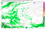
A 604 dm peaking 500 mb Bermuda high is progged on all of the models for tomorrow evening. This not only is one of the strongest Bermuda highs at 500 mb on record based on records back to 1950. It is THE strongest on record! The record strongest is 600 dm. Bermuda itself is progged to peak at 601-2, which would beat its record of 600 dm. It’s amazing what the warmest oceans on record are causing.

The strongest on record for the entire Atlantic is 603 (just offshore Casablanca, Morocco). So, this looks to be the strongest on record for the entire Atlantic! The strongest on record for entire globe is 605.6 in the NPAC S of the Aleutians.

IMG_9913.png

 
Last edited:
With that strong Bermuda high parked in the Atlantic, if anything were to come off Africa and develop the east coast would definitely be in play as far as potential track. Fortunately it looks like we will not see anything develop for the next ten days at least. There is a lot of Sahara dust over the Atlantic now. South Florida even reported Sahara dust over it yesterday.
 
A 604 dm peaking 500 mb Bermuda high is progged on all of the models for tomorrow evening. This not only is one of the strongest Bermuda highs at 500 mb on record based on records back to 1950. It is THE strongest on record! The record strongest is 600 dm. Bermuda itself is progged to peak at 601-2, which would beat its record of 600 dm. It’s amazing what the warmest oceans on record are causing.

The strongest on record for the entire Atlantic is 603 (just offshore Casablanca, Morocco). So, this looks to be the strongest on record for the entire Atlantic! The strongest on record for entire globe is 605.6 in the NPAC S of the Aleutians.

View attachment 148481


It’s amazing what the warmest oceans on record are causing.

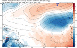
Last year temps were rather warm and ridging was totally absent in the Atlantic


1720744235122.png
 
It’s amazing what the warmest oceans on record are causing.

Last year temps were rather warm and ridging was totally absent in the Atlantic


View attachment 148485

It isn’t just the Atlantic temp. I should have stated that better. It isn’t that simple. I think it is the temp of the Atlantic in combo with a strong -PDO and developing La Nina that helped lead to this record strong Bermuda ridge.
Last year was about as warm overall. But very importantly there was also El Niño. El Niño, itself, is typically NOT conducive to a strong Bermuda ridge when averaged out. Actually it favors a weaker than average one was the case last hurricane season.

But a warming globe tends to favor stronger and stronger 500 mb hts. It also favors warming at other levels. Warmer 850 mb temps, etc.
 
Last edited:
From Larry Cosgrove


The period of cooling in the central chamber of the nation may last until the last days of July. I suspect that the ECMWF model weeklies are far too aggressive with the cool depictions in the U.S., what with the monthly forecasts from the American and European being very aggressive with hot weather well into October. One concern I have: why is the Gulf of Alaska Low pumping up a +PNA signal into the Yukon Territory? Not that I am thinking 1976 is happening again, but because a deeper curvature and cold pool formation meshing with a hurricane in the western Atlantic Basin could mean huge problems across the eastern half of the USA. It would make Beryl look like kid stuff.
 
Probably going to have to watch the gulf and maybe just N of Cuba in the coming days
GFS tries to get a weak storm to form along the NC coast to restart the season from a gulf dist ala the 2004 season


1721160925594.png


Hurricane Alex[edit]​

Main article: Hurricane Alex (2004)
Category 3 hurricane (SSHWS)
DurationJuly 31 – August 6
Peak intensity120 mph (195 km/h) (1-min);
957 mbar (hPa)
The interaction between a trough and tropical wave resulted in the development of a tropical depression on July 31, while centered about 200 mi (320 km) east of Jacksonville, Florida. After initially being poorly organized, the depression strengthened into Tropical Storm Alex late on August 1. The storm tracked northeastward and became a hurricane on August 3. As Alex moved out to sea, it intensified into a Category 3 hurricane and peaked with winds of 120 mph (190 km/h). Alex reached major hurricane status second farthest north in the Atlantic, after Hurricane Ellen in 1973. Eventually, Alex weakened due to cooler sea surface temperatures. The hurricane fell to tropical storm intensity around 12:00 UTC on August 6. Six hours later, it became extratropical while located about 955 mi (1,537 km) east of Cape Race, Newfoundland, and was soon absorbed by a large extratropical cyclone.[25]
 
I think the hyperactive season of 2020 only had 1 hurricane at this point. This slow period is nothing new.
The GFS shows nothing thru Aug03 so probably it will be some time after that something will happen. In 2020 the ninth named storm formed on July 31. Far different. 9vs3
 
The GFS shows nothing thru Aug03 so probably it will be some time after that something will happen. In 2020 the ninth named storm formed on July 31. Far different. 9vs3
True but in 2020 they started naming thunderstorms so the real count isn't that high and closer to avg. At this point in 2020 they only had one H, it started to ramp up in early Aug tho.
 
Status
Not open for further replies.
Back
Top