Downeastnc
Member
If there is even a low.
The is tons of model support in the ensembles for a storm that makes it to the SW ATL....
If there is even a low.

Maybe but its never a good sign when the models start to drop a storm.The is tons of model support in the ensembles for a storm that makes it to the SW ATL....
Looking at satellite I'd say there's gonna be a stormMaybe but its never a good sign when the models start to drop a storm.
From what I see, the models haven't dropped. More concerning, is the models are showing a weakness that puts the low closer to EC where it can explode.Maybe but its never a good sign when the models start to drop a storm.


Maybe, but the GFS says nothing now and the ICON was weaker. A storm at 35w means nothing if it cant get to 75wLooking at satellite I'd say there's gonna be a storm
We will see but thats a ghost of what the GFS was showing. Too bad too because the big high to the north would have a strong cane roaring up the east coast.From what I see, the models haven't dropped. More concerning, is the models are showing a weakness that puts the low closer to EC where it can explode.
Too far for models to really pick up on intensity....just looking for placement possibility.
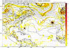
View attachment 136763


And there will be another 15 huge changes every 12 hours for the next week until models start honing in on what we are looking at.
Huge change in 12 hours
The euro still has it though not a threat. I hope it was another burp on the GFS.I'm not saying anything is guaranteed to form but the same GFS said there would be no Idalia for days too... So it's already failed with the biggest storm of the year so far
The ensemble still looks fine and is the same as 12zTotally gone on the GFS. Unless it makes a comeback tonight on the GFS this was a model mess-up across the board.


The GFS is a trought storm.While it seems highly likely this is our next hurricane, it also seems likely its a threat to the NE islands and Bermuda and that getting to the US would be difficult given the progressive pattern.

I would still consider that a threat.The GFS is a trought storm.
I would too. Bermuda should pay attention.I would still consider that a threat.
As should NC. Its moving due north as it passes Hatteras. In the earlier runs when the gfs had a strong cane it had already turned NE by Hatteras. Also, its a considerable improvement over this a few days agoI would too. Bermuda should pay attention.


Also this is not all that bad of a pattern. Big high over NW ATL and a trof to our west. Minor changes and a cane is coming right over the coast.


Yup and Florence showed that anything can happen in those ranges and as always we sit and watchThe surface high over the NW ATL isn’t doing anything to change the direction of the hurricane. The game is over way back around 240hrs when the TC rounds the west side of the subtropical ridge. You would need to get that ridge to actually build to the north of the hurricane and the broad trough to slow down or abnormally dig south, strengthen and cut off. It’s possible, but considering it isn’t supported by any model rather unlikely.
View attachment 136771


GFS got alot more interestingYup and Florence showed that anything can happen in those ranges and as always we sit and watch
Not nearly as interesting as it's ensembleGFS got alot more interesting
Yeah the ensembles get it deeper into the Caribbean and the Bahamas but the ridge still breaks down a bit too soon. Still a long way to goNah. You need a lot more ridging over New England to keep it going west.
Sent from my iPhone using Tapatalk


