-
Hello, please take a minute to check out our awesome content, contributed by the wonderful members of our community. We hope you'll add your own thoughts and opinions by making a free account!
You are using an out of date browser. It may not display this or other websites correctly.
You should upgrade or use an alternative browser.
You should upgrade or use an alternative browser.
Severe 2023 Spring Severe
- Thread starter SD
- Start date
- Status
- Not open for further replies.
NoSnowATL
Member
Still spring?
It's Spall.Still spring?
tennessee storm
Member
What abut fall severe weather season ?
NoSnowATL
Member
Whenever it actually starts. I’d guess November.What abut fall severe weather season ?
Just noticed your profile pic, I like itWhenever it actually starts. I’d guess November.
JHS
Member
It is WAY out, but the 12z GFS shows a possible severe weather episode at days 15 into 16. Would be from ARK, LA, and Missouri east to the southern Appalachians. Basically dixie alley. A 998MB low.
Euro showed something in Kansas around D9.It is WAY out, but the 12z GFS shows a possible severe weather episode at days 15 into 16. Would be from ARK, LA, and Missouri east to the southern Appalachians. Basically dixie alley. A 998MB low.
Downeastnc
Member
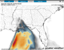
Rough night in Florida.
Downeastnc
Member
- Joined
- Jan 5, 2017
- Messages
- 3,802
- Reaction score
- 6,051
Possible severe outbreak coming over the next two weeks for MS/AL/LA and maybe GA/SC/NC, too. If the CAD is not established to save us to the east, dynamics will be strong and support tornadoes. Can we get a new 2024 Severe thread going, please?
- Joined
- Jan 5, 2017
- Messages
- 3,802
- Reaction score
- 6,051
Could mods get a 2024 Spring Severe thread set up?
Possible severe outbreak coming over the next two weeks for MS/AL/LA and maybe GA/SC/NC, too. If the CAD is not established to save us to the east, dynamics will be strong and support tornadoes. Can we get a new 2024 Severe thread going, please?
DoneCould mods get a 2024 Spring Severe thread set up?
Severe - 2024 Severe Discussion
Well time to move on to severe season and back by popular demand....... have at it!
southernwx.com
- Status
- Not open for further replies.