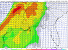
Well time to move on to severe season and back by popular demand....... have at it!
-
Hello, please take a minute to check out our awesome content, contributed by the wonderful members of our community. We hope you'll add your own thoughts and opinions by making a free account!
You are using an out of date browser. It may not display this or other websites correctly.
You should upgrade or use an alternative browser.
You should upgrade or use an alternative browser.
Severe 2024 Severe Discussion
- Thread starter Metwannabe
- Start date
weatherfide
Member
- Joined
- Jan 5, 2017
- Messages
- 3,076
- Reaction score
- 4,498
We have cutter after cutter showing up on the Euro and GFS. It's going to be rocking in TX/LA/MS and most of AL. CAD may limit potential in GA/SC/NC but could play havoc with storms riding the boundary. First up is next Tuesday. Then looking at the 12th/13th and then again on the 18th/19th. Each round should decrease the amount of cold air damming and bring more warm, unstable air in to the southern states. For example, GFS is showning 850mb temps in the 15 to 20 Celsius range over TX/LA/MS ahead of the 18th cutter.
JHS
Member
The Tuesday storm will bear watching close for severe weather. The GFS is slowly bringing the warm air farther into the CAD area as we get closer. Instability may be limited for sure, but you cannot really ask for better dynamics. The SPC is already mentioning strong tors for Tuesday.We have cutter after cutter showing up on the Euro and GFS. It's going to be rocking in TX/LA/MS and most of AL. CAD may limit potential in GA/SC/NC but could play havoc with storms riding the boundary. First up is next Tuesday. Then looking at the 12th/13th and then again on the 18th/19th. Each round should decrease the amount of cold air damming and bring more warm, unstable air in to the southern states. For example, GFS is showning 850mb temps in the 15 to 20 Celsius range over TX/LA/MS ahead of the 18th cutter.
weatherfide
Member
- Joined
- Jan 5, 2017
- Messages
- 3,076
- Reaction score
- 4,498
It appears there will be another cutter with severe potential on 1/13, according the the GFS. The wedge won't be around to protect the Piedmont areas this time.
Last edited:
Brick Tamland
Member
Severe season is year round now. We have more severe threats than snow threats.
accu35
Member
- Joined
- Jan 5, 2017
- Messages
- 8,278
- Reaction score
- 9,645
Your right, i use to hate severe weather growing up but now i love it.Severe season is year round now. We have more severe threats than snow threats.
tractor girl
Member
NWS Atlanta raising alerts to second system projected to pass through Friday:
.LONG TERM...
(Wednesday morning through next Sunday)
Issued at 321 PM EST Mon Jan 8 2024
The long term forecast begins with chilly temperatures (morning lows
in the upper 20s to 30s) as the cold front exits the region. The
cold airmass will result in high temperatures in the 40s and low 50s
on Wednesday. The airmass will also be a good bit drier
characterized by cooler dewpoints in the upper 20s and 30s. This
period of calm weather will last through Thursday, but high
temperatures will warm Thursday back into the 50s. Temperatures will
continue to warm through Friday into the mid to upper 60s for areas
south of I-20. This is ahead of the next storm system that will
bring another potential for a round of severe weather to the
forecast area. A potent negatively tilted shortwave will dig in from
the central Plains Friday with a surface low developing near the
ArkLaTex.
.LONG TERM...
(Wednesday morning through next Sunday)
Issued at 321 PM EST Mon Jan 8 2024
The long term forecast begins with chilly temperatures (morning lows
in the upper 20s to 30s) as the cold front exits the region. The
cold airmass will result in high temperatures in the 40s and low 50s
on Wednesday. The airmass will also be a good bit drier
characterized by cooler dewpoints in the upper 20s and 30s. This
period of calm weather will last through Thursday, but high
temperatures will warm Thursday back into the 50s. Temperatures will
continue to warm through Friday into the mid to upper 60s for areas
south of I-20. This is ahead of the next storm system that will
bring another potential for a round of severe weather to the
forecast area. A potent negatively tilted shortwave will dig in from
the central Plains Friday with a surface low developing near the
ArkLaTex. This system appears to have a more favorable thermodynamic
profile with warm surface and dewpoint temperatures and MUCAPE
between 600-800 J/kg. The kinematics of the system also look
favorable for strong to severe storms with bulk shear up to 70+kt
and 0-3km SRH over 700+m2/s2. It`s a little too soon to be diving
into the exact details, but it does appear there is a strong signal
that this system will bring another round of severe weather to the
forecast area Friday afternoon. Furthermore, this system will bring
additional rainfall will be brought to the area with amounts between
0.5-1.0" inches. High pressure returns to the area at the end of the
period with dry weather forecast through Sunday evening.
KAL
&&
The kinematics of the system also look
favorable for strong to severe storms with bulk shear up to 70+kt
and 0-3km SRH over 700+m2/s2. It`s a little too soon to be diving
into the exact details, but it does appear there is a strong signal
that this system will bring another round of severe weather to the
forecast area Friday afternoon. Furthermore, this system will bring
additional rainfall will be brought to the area with amounts between
0.5-1.0" inches. High pressure returns to the area at the end of the
period with dry weather forecast through Sunday evening.
KAL
&&
.LONG TERM...
(Wednesday morning through next Sunday)
Issued at 321 PM EST Mon Jan 8 2024
The long term forecast begins with chilly temperatures (morning lows
in the upper 20s to 30s) as the cold front exits the region. The
cold airmass will result in high temperatures in the 40s and low 50s
on Wednesday. The airmass will also be a good bit drier
characterized by cooler dewpoints in the upper 20s and 30s. This
period of calm weather will last through Thursday, but high
temperatures will warm Thursday back into the 50s. Temperatures will
continue to warm through Friday into the mid to upper 60s for areas
south of I-20. This is ahead of the next storm system that will
bring another potential for a round of severe weather to the
forecast area. A potent negatively tilted shortwave will dig in from
the central Plains Friday with a surface low developing near the
ArkLaTex.
.LONG TERM...
(Wednesday morning through next Sunday)
Issued at 321 PM EST Mon Jan 8 2024
The long term forecast begins with chilly temperatures (morning lows
in the upper 20s to 30s) as the cold front exits the region. The
cold airmass will result in high temperatures in the 40s and low 50s
on Wednesday. The airmass will also be a good bit drier
characterized by cooler dewpoints in the upper 20s and 30s. This
period of calm weather will last through Thursday, but high
temperatures will warm Thursday back into the 50s. Temperatures will
continue to warm through Friday into the mid to upper 60s for areas
south of I-20. This is ahead of the next storm system that will
bring another potential for a round of severe weather to the
forecast area. A potent negatively tilted shortwave will dig in from
the central Plains Friday with a surface low developing near the
ArkLaTex. This system appears to have a more favorable thermodynamic
profile with warm surface and dewpoint temperatures and MUCAPE
between 600-800 J/kg. The kinematics of the system also look
favorable for strong to severe storms with bulk shear up to 70+kt
and 0-3km SRH over 700+m2/s2. It`s a little too soon to be diving
into the exact details, but it does appear there is a strong signal
that this system will bring another round of severe weather to the
forecast area Friday afternoon. Furthermore, this system will bring
additional rainfall will be brought to the area with amounts between
0.5-1.0" inches. High pressure returns to the area at the end of the
period with dry weather forecast through Sunday evening.
KAL
&&
The kinematics of the system also look
favorable for strong to severe storms with bulk shear up to 70+kt
and 0-3km SRH over 700+m2/s2. It`s a little too soon to be diving
into the exact details, but it does appear there is a strong signal
that this system will bring another round of severe weather to the
forecast area Friday afternoon. Furthermore, this system will bring
additional rainfall will be brought to the area with amounts between
0.5-1.0" inches. High pressure returns to the area at the end of the
period with dry weather forecast through Sunday evening.
KAL
&&
NWMSGuy
Member
Climate Prediction Center calling for an ENSO Neutral phase moving into April - June time frame. Anyone have thoughts on how this may play into this upcoming Severe Weather Season?
NWMSGuy
Member
Yep starting to look decent around the month changeMay need to start watching this last week of February for the possibility of Severe Weather:
View attachment 146548
tennessee storm
Member
Both gfs n euro picking up a potent severe wx day 7to 8 days out. Midsouth Dixie
NWMSGuy
Member
Anyone have additional thoughts on the potential Severe Weather for next week?
My early thoughts here are the best corridor of severe will be east TX/ok, ark, Missouri boot heel, northern TN, KY where we typically see the higher end severe weather as the trough rides the western flank of the SER. Then that all combines into a qlcs across most of the region.Anyone have additional thoughts on the potential Severe Weather for next week?
tennessee storm
Member
Some gut wrenching runs for the midsouth region for next weeks big systemAnyone have additional thoughts on the potential Severe Weather for next week?
Darklordsuperstorm
Member
This feels like a primer for Dixie Alley. It's that time of year where you see the threats start to the west and gradually move eastward with each system.
gawxnative
Member
Well SPC got the crayons out for Day 6 and Day 7 this morning (Next Tues/Weds)


